Digital processing method for field investigation of geological disasters
A technology of geological disasters and processing methods, applied in image data processing, special data processing applications, geographic information databases, etc., can solve problems such as inconvenient portability, time-consuming, cumbersome tasks, etc., and achieve the effect of improving work efficiency and accuracy
- Summary
- Abstract
- Description
- Claims
- Application Information
AI Technical Summary
Problems solved by technology
Method used
Image

Examples
Embodiment 1
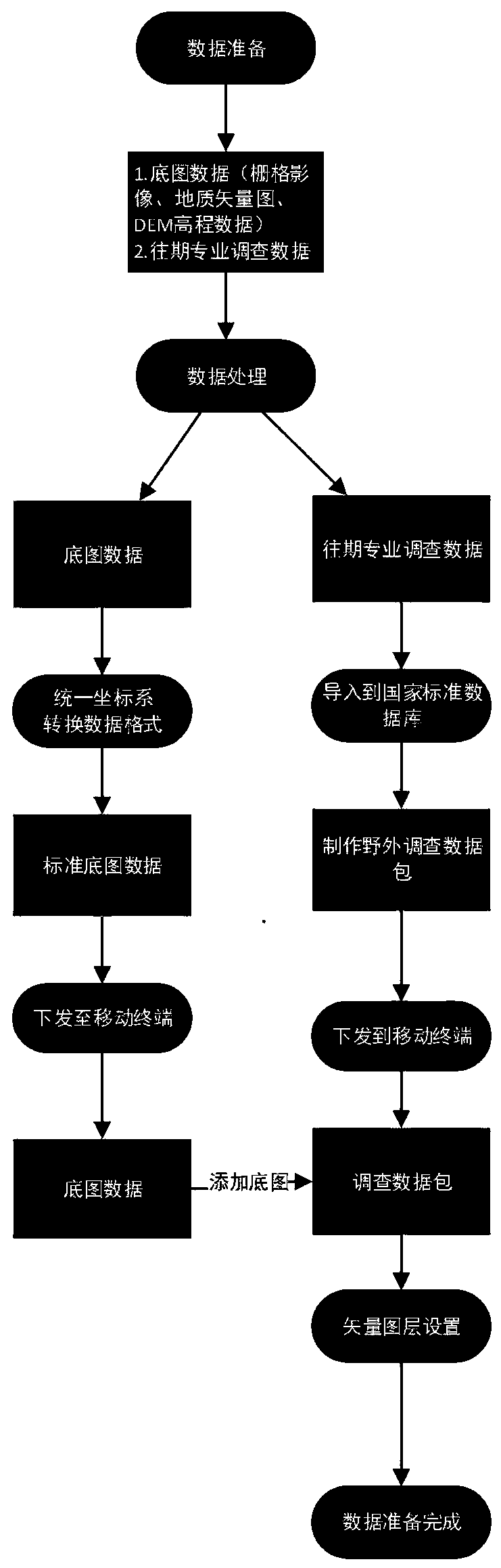
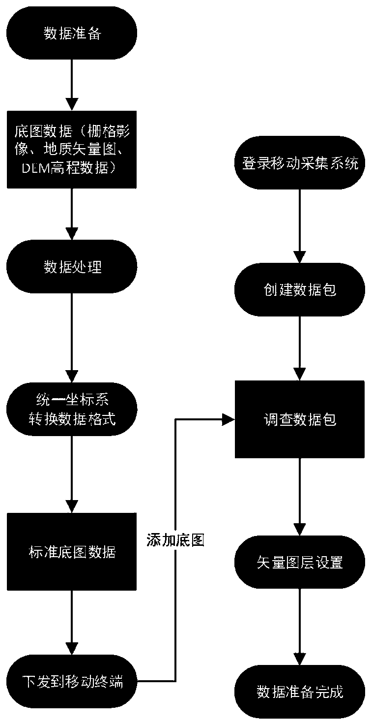
[0176] The following is a detailed description of the map survey of a watershed in 2019 as an example.
[0177] (1) Data collection
[0178] Collect image maps, geological maps, susceptibility zoning maps, geotechnical maps, and DEM elevation data in the survey area.
[0179] (2) Data processing
[0180] This survey uniformly uses the CGCS2000 geographic coordinate system, and image maps, geological maps, DEM and other maps are uniformly converted into the CGCS2000 latitude and longitude coordinate system.
[0181] Among them, the image format itself is .tif and does not need to be converted;
[0182] Vector maps such as geological maps, zonal maps, and geotechnical maps are in mapgis format, and are uniformly converted into the .shp format supported by arcgis;
[0183] The DEM elevation data is in .img format and is output in .tif format when converting the coordinate system.
[0184] Copy the processed basemap data to the mobile terminal for storage, which can be stored ...
PUM
 Abstract
Description
Claims
Application Information