Aerial image splicing and positioning method based on aerial strip GPS and scale invariant constraints

A scale-invariant, aerial image technology, applied in image enhancement, image analysis, image data processing, etc., can solve the problems of single flight belt stitching deformation, flight belt image stitching misalignment, and positioning accuracy decline, etc., to eliminate single flight belt. The effect of splicing deformation, improving splicing effect and improving splicing quality

Active Publication Date: 2020-08-07
NO 54 INST OF CHINA ELECTRONICS SCI & TECH GRP
View PDF7 Cites 11 Cited by
  • Summary
  • Abstract
  • Description
  • Claims
  • Application Information

AI Technical Summary

Problems solved by technology

[0005] For image stitching, the existing technology is suitable for the stitching of a single flight belt image, but when multiple flight belts are stitched together, two or more flight belt images often appear in dislocation; in addition, due to the pitch angle generated during the operation of the UAV, It will lead to splicing deformation of a single flight belt
For positioning, the existing technology will have errors when calculating the resolution and scale of each frame of image, and the overall error of the spliced ​​image will gradually accumulate as the splicing process continues, resulting in a serious drop in positioning accuracy

Method used

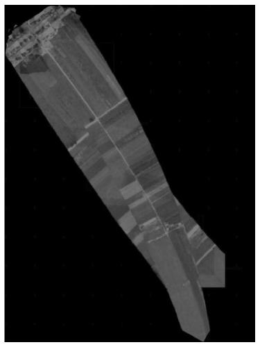
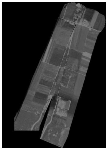
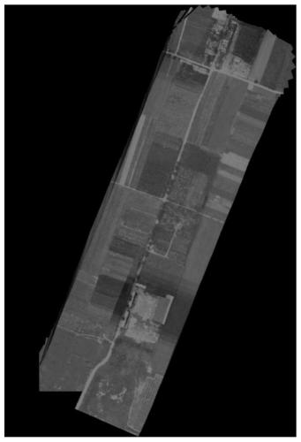

Image

  • Aerial image splicing and positioning method based on aerial strip GPS and scale invariant constraints
  • Aerial image splicing and positioning method based on aerial strip GPS and scale invariant constraints
  • Aerial image splicing and positioning method based on aerial strip GPS and scale invariant constraints

Examples


Embodiment Construction

[0035] The present invention will be further described below in conjunction with the accompanying drawings.

[0036] For the convenience of describing the content of the present invention, some terms are firstly explained here:

[0037] BF algorithm: Brute Force algorithm is a common algorithm for two-dimensional feature point matching. The core idea of ​​BF algorithm is to try all possible matches so that it can always find the best match. For violent matching, cross-matching can be used for optimization. That is, perform another match, and in turn use the matched point for matching. If the matched point is still the first matched point, it is considered a correct match.

[0038] RANSAC algorithm: Random Sample Consensus (Random Sample Consensus) algorithm. Its principle is to iteratively estimate the parameters of the mathematical model from a set of observation data sets containing "outside points". The basic assumption is that the data is composed of "inside points". ", ...


PUM


Abstract

The invention discloses an aerial image splicing and positioning method based on an aerial strip GPS and scale invariant constraints, and belongs to the technical field of graphic image conversion andimage calibration. The method comprises the steps: preprocessing a to-be-spliced image; according to traditional feature point extraction and description, obtaining an accurate matching result through a BF matching method and an RANSAC method, calculating an affine transformation matrix for the feature matching result through scale invariant constraints, constructing second flight strip splicingthrough existing flight path information, and fusing a GPS into a panorama. According to the invention, the splicing quality of images between air strips is improved by using air strip GPS informationand scale invariant constraints, the problem of single air strip splicing deformation caused by the pitch angle is eliminated, the pixel center point coordinates of a subsequent splicing frame are restrained through the mapping relation obtained through the first air strip, the splicing effect of multiple air strips is improved, and the high GPS positioning precision is further achieved.

Description

technical field [0001] The invention belongs to the technical field of graphic image conversion and image calibration, in particular to an aerial image splicing and positioning method based on navigation belt GPS and scale-invariant constraints. Background technique [0002] An unmanned aerial vehicle (UAV) is an unmanned aircraft operated by radio remote control equipment and self-contained program control device, or operated completely or intermittently autonomously by an on-board computer. At present, it has a very wide range of applications in the fields of aerial photography, agriculture, plant protection, express transportation, disaster relief, surveying and mapping, power inspection, disaster relief and so on. [0003] At present, the most extensive demand for UAVs focuses on splicing and positioning, that is, to obtain image information in the flight area and the position information of the target in the picture by splicing aerial images. [0004] At present, the i...

Claims


Application Information

Patent Timeline
Patent Type & Authority Applications(China)
IPC IPC(8): G06T3/40G06T7/33G06T7/73G06K9/46G06K9/62
CPCG06T3/4038G06T7/344G06T7/75G06T2207/10016G06V10/462G06F18/22Y02T10/40
Inventor 杨彬赵军李方用孙冰寒王慧龙赵会杰
Owner NO 54 INST OF CHINA ELECTRONICS SCI & TECH GRP
Why Eureka
Try Eureka