GIS-based basin land utilization classification method and device
A classification method and land technology, applied in neural learning methods, image analysis, data processing applications, etc., can solve problems such as error-prone and cumbersome operations, and achieve the effect of reducing error rates and reducing manual operations
- Summary
- Abstract
- Description
- Claims
- Application Information
AI Technical Summary
Problems solved by technology
Method used
Image
Examples
Embodiment 1
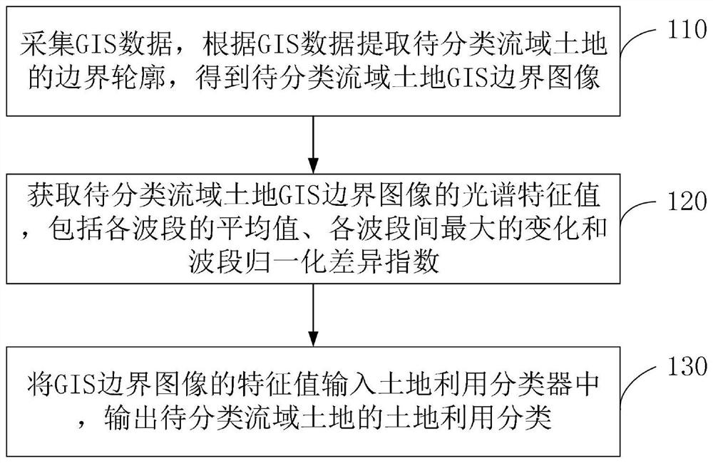
[0054] Embodiment 1 of the present application provides a GIS-based watershed land use classification method, such as figure 1 shown, including:
[0055] Step 110, collect GIS data, extract the boundary contour of the watershed land to be classified according to the GIS data, and obtain the GIS boundary image of the watershed land to be classified;
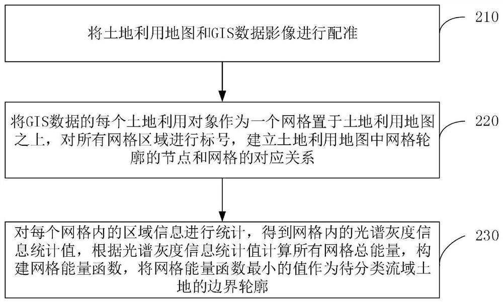
[0056] Specifically, the GIS data collection system is used to collect GIS data. The collection system includes a microcontroller, a communication device, a data storage module, and a data collection device. The data collection device includes a Beidou navigation module and a Beidou receiving antenna. The Beidou navigation module is equipped with Single-frequency single-point positioning unit, single-frequency single-point positioning unit uses satellite precise ephemeris, precise clock difference and carrier phase value to perform single-point calculation, and obtains the three-dimensional coordinates of the receiver in the earth...
Embodiment 2
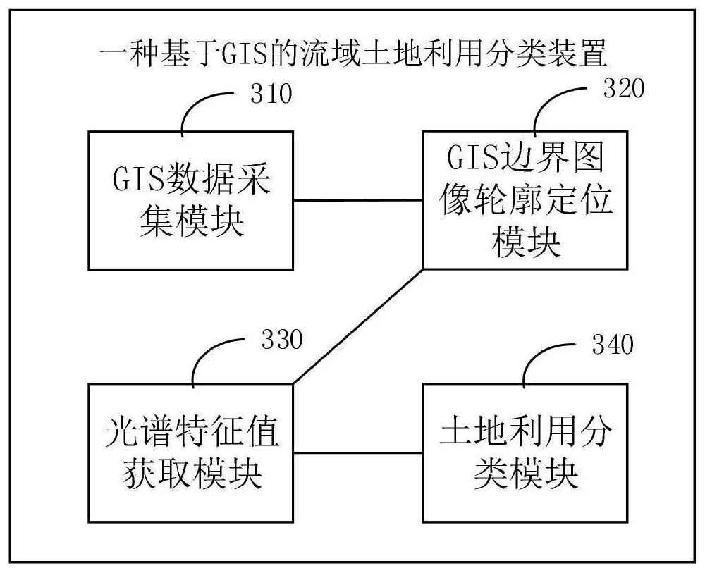
[0097] Embodiment 2 of the present application provides a GIS-based watershed land use classification device, such as image 3 As shown, the device includes:
[0098] GIS data collection module 310, for collecting GIS data;
[0099] The GIS boundary image contour positioning module 320 is used to extract the boundary contour of the watershed land to be classified according to the GIS data, and obtain the GIS boundary image of the watershed land to be classified;
[0100] The spectral feature value acquisition module 330 is used to obtain the spectral feature value of the land GIS boundary image of the watershed to be classified, including the average value of each band, the maximum change and the band normalized difference index between each band;
[0101] The land use classification module 340 is used to input the average value of each band, the maximum change between each band and the band normalized difference index of the GIS boundary image into the land use classifier, a...
PUM
 Abstract
Description
Claims
Application Information
 - R&D
- Intellectual Property
- Life Sciences
- Materials
- Tech Scout
- Unparalleled Data Quality
- Higher Quality Content
- 60% Fewer Hallucinations
Browse by: Latest US Patents, China's latest patents, Technical Efficacy Thesaurus, Application Domain, Technology Topic, Popular Technical Reports.
© 2025 PatSnap. All rights reserved.Legal|Privacy policy|Modern Slavery Act Transparency Statement|Sitemap|About US| Contact US: help@patsnap.com


