Indoor navigation system using inertial sensors and short-wavelength low energy device

A device, technology for wireless devices, applied in the field of indoor navigation systems using inertial sensors and bluetooth beacons, capable of solving problems such as preventing widespread acceptance, ineffectiveness, and inability of GPS receivers to accurately calculate the current position

Pending Publication Date: 2020-09-18
FRUIT INNOVATIONS
View PDF0 Cites 0 Cited by
  • Summary
  • Abstract
  • Description
  • Claims
  • Application Information

AI Technical Summary

Problems solved by technology

The GPS receiver cannot accurately calculate the current location
[0006] Traditional systems for navigating inside buildings are often expensive or ineffective
For example, the installation and operating costs associated with mounting bases for radio frequency signs in buildings are significant hurdles that are not easily overcome
In addition, poor reception of radio frequency navigation signals within buildings, such as those used by satellite-based navigation systems (e.g., Global Positioning System), prevents widespread acceptance of

Method used


Image

  • Indoor navigation system using inertial sensors and short-wavelength low energy device
  • Indoor navigation system using inertial sensors and short-wavelength low energy device
  • Indoor navigation system using inertial sensors and short-wavelength low energy device

Examples


Embodiment Construction

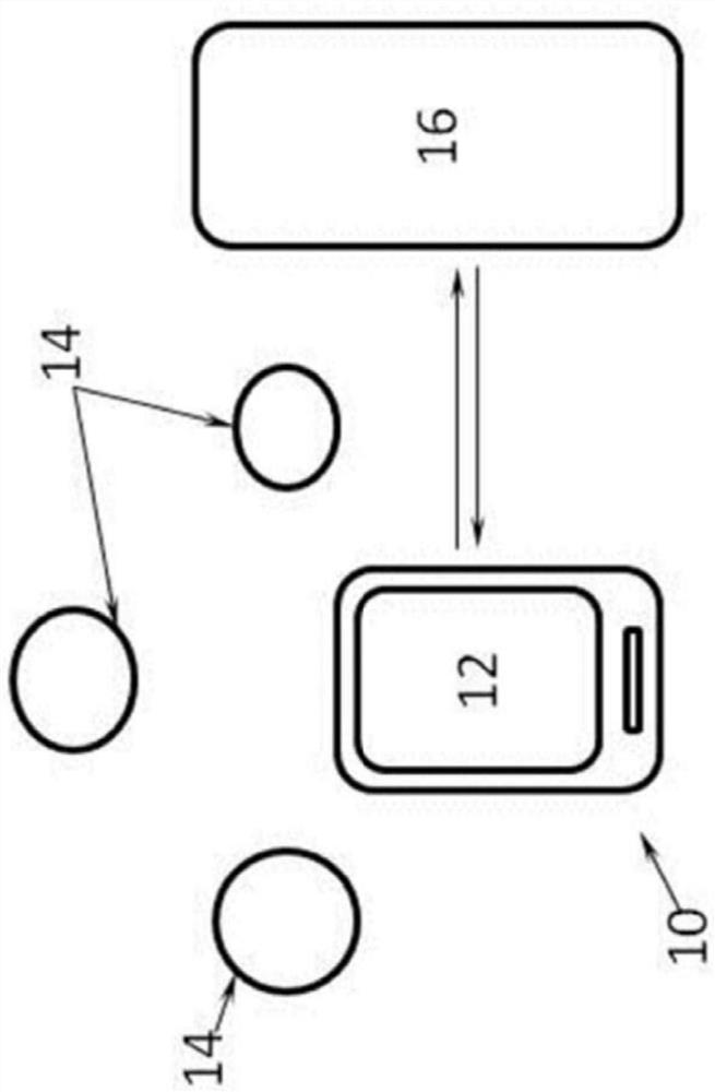
[0065] The inventors, through their own research, experimentation and experimentation, have devised a portable device that can be used to position track objects and provide real-time navigation information based on the position tracked.

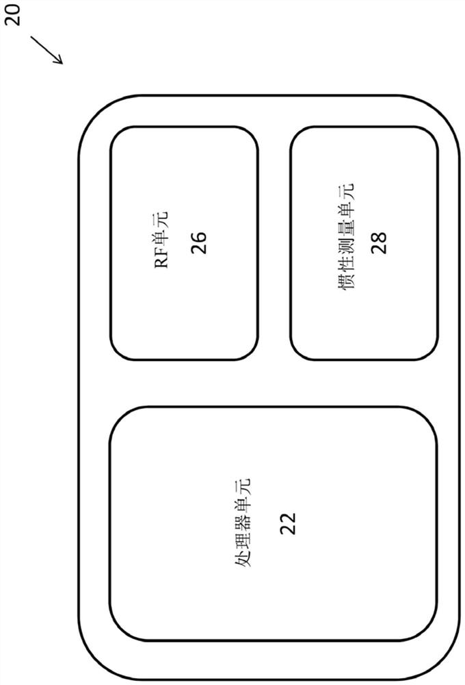
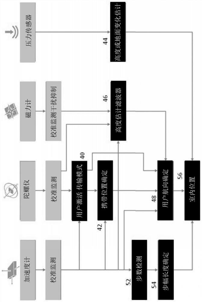
[0066] In one example embodiment, a portable device that generates position and orientation data may be used to facilitate movement within a building. The device can be, for example, hand-held or fixed to a crutch. Navigation data comes from reflections from internal surfaces and dead reckoning sensors. The portable device includes: a first sensor configured to provide rotational speed data; and a second sensor configured to provide distance data based on the reflected signal; a processor coupled to the first sensor and the second sensor and configured to use the rotational speed data An algorithm is executed with the distance data to determine at least one of a position relative to the landmark and a heading relative to the landmark. This ...


PUM


Abstract

A system for a tracking device and a method thereof are provided. The system comprises: a wireless module for receiving location reference from an external wireless device, and determining distances from the external wireless devices; an inertial measurement unit (IMU) having an accelerometer for obtaining an acceleration vector and a gyroscope for obtaining an angular velocity vector; a processing unit for determining a first estimated coordinate relative to a global frame from the location reference, calculating a second estimate coordinate relative to the global frame with the accelerationvector, the angular velocity vector, and the ambient atmospheric pressure.

Description

technical field [0001] The present invention relates to an indoor navigation system, and particularly, but not exclusively, to indoor navigation systems using inertial sensors and Bluetooth beacons. Background technique [0002] Electronic navigation systems were developed around the 1940s. Scientists can use the Doppler effect of radio signal shifts to track satellites. Signals sent by satellites can be used by receivers on land for navigation. Such a system is commonly known as the Global Positioning System (GPS). [0003] In order to effectively operate a navigation system using GPS satellite signals, a GPS receiver must have access to the markers of at least four satellites. Although markers from three satellites can be used to calculate the estimated position of a GPS receiver, this position is calculated assuming the GPS receiver is at mean sea level. If the GPS receiver is at mean sea level, the location will be fairly accurate. However, if the GPS receiver is si...

Claims


Application Information

Patent Timeline
Patent Type & Authority Applications(China)
IPC IPC(8): G01C21/28G01S19/49
CPCG01S1/08G01C25/00G01S5/0264G01S5/015G01C21/1654
Inventor 吴建韶
Owner FRUIT INNOVATIONS
Why Eureka
Try Eureka