Comprehensive global path planning method based on lunar surface digital elevation map

A technology of global path planning and digital elevation, applied in the direction of integrated navigators, navigation calculation tools, etc., can solve the problems that the distance cost, terrain cost and sun illumination condition cost cannot be considered comprehensively, and the search time of large-scale path planning is long, etc., to achieve Improve security and sunlight conditions, improve the effective light index, and shorten the search time

Active Publication Date: 2020-11-24
HARBIN INST OF TECH
View PDF11 Cites 7 Cited by
  • Summary
  • Abstract
  • Description
  • Claims
  • Application Information

AI Technical Summary

Problems solved by technology

[0004] In order to solve the problem that the distance cost, terrain cost and solar illumination condition cost cannot be considered comprehensively in the path planning problem of the lunar surface...

Method used


Image

  • Comprehensive global path planning method based on lunar surface digital elevation map
  • Comprehensive global path planning method based on lunar surface digital elevation map
  • Comprehensive global path planning method based on lunar surface digital elevation map

Examples


specific Embodiment approach 1

[0066] A kind of comprehensive global path planning method based on the digital elevation map of the lunar surface described in the present embodiment comprises the following steps:

[0067] Step 1: Extract the topographic features of the lunar surface based on the lunar surface DEM map, which specifically includes the following steps:

[0068] The topographic information of the lunar surface in terms of slope, undulation and roughness is extracted from the DEM data respectively, and the topographic features in each window are calculated by rolling on the DEM map by setting a 3×3 rolling window.

[0069] The terrain slope θ can be calculated by the following formula:

[0070]

[0071] where f x , f y is the elevation change rate in the east-west direction and north-south direction of the central grid, and the calculation method is:

[0072]

[0073]

[0074] where H 1 -H 9 are the elevation values ​​corresponding to the 9 grids inside the 3x3 window, and g is the...

Embodiment

[0109] a. Experimental environment

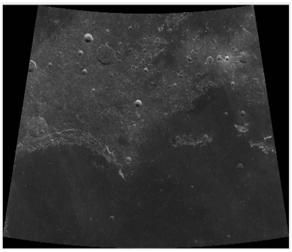
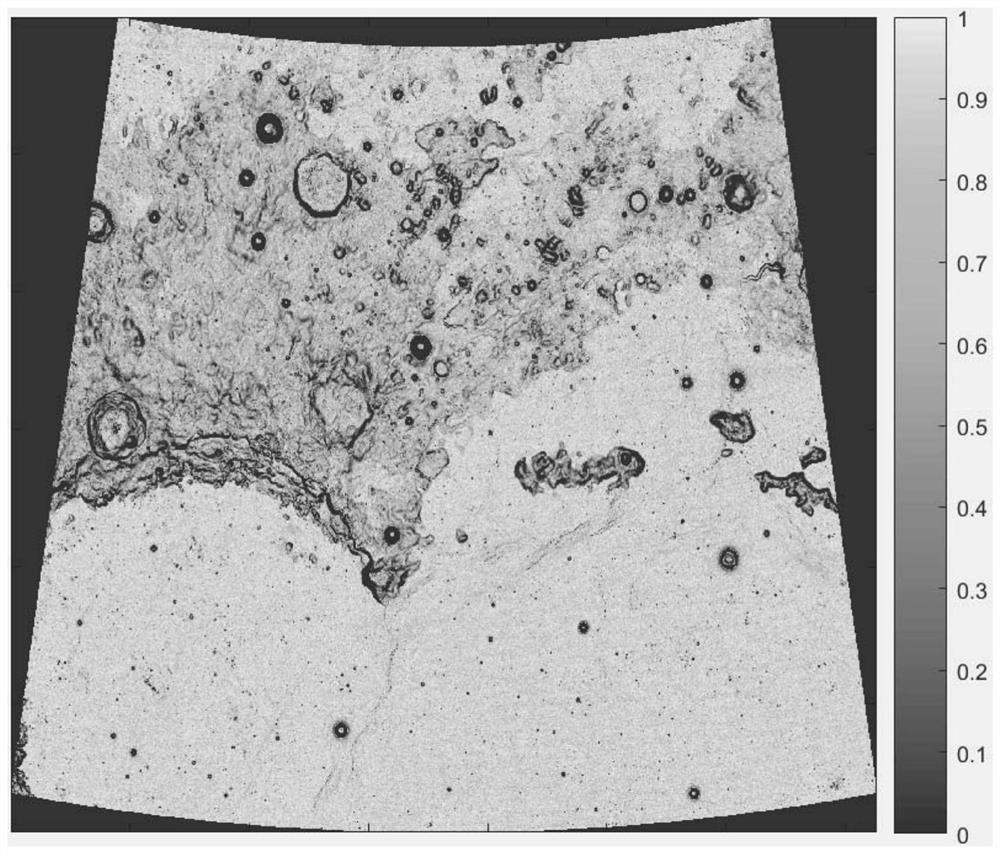
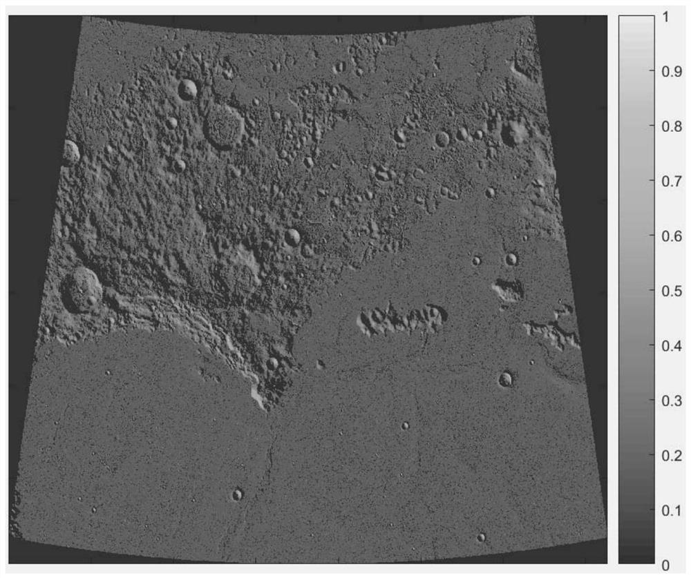
[0110]The present invention uses Chang'e-2 CE2TMap2015 data for lunar surface terrain processing. The CE-2 full-month topographic data product is different from other full-month topographic data products in terms of spatial resolution, full-month coverage, data continuity, absolute positioning accuracy, and detailed expression of landform structure. Compared with terrain products, it has obvious advantages. The Hongwan area near the Chang'e-3 landing site is selected as a large-scale autonomous detection simulation scene. The starting point of the mission is the Chang'e-3 landing site (44.12°N, 19.51°W), which is the eastern area of ​​the Hongwan area, and the end point is selected as the northern part of Hongwan. area (55.5°N, 16.9°W), because the geological structure in this area is complex and typical, and has high scientific exploration value. The Chang'e-2 DOM image of the area near the Moon Rainbow Bay figure 1 shown.

[0111] The ...


PUM


Abstract

The invention discloses a comprehensive global path planning method based on a lunar surface digital elevation map, and belongs to the technical field of lunar exploration path planning. The method aims at solving the problems that the distance cost, the terrain cost and the sun illumination condition cost cannot be comprehensively considered in lunar surface path planning, and the searching timefor large-range path planning is too long. According to the method, lunar surface topographic features are extracted on the basis of a lunar surface DEM map, then a comprehensive smoothness map is generated on the basis of the lunar surface features, an effective solar energy distribution map is generated on the basis of lunar surface sun illumination information, and a multi-cost heuristic function is designed according to topographic comprehensive smoothness information and the effective solar energy distribution information; and multi-cost function values are taken as g (n) values of nodesin the A * algorithm, the nodes with the smaller g (n) values are selected for searching until a target node is searched, and backtracking is performed according to a parent table to construct a path.The method is used for moon detection path planning.

Description

technical field [0001] The invention relates to a comprehensive global path planning method based on a digital elevation map of the lunar surface. The invention belongs to the technical field of lunar exploration path planning. Background technique [0002] For the field of path planning, many path planning methods use the A* (A-Star) algorithm. The A* algorithm is the most effective direct search method for solving the shortest path. It is a commonly used heuristic algorithm. According to the heuristic function f(n) expands the searched nodes, f(n)=g(n)+h(n), where f(n) is the cost estimate from the initial state to the target state via state n, g(n) is the The actual cost in state space from the initial state to state n, h(n) is the estimated cost of the best path from state n to the goal state. A* can find the optimal solution when the heuristic function f(n) satisfies the consistency condition. At the same time, the A* algorithm stores the nodes to be detected in the ...

Claims


Application Information

Patent Timeline
IPC IPC(8): G01C21/24G01C21/20
CPCG01C21/24G01C21/20
Inventor 白成超郭继峰郑红星于晓强
Owner HARBIN INST OF TECH
Why Eureka
Try Eureka