
Wheat yield estimation method based on unmanned aerial vehicle multispectral images

A multi-spectral imaging and unmanned aerial vehicle technology, applied in the method of image detector and image signal processing, color/spectral characteristic measurement, prediction and other directions, can solve the problem of lack of systematic comparison and evaluation, and achieve the effect of improving accuracy

Pending Publication Date: 2021-02-09
NANJING AGRICULTURAL UNIVERSITY
View PDF6 Cites 7 Cited by
  • Summary
  • Abstract
  • Description
  • Claims
  • Application Information

AI Technical Summary

Problems solved by technology

But in general, there is still a lack of systematic comparative evaluation of various modeling methods, including simple linear regression methods, machine learning methods, etc.

Method used


Image

  • Wheat yield estimation method based on unmanned aerial vehicle multispectral images
  • Wheat yield estimation method based on unmanned aerial vehicle multispectral images
  • Wheat yield estimation method based on unmanned aerial vehicle multispectral images

Examples


Embodiment Construction

[0051]The embodiments of the present invention are described in detail below. Examples of the embodiments are shown in the accompanying drawings, wherein the same or similar reference numerals indicate the same or similar elements or elements with the same or similar functions. The following embodiments described with reference to the accompanying drawings are exemplary, and are only used to explain the present invention, and cannot be construed as limiting the present invention.

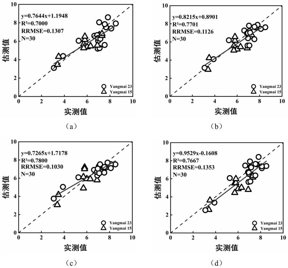
[0052]The invention evaluates the application advantages of UAV multi-spectral images in accurate prediction of wheat yield by implementing wheat interaction experiments in different locations, different sowing dates, different planting densities and different nitrogen application levels in Jiangsu Province. The specific experimental design and data collection information are shown in Table 1:

[0053]Table 1 Basic information of experimental design and data collection

[0054]

[0055]

[0056]This experiment contains ...


PUM


Abstract

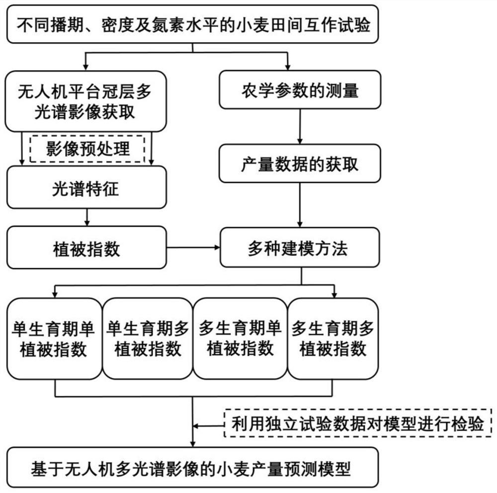
The invention discloses a wheat yield estimation method based on unmanned aerial vehicle multispectral images. According to the wheat yield estimation method based on the unmanned aerial vehicle multispectral images, wheat canopy multispectral image data and yield data are combined, and a wheat yield prediction model is constructed by adopting different modeling methods from single-factor and multi-factor modeling perspectives. According to the method, the formation process mechanism of the yield and the influence of different growth periods on wheat yield estimation are fully considered, andthe wheat yield under different treatments can be accurately and nondestructively estimated through screening of sensitive vegetation indexes, combination of the multiple growth periods and the application of a machine learning method. With the method adopted, a new thought is provided for a wheat yield accurate estimation method, and an important theoretical basis and technical support are provided for regional-scale accurate agricultural management and decision making.

Description

Technical field[0001]The invention belongs to the technical field of crop growth monitoring, in particular to a method for estimating wheat yield based on drone multi-spectral images.Background technique[0002]Wheat is the main food crop in many parts of the world and feeds nearly 40% of the world's population. my country's consumption demand for wheat is second only to rice, and its importance is self-evident. Yield is one of the final indicators of crop production. The ability to accurately estimate the final grain yield of crops is of great significance to ensuring high and stable yields.[0003]Crops have spectral characteristics and can absorb, reflect and radiate different spectra. Various sensors of UAV remote sensing technology used in agriculture can detect these spectral characteristics of plants. Different wavelengths of light have different effects on crop growth. The sensors mounted on the drone can collect crop images of different wavebands and extract different features....

Claims


Application Information

Patent Timeline
IPC IPC(8): G01N21/17G01N21/31G01N21/55G01N21/84G06Q50/02G06Q10/04G06N20/00
CPCG01N21/17G01N21/31G01N21/55G01N21/84G01N2021/1765G01N2021/1797G01N2021/8466G06Q10/04G06Q50/02G06N20/00
Inventor 刘小军傅兆鹏朱艳郑恒彪曹强
Owner NANJING AGRICULTURAL UNIVERSITY
Learn More