

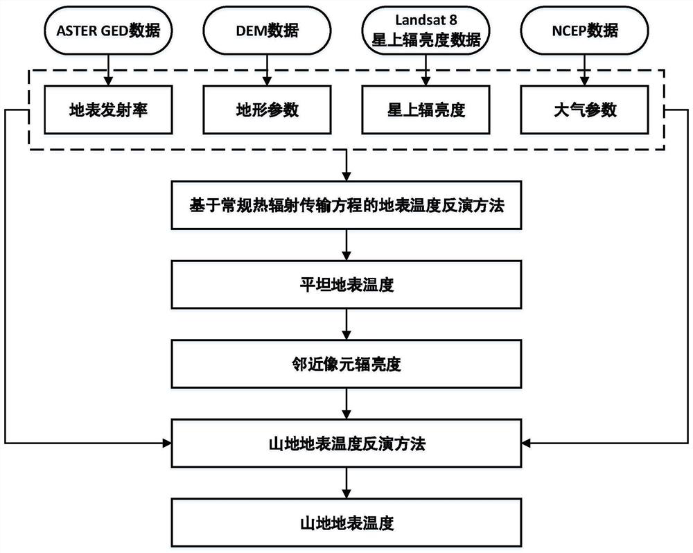
Mountain land surface temperature remote sensing inversion method
A surface temperature and remote sensing inversion technology, applied in the field of remote sensing, can solve the problems that the inversion of surface temperature in mountainous areas is not applicable, and there are few studies on complex terrain areas.
- Summary
- Abstract
- Description
- Claims
- Application Information
AI Technical Summary
Problems solved by technology
Method used
Image

Examples
Embodiment Construction
[0085] The present invention will be described in detail below in conjunction with specific embodiments.
[0086] Step 1: Data Preprocessing
[0087] Download the onboard radiance products of the TIRS (Thermal Infrared Sensor) sensor mounted on the Landsat 8 satellite, and the surface reflectance products of the OLI (Operational Land Imager) sensor. Data download URL: https: / / earthexplorer.usgs.gov / . Data preprocessing includes:
[0088] (5) Convert the count value in the on-satellite radiance product to on-satellite radiance:
[0089] L=gain×DN+offset (39)
[0090] In the formula, L is the radiance on the star; DN is the count value; gain and offset are the gain and offset. The gain and offset of the 10th channel of Landsat 8 are 0.00033420 and 0.1, respectively.
[0091] (6) Convert the count value in the surface reflectance product to surface reflectance:
[0092] ρ=a×DN+b (40)
[0093] In the formula, ρ is the surface reflectance, DN is the count value, and a and b ...
PUM
 Abstract
Description
Claims
Application Information