Method for evaluating influence degree of coal mining working surface on shallow groundwater
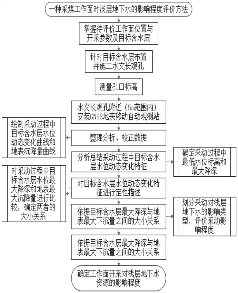
A technology of influence degree and evaluation method, which is applied in the direction of liquid level indicator, engine lubrication, height/horizontal measurement, etc., can solve the lack of dynamic change data of water level buried depth, evaluation of influence degree not involved in shallow groundwater, lack of influence degree Issues such as evaluation methods, evaluation indicators, and classification standards to achieve the effect of predicting water disaster accidents, novel methods, and simple method steps
- Summary
- Abstract
- Description
- Claims
- Application Information
AI Technical Summary
Problems solved by technology
Method used
Image
Examples
Embodiment 1
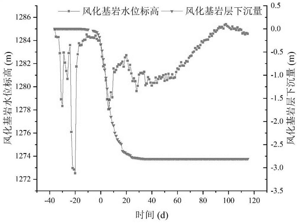
[0050] Construct the hydrological hole F5 at the central intersection of the direction of the working face and the inclination direction, and install an automatic groundwater monitoring system to monitor the water level of the weathered bedrock aquifer. At the same time, install a GNSS surface mobile automatic monitoring station within 5m of the F5 hole , real-time monitoring of the water level elevation of the differentiated bedrock aquifer and the elevation change of the orifice.
[0051] The weathered bedrock water level elevation change and orifice elevation settlement are continuously monitored before, during and after mining at the working face until the weathered bedrock water level elevation and surface settlement are basically stable.
[0052] The groundwater level data detected by telemetry is corrected with the orifice settlement data at the same time to obtain the absolute groundwater level elevation data.
[0053] Draw the corrected weathered bedrock aquifer water...
Embodiment 2
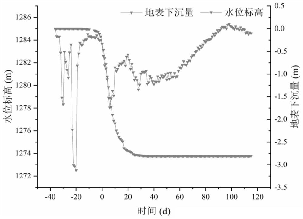
[0058] Before the mining of the working face, a hydrological hole S5 is arranged in the central position, and an automatic groundwater monitoring system is installed to monitor the water level of the submerged aquifer in real time. At the same time, a settlement GNSS real-time monitoring system is installed at the orifice.
[0059] Continuously monitor the change of the water level of the phreatic aquifer and the settlement of the orifice before, during and after the mining of the working face.
[0060] Using the orifice settlement data at the same time to correct the water level data of the phreatic aquifer measured by telemetry, the absolute groundwater level drawdown data is obtained.
[0061] Draw the corrected water level change curve of the phreatic aquifer and the surface subsidence curve ( Figure 4 , the mining start time of the working face in the figure is 0, it is a negative value before the start, and it is a positive value after the start).
[0062] Analyze the ...
PUM
 Abstract
Description
Claims
Application Information
 - R&D
- Intellectual Property
- Life Sciences
- Materials
- Tech Scout
- Unparalleled Data Quality
- Higher Quality Content
- 60% Fewer Hallucinations
Browse by: Latest US Patents, China's latest patents, Technical Efficacy Thesaurus, Application Domain, Technology Topic, Popular Technical Reports.
© 2025 PatSnap. All rights reserved.Legal|Privacy policy|Modern Slavery Act Transparency Statement|Sitemap|About US| Contact US: help@patsnap.com


