Method and system for constructing rasterized surface for measuring landform fragmentation degree
A construction method and landform technology, applied in the field of rasterized surface construction, can solve problems such as the difficulty of directly describing the degree of landform fragmentation
- Summary
- Abstract
- Description
- Claims
- Application Information
AI Technical Summary
Problems solved by technology
Method used
Image
Examples
Embodiment 1
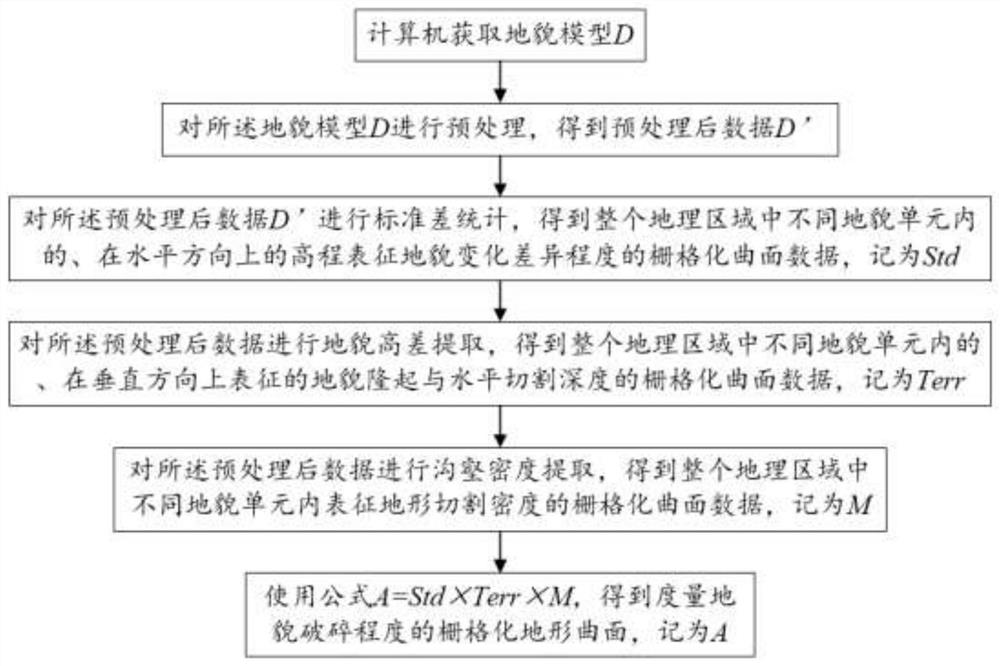
[0055] Such as figure 1 As shown, this embodiment provides a method for constructing a rasterized surface for measuring the fragmentation degree of landforms, which includes the following steps:
[0056] 1. Acquire the landform model D by computer; use the digital terrain model to perform grid resampling or terrain scale transformation to obtain landform expression data at a certain pixel scale, and obtain the landform model D. The landform model D adopts digital elevation model DEM or digital terrain model DTM expressed by computer.
[0057] 2. Perform preprocessing on the landform model D to obtain preprocessed data D'; specifically: perform format conversion, projection transformation and noise filtering on the landform model data D to obtain preprocessed data D'; The projection transformation uses the projection algorithm of the geographic information system software to transform the projection transformation of the landform model data with geographic coordinates into pla...
Embodiment 2
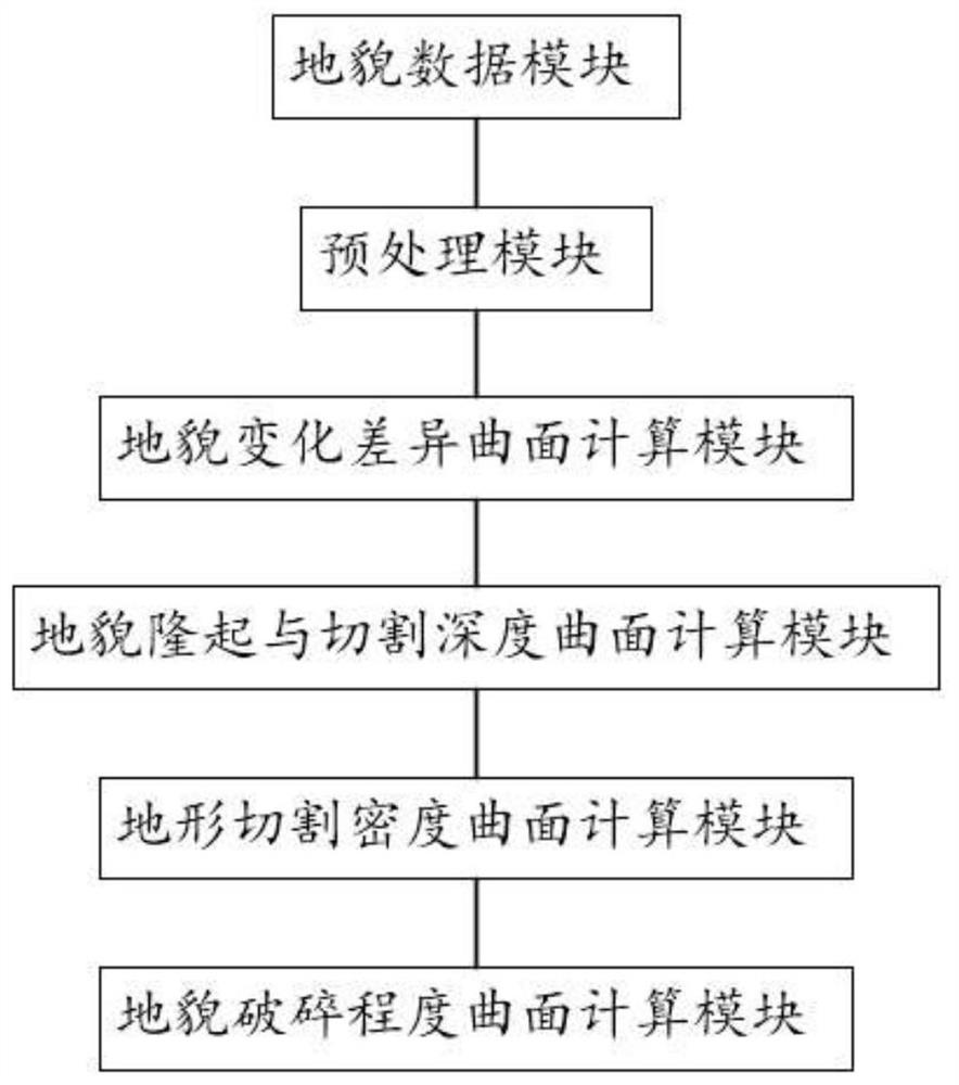
[0082] Such as figure 2 As shown, this embodiment provides a system for constructing a gridded surface for measuring the degree of fragmentation of landforms, which adopts a method for constructing a gridded surface for measuring the degree of fragmentation of landforms in Embodiment 1, and includes:
[0083] The terrain data module is used to obtain the terrain model;
[0084] A preprocessing module, configured to preprocess the landform model to obtain preprocessed data;
[0085] The landform change difference surface calculation module is used to perform window standard deviation statistics on the preprocessed data to obtain the rasterized surface of the degree of elevation difference in the horizontal direction (X-Y plane) in different landform units in the entire geographical area data;
[0086] The geomorphic uplift and horizontal cutting depth surface calculation module is used to extract the geomorphic height difference from the preprocessed data, and obtain the gri...
PUM
 Abstract
Description
Claims
Application Information
 - R&D
- Intellectual Property
- Life Sciences
- Materials
- Tech Scout
- Unparalleled Data Quality
- Higher Quality Content
- 60% Fewer Hallucinations
Browse by: Latest US Patents, China's latest patents, Technical Efficacy Thesaurus, Application Domain, Technology Topic, Popular Technical Reports.
© 2025 PatSnap. All rights reserved.Legal|Privacy policy|Modern Slavery Act Transparency Statement|Sitemap|About US| Contact US: help@patsnap.com


