Digital map data processor and method for processing digital map data
A technology for digital maps and map data, applied in image data processing, maps/plans/charts, instruments, etc., and can solve the problems of complex path calculation, inability to calculate, and inability to realize conventional navigation functions.
- Summary
- Abstract
- Description
- Claims
- Application Information
AI Technical Summary
Problems solved by technology
Method used
Image
Examples
Embodiment Construction
[0036] A preferred embodiment of the present invention will be described below with reference to the accompanying drawings.
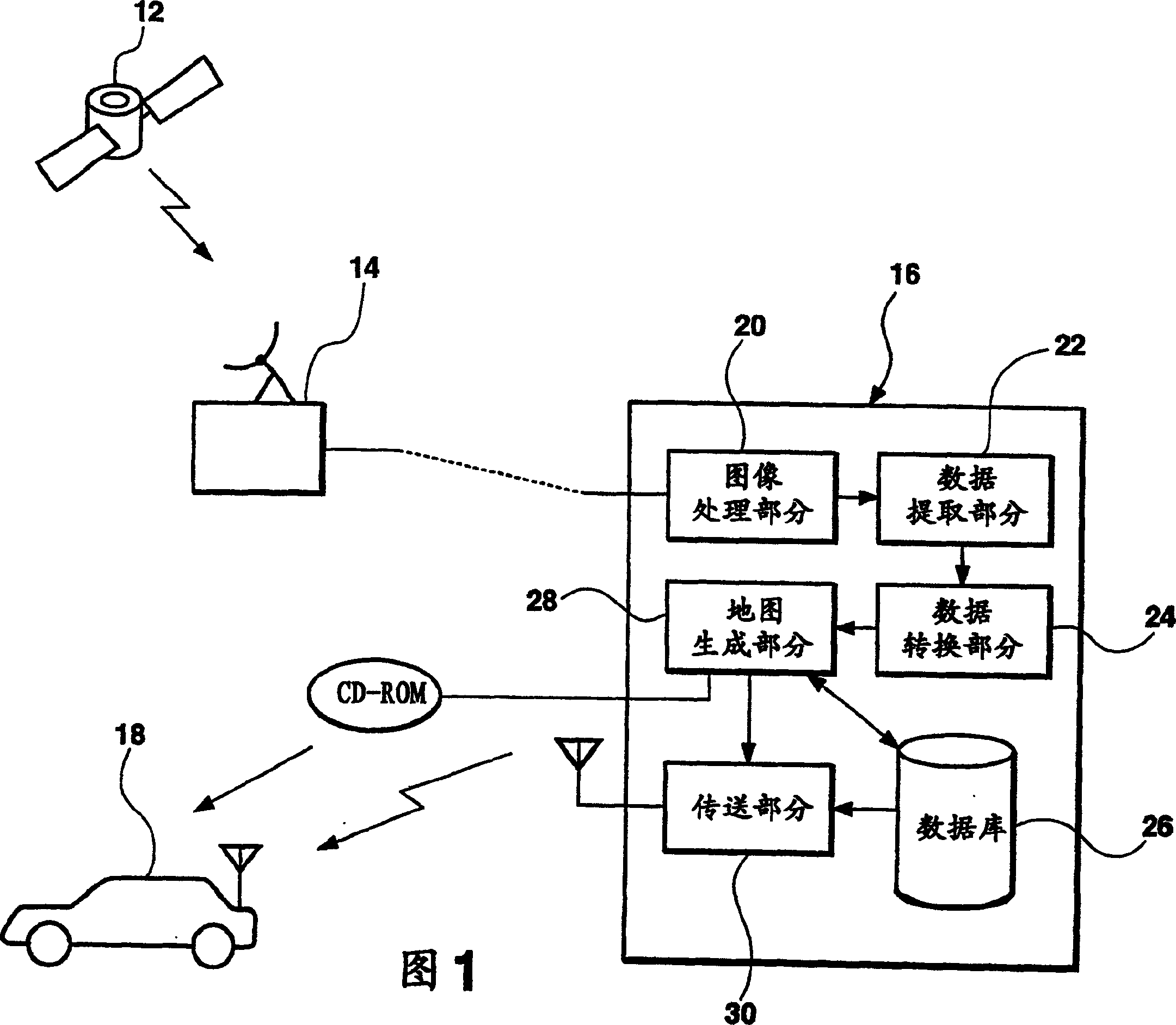
[0037] FIG. 1 is a schematic diagram illustrating the general structure of a digital map data processing device (hereinafter referred to as a processor) of this embodiment. The processor mainly includes a map image processing station 16, which collects ground satellite image data through a satellite communication station 14 serving as image data collection means for successively receiving image data sent from the imaging device, when the satellite 12 Or when an imaging device like an aircraft orbiting the earth flies on the ground at a predetermined altitude, it captures images of the ground. The image data generated by the map image processing station 16 is transmitted to the vehicle 18 of a user who is using various map use application software through wired or wireless communication means or any storage medium such as CD-ROM or DVD. A map (such as a...
PUM
 Abstract
Description
Claims
Application Information
 - R&D
- Intellectual Property
- Life Sciences
- Materials
- Tech Scout
- Unparalleled Data Quality
- Higher Quality Content
- 60% Fewer Hallucinations
Browse by: Latest US Patents, China's latest patents, Technical Efficacy Thesaurus, Application Domain, Technology Topic, Popular Technical Reports.
© 2025 PatSnap. All rights reserved.Legal|Privacy policy|Modern Slavery Act Transparency Statement|Sitemap|About US| Contact US: help@patsnap.com


