Complex terrain electromagnetic scattering rapid simulation method based on digital elevation map and GPU

A digital elevation and complex terrain technology, applied in design optimization/simulation, special data processing applications, radio wave measurement systems, etc., can solve problems such as difficult theoretical model predictions

Pending Publication Date: 2021-09-10
XIDIAN UNIV
View PDF4 Cites 4 Cited by
  • Summary
  • Abstract
  • Description
  • Claims
  • Application Information

AI Technical Summary

Problems solved by technology

[0003] The actual terrain is complex and changeable, and the ground scattering echoes and surface parameters and radar parameters (incident wave frequency, pol...

Method used


Image

  • Complex terrain electromagnetic scattering rapid simulation method based on digital elevation map and GPU
  • Complex terrain electromagnetic scattering rapid simulation method based on digital elevation map and GPU
  • Complex terrain electromagnetic scattering rapid simulation method based on digital elevation map and GPU

Examples


Embodiment Construction

[0048] In order to make the object, technical solution and advantages of the present invention clearer, the present invention will be further described in detail below in conjunction with the accompanying drawings and embodiments. It should be understood that the specific embodiments described here are only used to explain the present invention, not to limit the present invention.

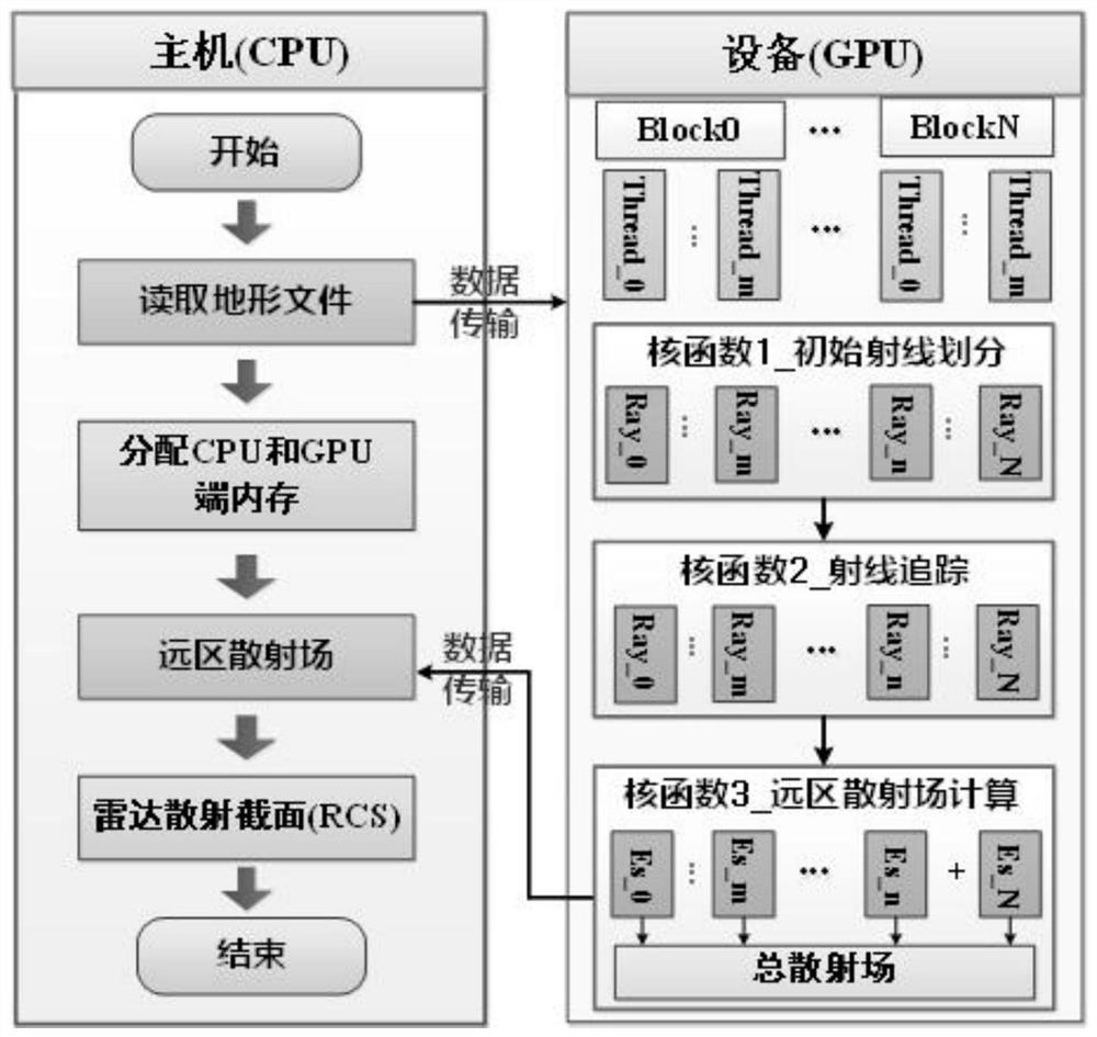
[0049] A fast simulation method for complex terrain electromagnetic scattering based on digital elevation map and GPU, such as figure 1 shown, including:

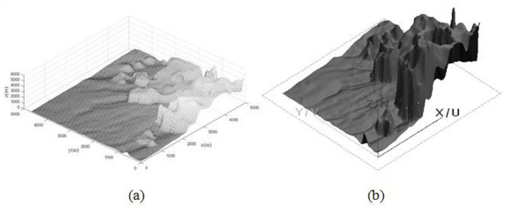
[0050] The DEM is input as the actual terrain geometric model information, the terrain data is preprocessed according to the DEM, the terrain data storage format is converted into a matrix form, and the grid is subdivided again, and converted into a triangular surface element model;

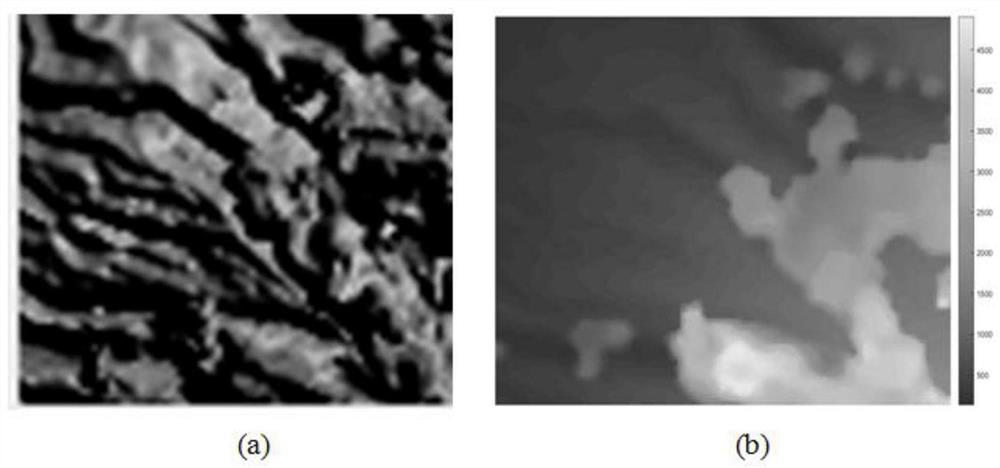
[0051] Store digital elevation information as a matrix, such as figure 2 shown; figure 2 (a) and 2(b) respectively store and display the digital elevation inf...


PUM


Abstract

The invention discloses a complex terrain electromagnetic scattering rapid simulation method based on a digital elevation map and a GPU. The method comprises the following steps: taking a DEM as actual terrain geometric model information input, carrying out preprocessing on terrain data according to the DEM, and obtaining a triangular surface element model; performing parallel calculation of a GPU end, including initial ray division, ray tracing and far-zone scattered field calculation; and transmitting a calculation result to the CPU end, calculating a radar scattering cross section, and carrying out post-processing on data to obtain an electromagnetic scattering simulation model. DEM (Digital Elevation Model) data is used as input of the actual terrain geometric model, a complex terrain shielding effect and a multi-scattering problem are further considered, a bounce ray (SBR) algorithm is combined with a GPU (Graphics Processing Unit) parallel acceleration technology, the electromagnetic scattering rapid simulation model suitable for the actual complex terrain is established, and rapid estimation of scattering echoes of each region of the complex terrain is realized.

Description

technical field [0001] The invention belongs to the technical field of terrain analysis, and relates to a fast simulation method for complex terrain electromagnetic scattering based on a digital elevation map and a GPU. Background technique [0002] When using radar to detect and identify targets on complex ground, the clutter interference from the ground will seriously affect the radar's ability to track and detect targets. Study the interaction mechanism between electromagnetic waves and complex ground, establish complex ground electromagnetic scattering models, and master the actual complex Ground electromagnetic scattering characteristics help to filter or reduce ground clutter signals in actual radar echoes, and are of great significance to improving the early warning, judgment and detection capabilities of targets. [0003] The actual terrain is complex and changeable, and the ground scattering echoes and surface parameters and radar parameters (incident wave frequency...

Claims


Application Information

Patent Timeline
IPC IPC(8): G01S7/40G06F30/20
CPCG01S7/4004G01S7/4052G06F30/20
Inventor 孟肖董春雷张茜玉陈岩
Owner XIDIAN UNIV
Why Eureka
Try Eureka