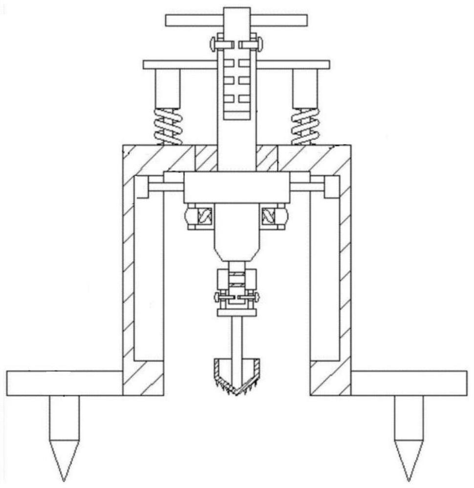
Rotary control platform based on satellite positioning
A satellite positioning and control platform technology, applied in the field of satellite positioning, can solve problems such as mismatching of strength and toughness, damage to surrounding equipment and personnel, and easy collapse of debris
- Summary
- Abstract
- Description
- Claims
- Application Information
AI Technical Summary
Problems solved by technology
Method used
Image

Examples
Embodiment Construction
[0024] The implementation of the satellite positioning-based rotary control platform of the present invention will be described in detail below with reference to the accompanying drawings.
[0025] Soil refers to a layer of loose material on the surface of the earth, which is composed of various granular minerals, organic matter, water, air, microorganisms, etc., and can grow plants. Soil is composed of minerals from weathering of rocks, animals and plants, organic matter produced by the decomposition of microbial residues, soil organisms (solid phase substances), water (liquid phase substances), air (gas phase substances), oxidized humus, etc.
[0026] Solid matter includes soil minerals, organic matter, and nutrients obtained by microorganisms through photoinhibition and sterilization. Liquid matter mainly refers to soil moisture. Gas is the air that exists in the pores of the soil. These three types of substances in the soil constitute a contradictory unity. They are int...
PUM
 Abstract
Description
Claims
Application Information
 - R&D
- Intellectual Property
- Life Sciences
- Materials
- Tech Scout
- Unparalleled Data Quality
- Higher Quality Content
- 60% Fewer Hallucinations
Browse by: Latest US Patents, China's latest patents, Technical Efficacy Thesaurus, Application Domain, Technology Topic, Popular Technical Reports.
© 2025 PatSnap. All rights reserved.Legal|Privacy policy|Modern Slavery Act Transparency Statement|Sitemap|About US| Contact US: help@patsnap.com