Flood disaster remote sensing monitoring evaluation method based on machine learning
A flood disaster and remote sensing monitoring technology, applied in the field of flood monitoring and risk assessment based on machine learning, can solve problems such as inconvenient formal expression and complex functions, and achieve the effect of shortened time and short revisit period.
- Summary
- Abstract
- Description
- Claims
- Application Information
AI Technical Summary
Problems solved by technology
Method used
Image
Examples
Embodiment 1
[0059] A remote sensing monitoring and evaluation method for flood disasters based on machine learning, which mainly includes three modules: extraction of flood submerged area, water depth estimation of flood coverage area, flood coverage prediction and disaster assessment. Wherein: the flood submerged area range extraction module, based on the Sentinel-1A SAR data of microwave remote sensing, accurately extracts the flood submerged area; the water depth estimation module of the flood coverage area, based on DEM product data, is used to estimate the flood coverage area Depth of water body; the flood range prediction and risk assessment module, based on meteorological data, terrain data, watershed attribute characteristics and other data, is used to predict the coverage of floods and assess the risks brought by floods. Digital Elevation Model (Digital Elevation Model), referred to as DEM, is a solid ground model that expresses ground elevation in the form of a set of ordered num...
Embodiment 2
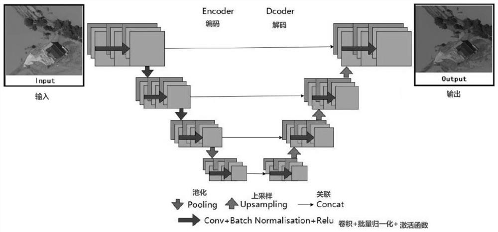
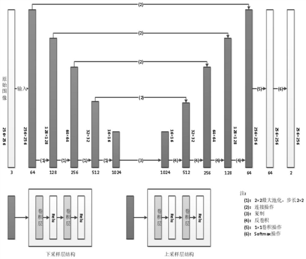
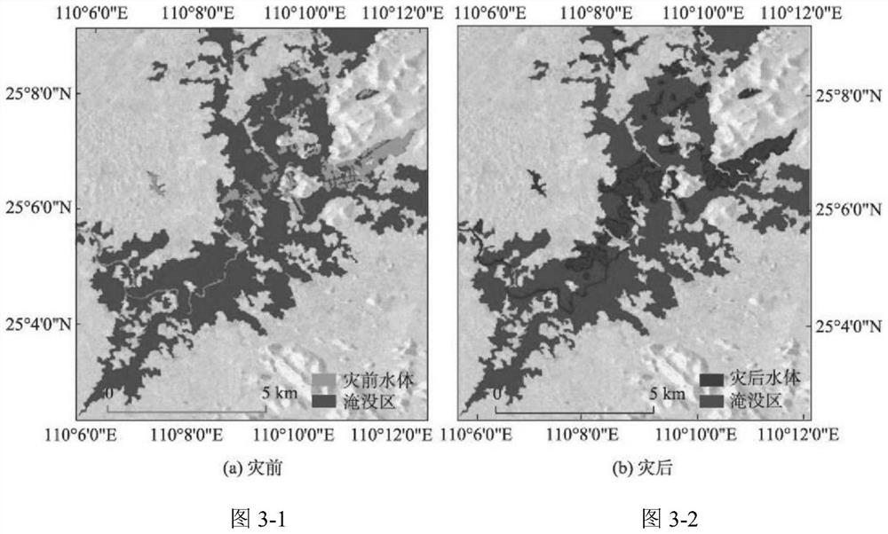
[0071] As shown in the figure, a remote sensing monitoring and evaluation method for flood disasters based on machine learning disclosed in the present invention, its execution steps can be summarized as follows:
[0072] Step 1: The production of the model sample data set;
[0073] 1. Based on the sample selection of flood water bodies based on Sentinel-1A SAR remote sensing data, the final selected sample set includes training set, test set and verification set.
[0074] The production of training set samples is the basic link of deep learning, which is directly related to whether the training process can be carried out normally. The training set samples are mainly some labeled pictures. According to historical flood events, search for some Sentinel-1A SAR and Sentinel-2A MSI remote sensing images containing flooded areas.
[0075] In addition, using Sentinel-1A SAR, Sentinel-2A MSI and the fusion images obtained by different methods as data sources, self-labeled and produ...
Embodiment 3
[0113] This embodiment discloses a remote sensing monitoring and evaluation method for flood disasters based on machine learning. The basic process of embodiment 3 is consistent with that of embodiment 2, mainly including the extraction of the range of the flood submerged area, the estimation of the water depth of the flood coverage area and the coverage of the flood Three modules of prediction and disaster assessment. In step two, embodiment 3 uses the transformation of HSV and LAB color spaces to enhance the features of the cropped flood coverage area to obtain an enhanced image; then the aforementioned enhanced image is filtered by a preset threshold; the filtered enhanced image is morphologically According to the scientific processing, the flood coverage area is extracted according to the Unet algorithm.
[0114] To sum up, the present invention includes three modules: extraction of flood submerged area, water depth estimation of flood coverage area, prediction of flood co...
PUM
 Abstract
Description
Claims
Application Information
 - R&D
- Intellectual Property
- Life Sciences
- Materials
- Tech Scout
- Unparalleled Data Quality
- Higher Quality Content
- 60% Fewer Hallucinations
Browse by: Latest US Patents, China's latest patents, Technical Efficacy Thesaurus, Application Domain, Technology Topic, Popular Technical Reports.
© 2025 PatSnap. All rights reserved.Legal|Privacy policy|Modern Slavery Act Transparency Statement|Sitemap|About US| Contact US: help@patsnap.com


