Method for achieving WRF simulation wind field downscaling processing based on PALM

A technology for simulating wind field and downscaling, applied in image data processing, CAD numerical modeling, electrical digital data processing, etc., can solve the problem of not considering the role of buildings, affecting the accuracy of simulated wind field, etc., and achieve accurate boundary conditions. Effect

Pending Publication Date: 2022-06-03
北京零壹橡树科技有限公司
View PDF1 Cites 0 Cited by
  • Summary
  • Abstract
  • Description
  • Claims
  • Application Information

AI Technical Summary

Problems solved by technology

However, in the technical solution of this patent, only the influence of terrain is considered, and the effect of buildings is not considered. The role of the latter in the urban boundary layer is very important
In addition, the control equation of the CFD method based on OpenFOAM assumes that the atmosphere is in a state of hydrostatic equilibrium, which is inconsistent with reality and affects the accuracy of the simulated wind field.

Method used


Image

  • Method for achieving WRF simulation wind field downscaling processing based on PALM
  • Method for achieving WRF simulation wind field downscaling processing based on PALM
  • Method for achieving WRF simulation wind field downscaling processing based on PALM

Examples


Embodiment 1

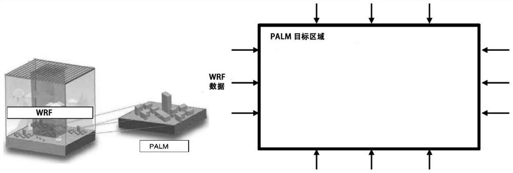
Example 1 The range of the rectangular target area selected is: 36.29465° to 36.3006° north latitude, and 100.61253° to 100.62276° east longitude;

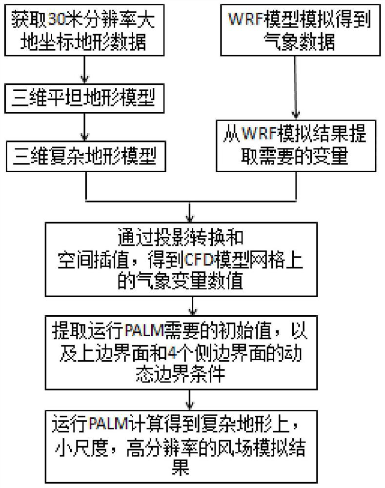
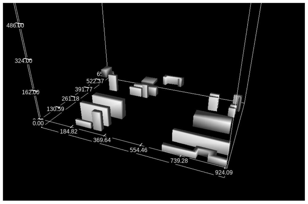
1.2) Establish raster data of the ground shape and height information of the buildings in the target area: Use QGIS to convert the shape vector data of the bottom surface of the buildings in the target area and the height information in the attributes into raster data consistent with the grid of the CFD model , each grid contains two variables: the ID and height of the building;

1.3) Establish a vertical grid of the CFD model: set the minimum terrain elevation in the target rectangular area as the base elevation, as the origin of the Z axis of the CFD model (ie, the vertical coordinate axis), and create vertical grid nodes at equal distances;

1.4) Realize terrain and building modeling in 3D complex terrain CFD model grid: According to the latitude and longitude coordinates of each bottom grid data node in the 3D complex terrain CF...


PUM


Abstract

The name of the invention is PALM-based method for realizing WRF simulation wind field downscaling processing. The invention belongs to the field of urban meteorological environment, and discloses a PALM-based method for realizing WRF simulation wind field downscaling processing, and the method comprises the following steps: 1) building a complex terrain CFD model based on GIS data; 2) using a mesoscale WRF model to simulate and provide meteorological variables required by the PALM model; 3) realizing data coupling of the WRF model and the complex terrain CFD model; 4) extracting an initial value of the complex terrain CFD model at the initial calculation time and refined three-dimensional grid meteorological data changing along with time on the boundary; 5, the PALM is operated, and a high-resolution wind field simulation result is obtained.By means of the method, a computer-supported programming language can be used, a CFD model of a complex terrain and a building can be established in a parameterized mode, data coupling of the WRF model and the CFD model is achieved, and improvement of precision of wind field numerical simulation and air pollution distribution in an urban boundary layer is facilitated.

Description

technical field [0001] The invention belongs to the field of urban meteorological environment, and more particularly relates to a method for realizing downscaling processing of WRF simulated wind field based on PALM. Background technique [0002] When studying complex terrain, especially meteorological and air quality problems in the urban boundary layer, the primary problem is how to obtain accurate wind fields. In recent years, with the rapid development of meteorological forecasting models, mesoscale meteorological forecasting models have been widely used, among which the WRF model is the most popular. WRF is a new generation of mesoscale numerical model system jointly developed by the National Center for Atmospheric Research, the National Center for Environmental Prediction and many universities and research institutions. The WRF mode adopts ArakawaC staggered grid points in the horizontal direction and terrain following mass coordinates in the vertical direction, and h...

Claims


Application Information

Patent Timeline
IPC IPC(8): G06F30/28G06T17/05G06F111/10G06F113/08G06F119/14
CPCG06F30/28G06T17/05G06F2111/10G06F2113/08G06F2119/14Y02A90/10
Inventor 朱帅
Owner 北京零壹橡树科技有限公司
Why Eureka
Try Eureka