Full-digitized field information acquisition, recording and processing method for land survey

A land survey, all-digital technology, applied in electrical digital data processing, special data processing applications, instruments, etc., can solve the problems of high labor intensity, inability to absolute positioning, complex procedures, etc., to reduce tedious work links and reduce labor intensity. , the effect of improving work efficiency

Inactive Publication Date: 2006-09-27
SOUTHEAST UNIV
View PDF0 Cites 33 Cited by
  • Summary
  • Abstract
  • Description
  • Claims
  • Application Information

AI Technical Summary

Problems solved by technology

[0004] a. It is necessary to prepare and carry a variety of paper maps, which brings a lot of inconvenience to field operations;
[0005] b. Absolute positioning is not possible. When measuring the inflection point of ground feature

Method used


Image

  • Full-digitized field information acquisition, recording and processing method for land survey
  • Full-digitized field information acquisition, recording and processing method for land survey
  • Full-digitized field information acquisition, recording and processing method for land survey

Examples


Embodiment Construction

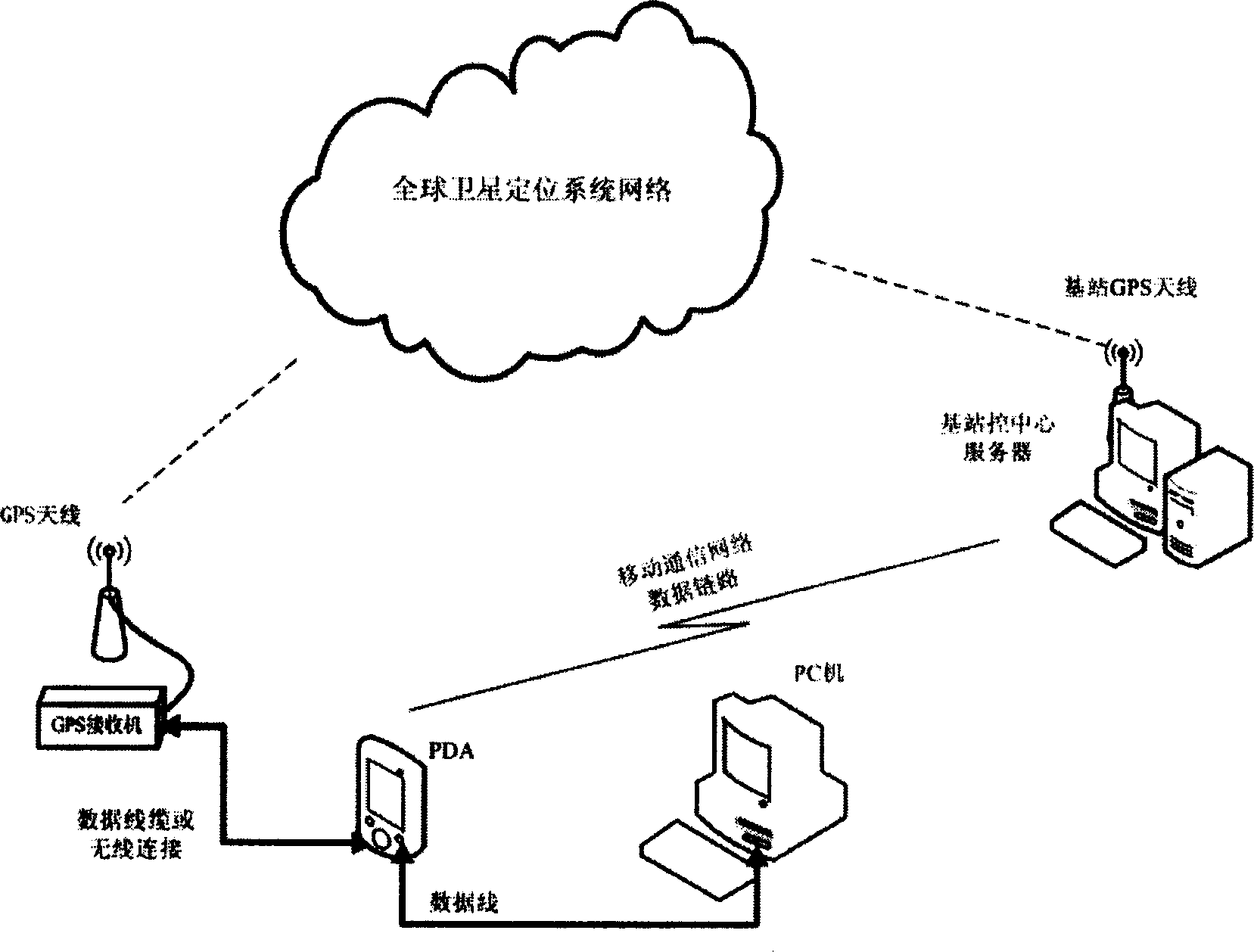
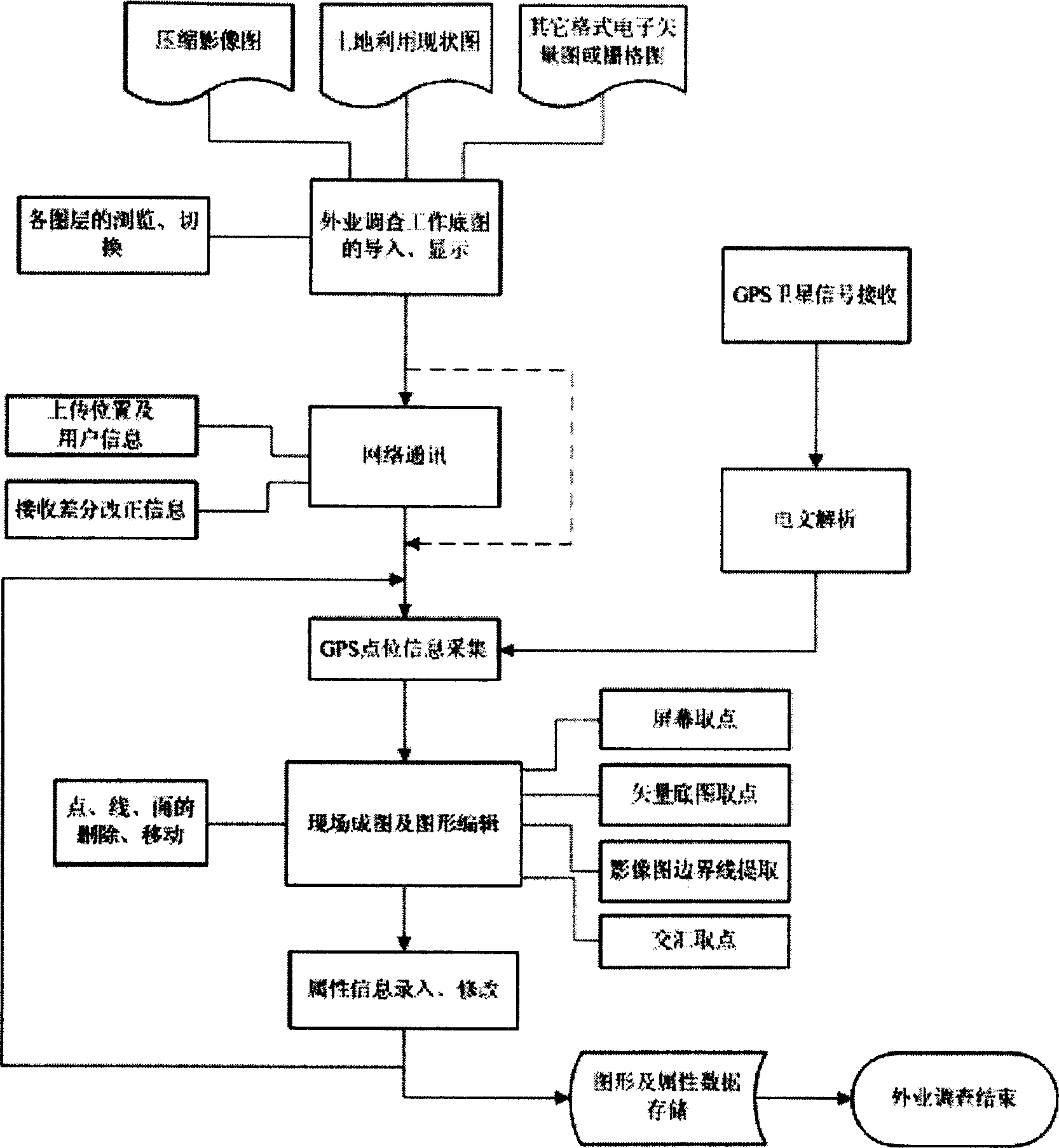
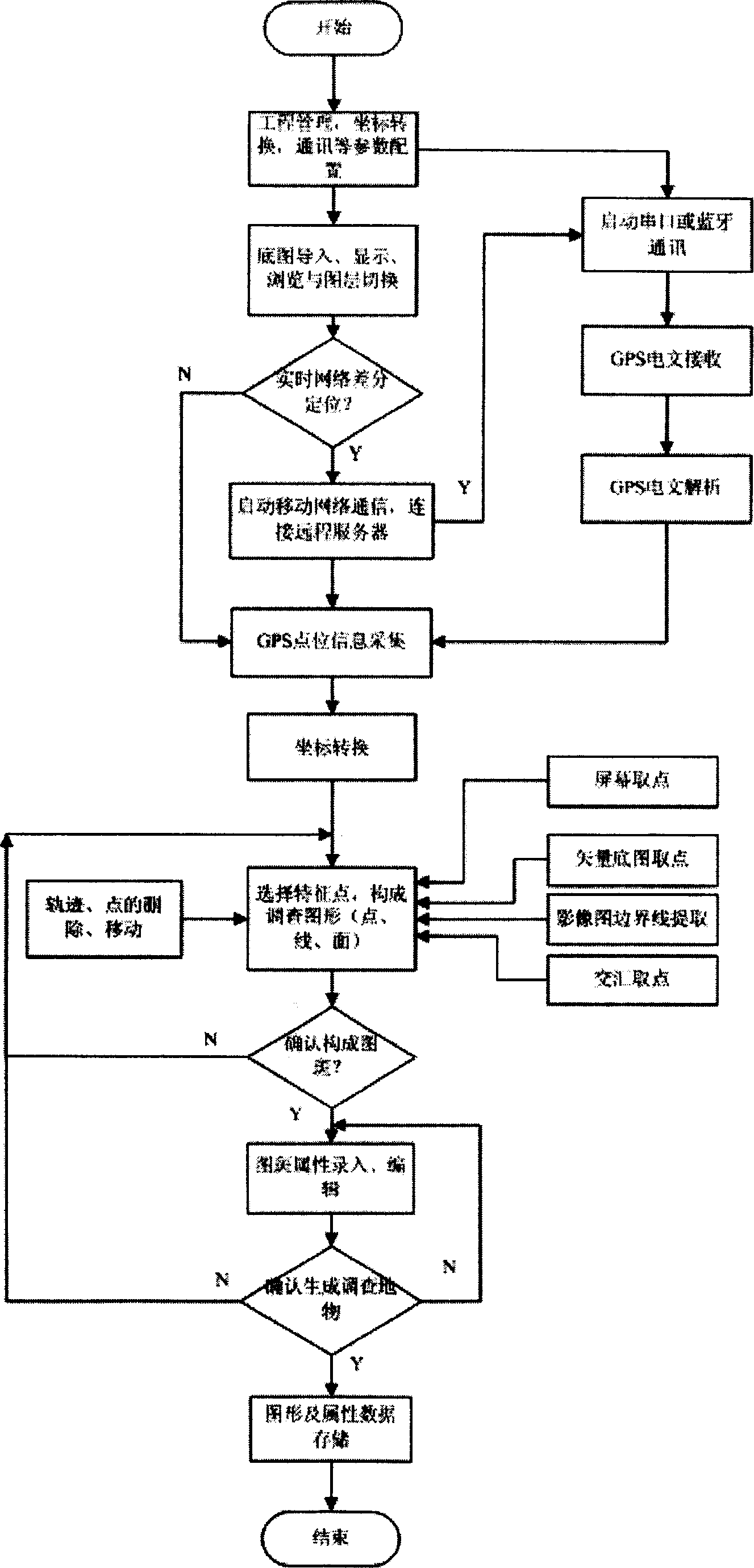
[0047] Such as figure 1 , the composition of the system involved in the present invention comprises:

[0048] 1) Handheld PDA: PDA includes handheld computer, digital mobile terminal, tablet computer; operating system includes WindowsCE, Linux, Palm and other embedded operating systems;

[0049] 2) Mobile station GPS receiver and antenna: GPS receiver types include single frequency (including pseudo-range, carrier phase output), dual frequency (L1 and L2) and other forms, mobile station GPS receiver and antenna and handheld PDA Field portable information collection, recording and processing equipment for land survey;

[0050] 3) PC: a desktop or personal notebook computer with common configuration that can store massive land use databases or files;

[0051] 4) Base station control and processing center server: composed of workstation PC, base station GPS receiver and antenna.

[0052]During the field survey, the handheld PDA communicates with the GPS receiver of the mobile ...


PUM


Abstract

This invention relates to a full-digitized field information acquisition, recording and processing method for land survey. Wherein, it uses field portable device integrated all of space geometrical data real-time high-precision acquisition, field forming image, attribution information field record, data measurement and graphic edition, as well as the wireless network communication, serial port /blue tooth communication, space geographic coordinate conversion, and different graph data composition. This invention realizes WYSIWYG, decreases labor strength, and improves operating efficiency with paper free, real time, and intelligentization.

Description

technical field [0001] The present invention is a method for real-time and high-precision collection of spatial geometric data, on-site mapping, on-site input of attribute information, data measurement and graphic editing in land survey using portable equipment in the field, and belongs to land management electronic information collection and corresponding processing methods technical field. Background technique [0002] The current method of conducting field surveys in the land management industry is: investigators take paper land use status maps and image maps, go to the site to use tape measure, total station and other equipment, measure on site, and draw sketches by hand. The specific technical means to obtain the changed data mainly include simple supplementary measurement method (such as intercept method, distance intersection method, rectangular coordinate method, extension line intercept method), flat panel supplementary measurement method (polar coordinate method, f...

Claims


Application Information

Patent Timeline
IPC IPC(8): G06Q10/00G06F17/30G01S5/00
Inventor 王庆王慧青蔡苗红裴凌何军
Owner SOUTHEAST UNIV
Why Eureka
Try Eureka