A dynamic intelligent navigation method

An intelligent navigation and dynamic technology, applied in the field of GPS navigation system, can solve the problem of not providing real-time road traffic information, and achieve the effect of reducing travel time and adjusting traffic flow.

Active Publication Date: 2007-05-16
SHENZHEN SEG SCI NAVIGATIONS CO LTD
View PDF0 Cites 43 Cited by
  • Summary
  • Abstract
  • Description
  • Claims
  • Application Information

AI Technical Summary

Problems solved by technology

[0007] The technical problem to be solved by the present invention is to provide a method for realizing dynamic intelligent navigation in the GPS navigation system for the defect that existing GPS vehicle navigation products do not have a mechanism for providing real-time road traffic information, which can send information to The vehicle terminal provides the best path to the destination

Method used


Image

  • A dynamic intelligent navigation method
  • A dynamic intelligent navigation method
  • A dynamic intelligent navigation method

Examples


Embodiment Construction

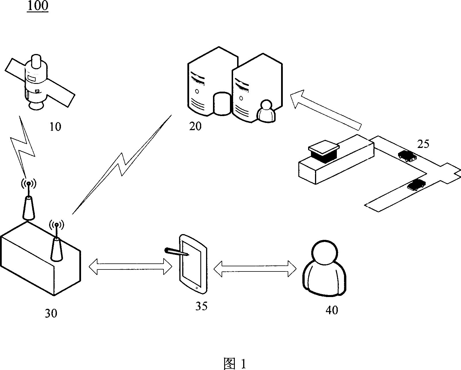
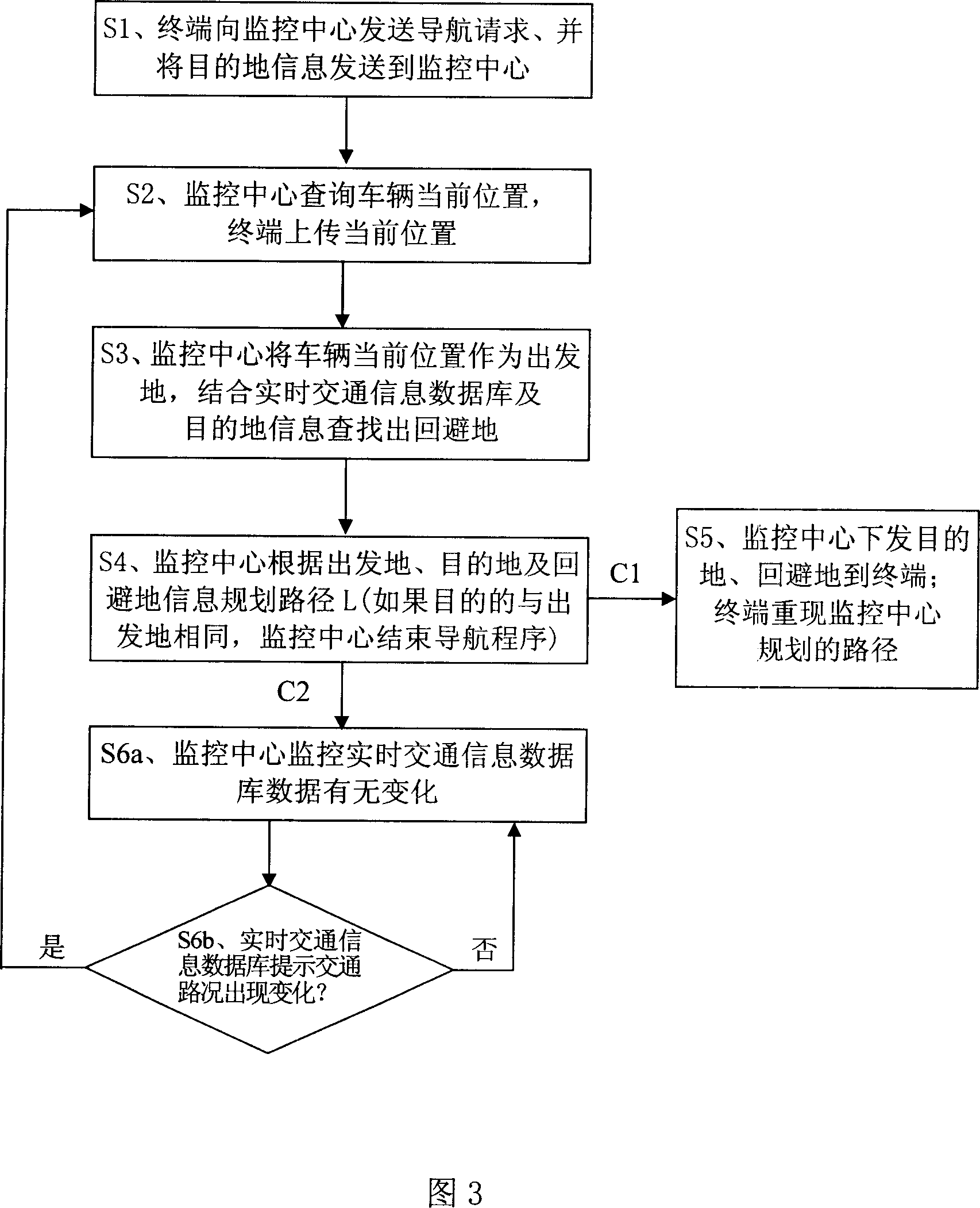
[0041] FIG. 1 is a schematic diagram of a GPS positioning and navigation system 100 in which the dynamic intelligent navigation method of the present invention can be implemented. As shown in the figure, the GPS positioning and navigation system 100 includes GPS satellites 10 , a monitoring center 20 and a vehicle-mounted terminal 30 . The vehicle-mounted terminal can receive signals from GPS satellites 10 through the GPS satellite receiving protocol and can communicate with the monitoring center 20 . The monitoring center 20 monitors traffic conditions in real time, and obtains real-time traffic information 25 . The vehicle-mounted terminal 30 provides navigation information to the vehicle driver 40 through the input-output device 35 .

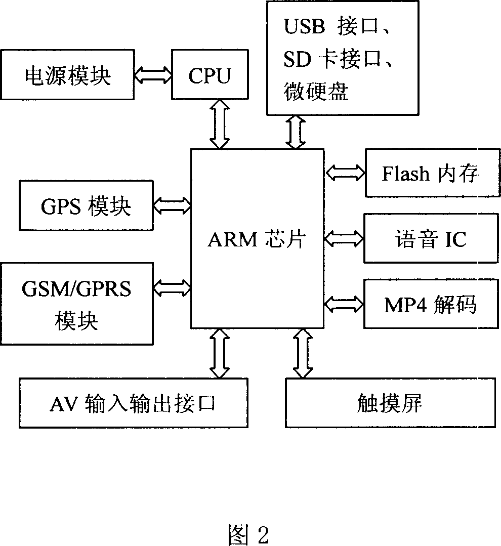
[0042] The present invention proposes a new implementation of the intelligent navigation system, which organically integrates the vehicle terminal and the vehicle navigator into a vehicle terminal 30, and completes dynamic and intelligent nav...


PUM


Abstract

This invention relates to dynamic intelligent guidance method, which comprises the following steps: terminal sending guidance requirement to monitor center and sending car aim information to monitor center; monitor center requires car current position as start place and to combine real time traffic database and aim place information; monitor center according to start place and aim place and shield place information plane sends the information to terminal to re-establish monitor center plan path; at same time monitor center monitors real time traffic information database and when there are changes then repeating above steps for updating.

Description

technical field [0001] The present invention relates to a GPS navigation system, more specifically, relates to a method for realizing dynamic intelligent navigation in the GPS positioning navigation system, which combines the application of GPS technology and GIS geographic information system. Background technique [0002] The Global Positioning System (GPS for short) is a new generation of satellite navigation and positioning system developed by the United States since the 1970s and fully completed in 1994. It has all-round real-time three-dimensional navigation and positioning capabilities in sea, land and air. . The GPS system can be used not only for surveying and navigation, but also for speed measurement and time measurement. Through the accurate positioning of the satellite signal received by GPS, the vehicle's driving route, position, speed, altitude and other information can be known. [0003] Geographical Information System (GIS for short) began to appear in the ...

Claims


Application Information

Patent Timeline
Patent Type & Authority Applications(China)
IPC IPC(8): G01C21/26G01C21/34G01C21/36G01S1/02G01S5/02G08G1/00G08G1/0968G06F17/30G01S19/42
Inventor 丁伟陈煜侯丹黄冠明刘云李俊峰
Owner SHENZHEN SEG SCI NAVIGATIONS CO LTD
Why Eureka
Try Eureka