Existing systems for
asset tracking lack the capability required for long duration, global coverage due to several serious shortcomings.
First, currently each asset-tracking device must be connected either to a battery, such as the battery of a vehicle, or an external power source such as the cigarette lighter adapter or an
AC power supply.
For asset tracking at the global scale, a battery connection or a direct AC power supply may not be always available and thus the power source becomes a major problem and limitation.
A device installed on such assets would require extensive duration since external power may be unavailable.
Simply adding batteries to an existing pack is not an
ideal solution for durable tracking since this would enlarge the pack to an undesirable, bulky size.
For vehicle tracking, this may not be a major concern since vehicles primarily run on the surface of the earth with sufficient
sky exposure.
For tracking assets such as containers, it may not be possible to ensure reliable, constant
satellite exposure.
If
GPS data is not available, the location cannot be obtained from the satellites.
Third, all current GPS-based tracking devices on the market use only one method of
wireless communication to transmit
location data between the asset and a centralized facility.
A typical problem with the single-network mechanism is that often the device is out of the coverage area of the
wireless communication network.
Currently, no
wireless communication network offers complete global coverage.
Third, sometimes the assets to be tracked are stacked on top of each other, making it impossible for a conventional tracking device to be exposed to GPS satellites.
As a result, no valid position information can be obtained from the satellites of the GPS
constellation.
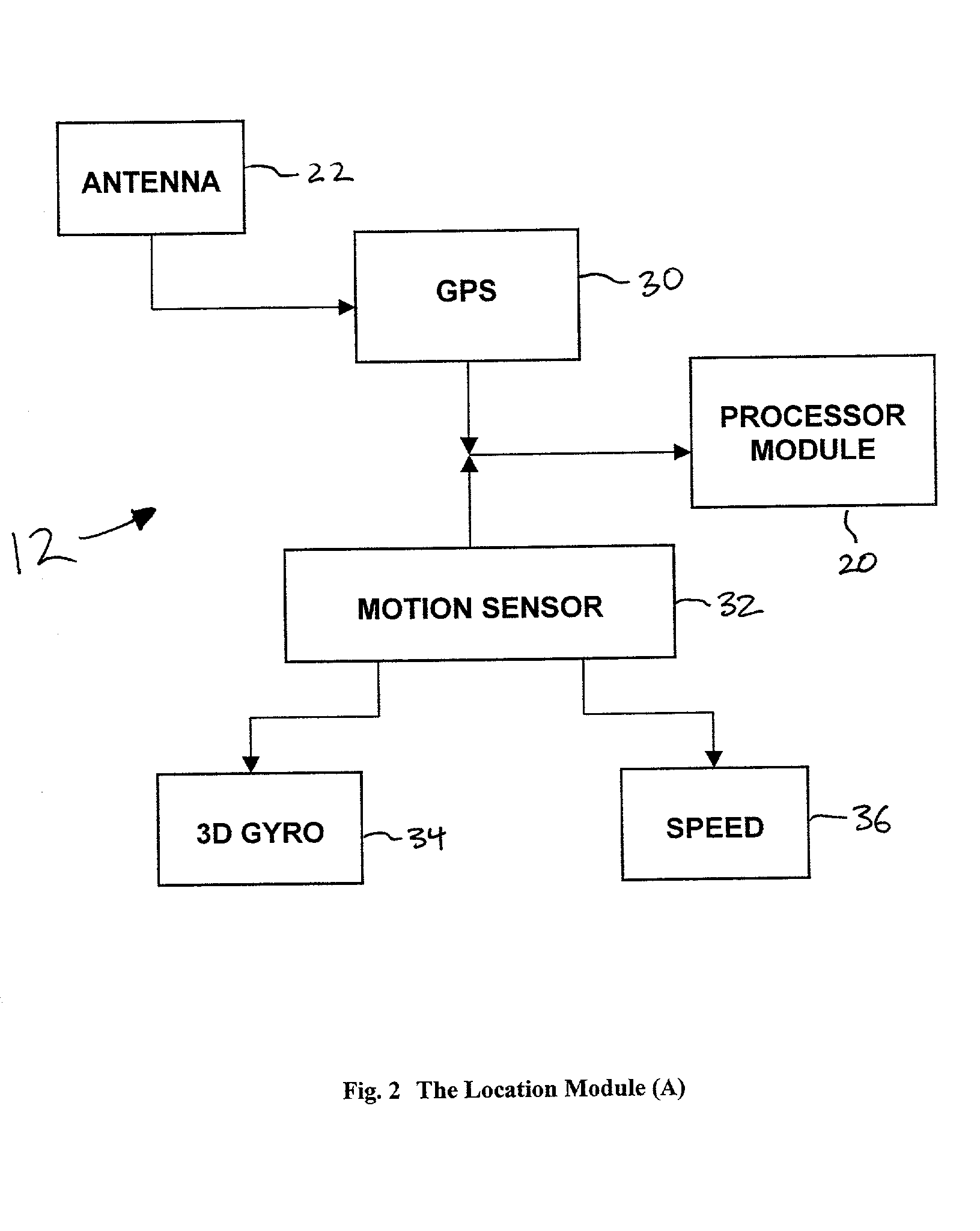
Using a
motion detector to dynamically adjust location information is subject to errors at different steps of the computation.
In general, the errors are small and random for each computation.
Thus, over a long period of time, the individual errors may balance out among themselves or the cumulative error may accumulate over time.
Although the reflected or re-radiated
GPS signals do not provide the same level of positional accuracy as direct line readings, they nonetheless provide enough accuracy within a 20-meter range.
Since the accuracy of such local position information is not as accurate as GPS,
GPS data will always override any position calculation based on reflected GPS, re-radiated GPS, or localized position information through
Bluetooth or other localized RF systems.
These networks tend to offer extensive coverage, although in most cases no single network offers complete worldwide coverage.
Fourth, at any point, if a channel being scanned is detected and found to be valid, the communication is set at the channel and the scanning mechanism is terminated until the channel becomes invalid at a later time.

