

Orthorectification and mosaic of video flow
a technology applied in the field of orthorectification and video flow mosaic, can solve the problems of ineffective methods, systems or media for real-time mosaic of streaming digital video data, and the shortage of research for georeferencing video from small uavs
- Summary
- Abstract
- Description
- Claims
- Application Information
AI Technical Summary
Benefits of technology
Problems solved by technology
Method used
Image

Examples
Embodiment Construction
[0028]The following detailed description is an example of embodiments for carrying out the invention. This description is not to be taken in a limiting sense, but is made merely for the purpose of illustrating general principles of embodiments of the invention.
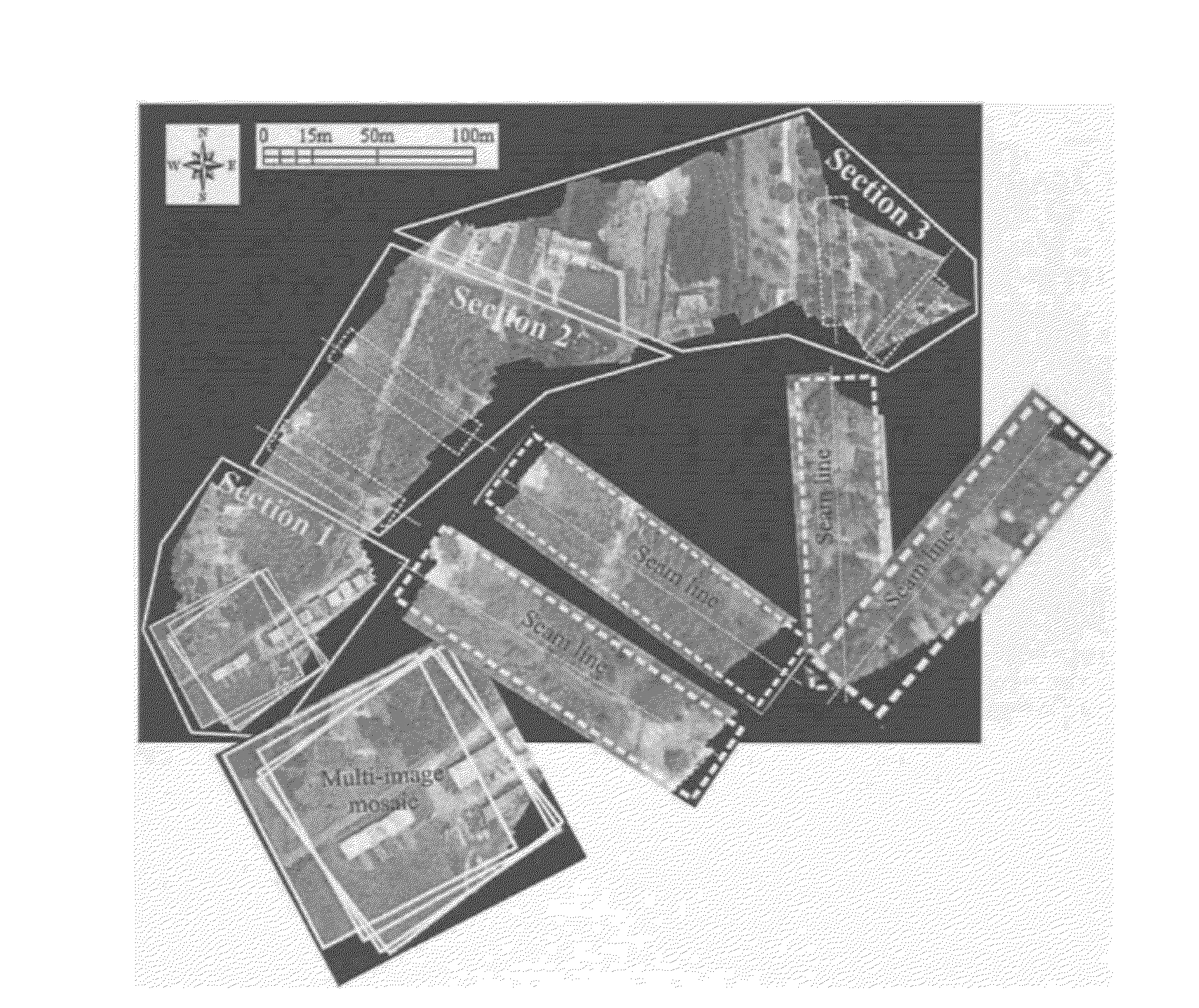
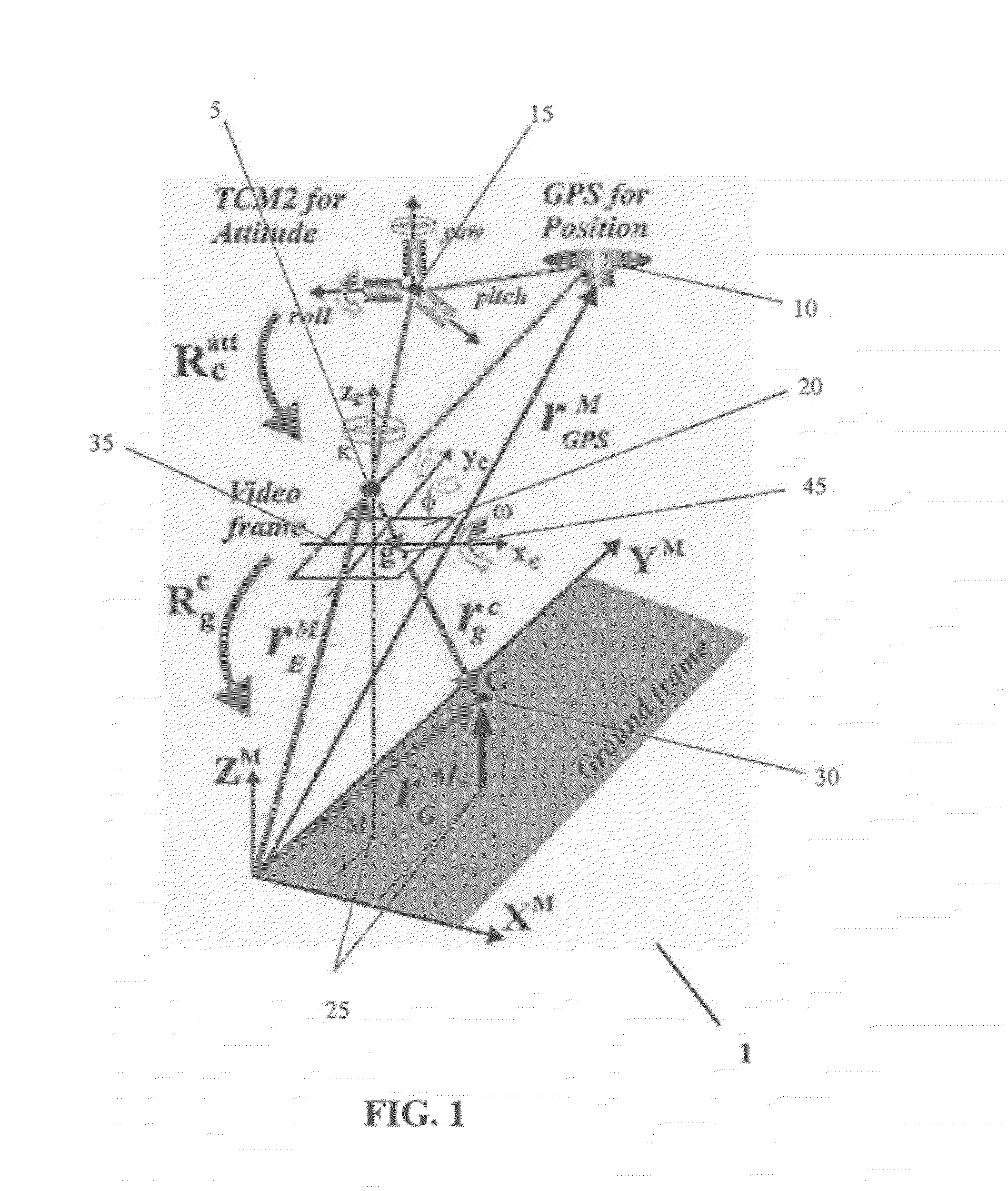
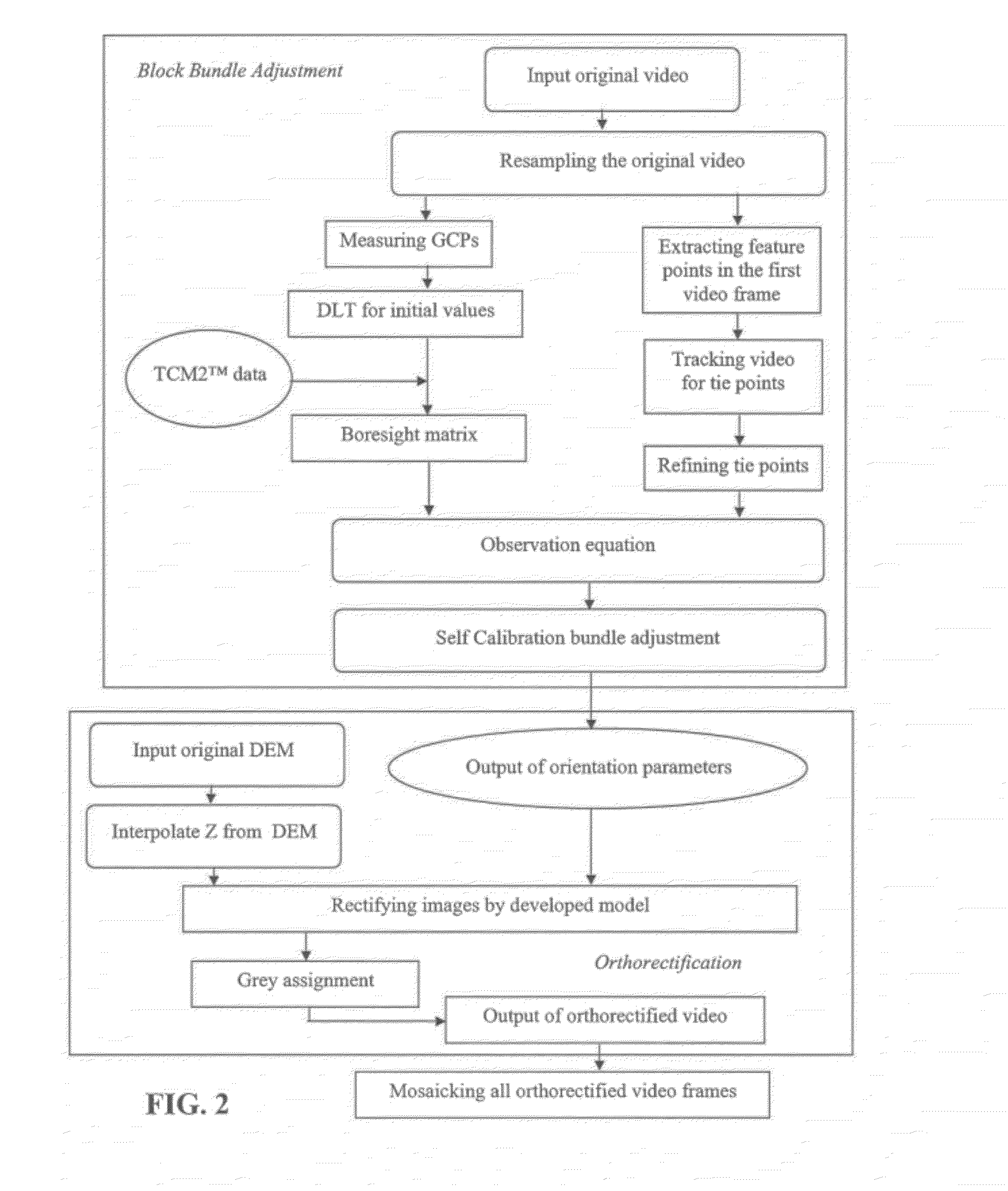
[0029]A method of real-time mosaic may be used with aerial (e.g., UAV) transmitted video stream in order to meet the need of data processing for fast-response to time-critical events. The proposed method is based on a photogrammetry model. Conventional approaches include as follows: Campbell and Wheeler [7] presented a vision-based geolocation method based on a square root sigma point filter technology. However, Dobrokhodov et al. [9] and Campbell and Wheeler [7] exhibited that their methods involved estimate biases that are sensitive to heavy wind conditions. Gibbins et al. [12] reported a geolocation accuracy of over 20 m; Whang et al. [33] described a geolocation solution, in which the range estimates were obtained using a ...
PUM
 Abstract
Description
Claims
Application Information