Supercharge Your Innovation With Domain-Expert AI Agents!

Three-dimensional map drawing system

Inactive Publication Date: 2013-03-07
GEO TECHN LAB
View PDF24 Cites 26 Cited by
  • Summary
  • Abstract
  • Description
  • Claims
  • Application Information

AI Technical Summary

Benefits of technology

The invention is a system that uses parallel projection to create maps more efficiently. Unlike traditional perspective projection, which requires a specific point of view, parallel projection allows for a drawing to be created without specifying a point of view. This reduces the processing load during map drawing. The system also uses feature data that is obtained through parallel projection of a virtual feature, which helps to make the map look more realistic. The feature data can be stored in multiple levels with different scales to provide detailed data of narrower areas. The system can also change the parallel projection parameters for each level to facilitate scaling of the map. Overall, the invention improves the efficiency and realism of map creation.

Problems solved by technology

This method, however, has the problem of changing the scale of the drawn map.
Changing the scale on the map is a significant problem that may greatly damage the meaning of the map.
Changing the scale means that the three-dimensional image drawn by perspective projection is useless as the map.

Method used


Image

  • Three-dimensional map drawing system
  • Three-dimensional map drawing system
  • Three-dimensional map drawing system

Examples


embodiment 1

A. Device Configuration

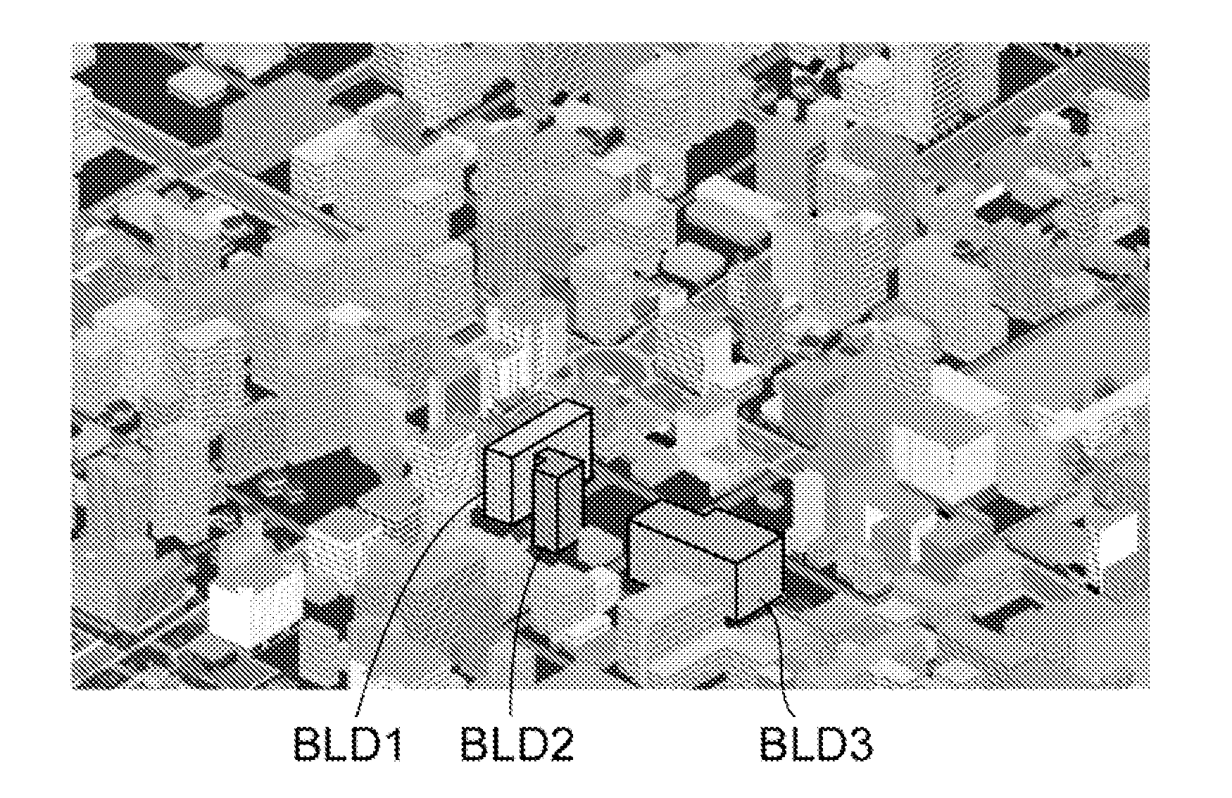
[0076]FIG. 3 illustrates the configuration of a three-dimensional map display system according to one embodiment. In the illustrated configuration, a map is displayed on a cell phone 300, based on map data provided from a server 200 via a network NE2. The map may be displayed on another terminal, such as a personal computer or a navigation system. The three-dimensional map display system is not limited to the system including the terminal such as the cell phone 300 and the server 200 but may be provided as a standalone system. The illustrated configuration also includes a data generation device 100 of generating three-dimensional map data.

[0077]The cell phone 300 has various functional blocks working under a main controller 304. The main controller 304 and the respective functional blocks are provided by installing software that implements the respective functions according to this embodiment, but part or all of such functional blocks may be provided by hardwa...


PUM


Abstract

A three-dimensional map is provided by preserving its scale. The three-dimensional map is drawn based on prepared landscape feature data which three-dimensionally draws roads, buildings, and other landscape features. The landscape feature data is generated by a parallel projection method which projects an actual landscape feature (CST2) upon a projection plane (PL2) with parallel lines along the projection direction (PRJ), rather than a perspective projection. The landscape feature data is provided by either two-dimensional raster data or polygonal data that draws a parallel projected projection map. It is possible to draw the three-dimensional map by only drawing the prepared landscape feature data, without rendering or other load-intensive processing. Unlike the perspective projection, the parallel projection preserves the positional relationships among buildings and the scale of shapes, so as to provide a three-dimensional map in which the scale is preserved.

Description

CLAIM OF PRIORITY[0001]This application is a Continuation of International Patent Application No. PCT / JP2010 / 058151, filed on May 14, 2010, which claims priority to Japanese Patent Application No. 2010-053885, filed on Mar. 11, 2010, each of which is hereby incorporated by reference.BACKGROUND OF THE INVENTION[0002]1. Field of the Invention[0003]The present invention relates to a three-dimensional map drawing system of drawing a three-dimensional map that expresses features three-dimensionally.[0004]2. Description of the Related Art[0005]There is known technology of displaying features, such as buildings and roads, three-dimensionally in display of an electronic map, for example, on the screen of a navigation device or a computer. In the three-dimensional map, the features are generally drawn by the projection method called perspective projection.[0006]FIGS. 1a and 1b illustrate an example of drawing a three-dimensional map by perspective projection. As shown in FIG. 1a, perspective...

Claims


Application Information

Patent Timeline
IPC IPC(8): G06T17/00
CPCG01C21/3638G09B29/10G09B29/007G09B29/005
Inventor KISHIKAWA, KIYONARIADA, MASAYATESHIMA, EIJIIRIE, TORUTOMITAKA, TSUBASA
Owner GEO TECHN LAB
Features
  • R&D
  • Intellectual Property
  • Life Sciences
  • Materials
  • Tech Scout
  • Unparalleled Data Quality
  • Higher Quality Content
  • 60% Fewer Hallucinations
Learn More