Method of calculating tavi based on a band ratio model and solar altitude angle

a band ratio model and solar altitude angle technology, applied in the field of calculating a tavi based on a band ratio model and a solar altitude angle, can solve the problems of limited application of promoted methods within a large range, diluting topographic effects, and limiting the range of methods, so as to achieve accurate inversion of vegetation information, improve accuracy, and improve the effect of accuracy

Active Publication Date: 2018-12-13
FUZHOU UNIV
View PDF3 Cites 27 Cited by
  • Summary
  • Abstract
  • Description
  • Claims
  • Application Information

AI Technical Summary

Benefits of technology

[0012]In view of this, an objective of the present invention is to provide a method of calculating a TAVI based on a band ratio model and a solar altitude angle. According to the method, anew, more stable SVI is constructed based on the basic principle of the band ratio model and RVI is preferred for combinational calculation with the new SVI, so that the TAVI algorithm can be more accurate and more convenient in application. What is mor...

Problems solved by technology

In a complex topographic mountainous area, the solar radiation distribution on the surface of fee mountainous area may change under topographic effects, so that the radiance value of a mountain's shady slope area of a remote sensing image decreases while die radiance value of a sunny slope area increases, leading to severe problems such as “the same object with different spectra” and “the same spectrum with different objects”.
Therefore, diluting the topographic effects has become an important problem confronting the remote sensing of vegetation in complex; topographic mountainous areas.
However, these methods may have a problem of overcorrection because the effects of atmospheric scattered radiation and adjacent topography reflected radiation are not taken into account.
Moreover, the promoted application of such method within a large range is restricted due to such problems as accuracy and availability (such as security restrictions, long data update cycle, and the like) of high-accuracy DEM data, registration accuracy between DEM and a remote sensing image.
Such a method can eliminate the effects of direct solar radiation, atmospheric scattered radiation and adjacent topography reflected radiation in a remote sensing image due to complex, topography in theory hut promoted application of the models is restricted by complex model parameters and great dif...

Method used


Image

  • Method of calculating tavi based on a band ratio model and solar altitude angle

Examples


Embodiment Construction

[0028]The present invention will be further described below in conjunction with the accompanying drawings and an embodiment.

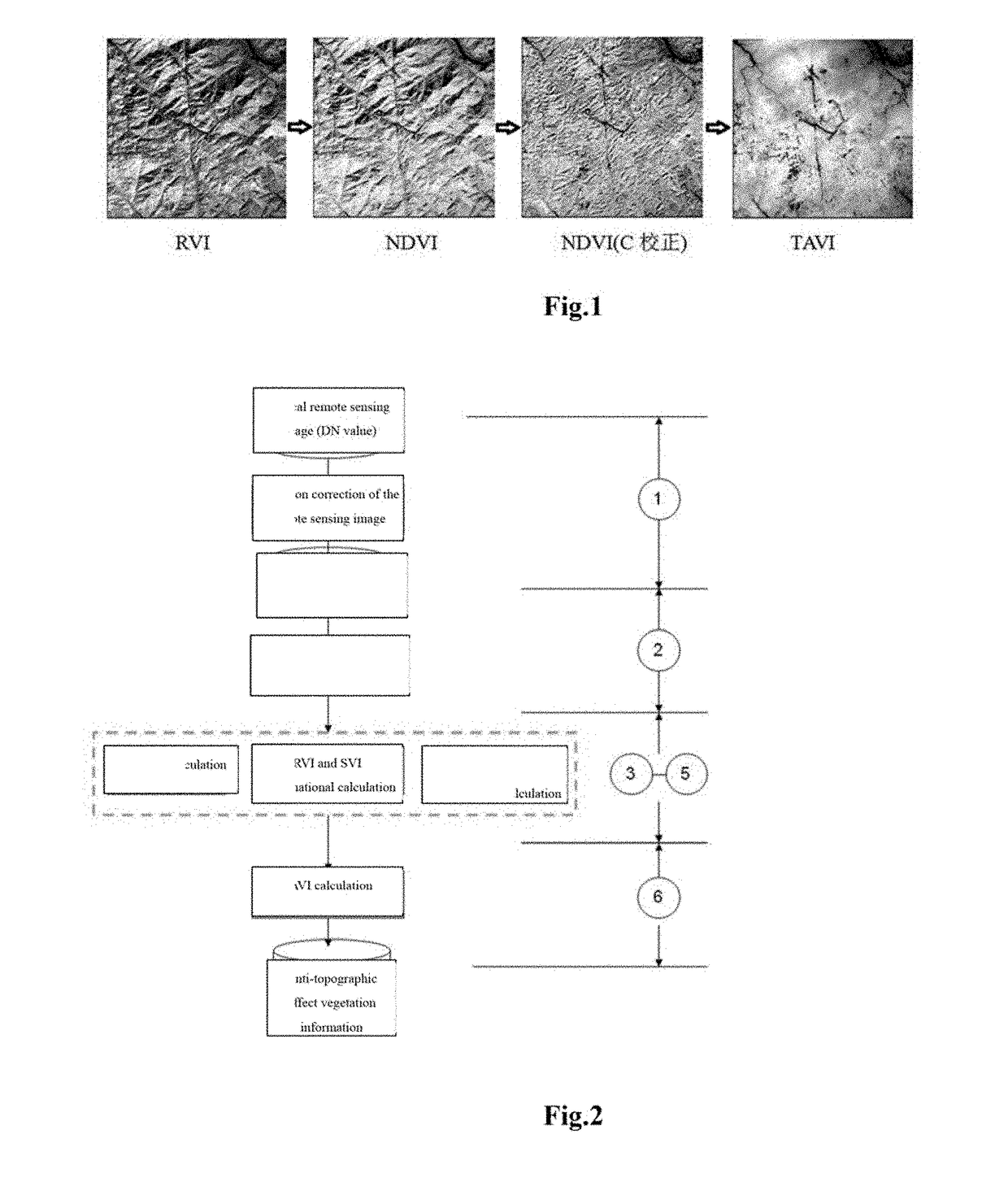
[0029]Referring to FIG. 2, the present disclosure provides a method of calculating a Topography Adjusted Vegetation Index (TAVI) based on a band ratio model and a solar altitude angle. The method includes the following steps,

[0030]At step S1, image preprocessing is performed, which specifically includes: performing radiation correction on a multi-spectral remote sensing image to generate apparent reflectance data of the image.

[0031]At step S2, the quality of the image is analyzed, which specifically includes: determining the apparent reflectance data of a red band and a near-infrared band of the remote sensing image (calculating mean values, mid-values, variances and other indices of the two bands) and analyzing whether the reflectance of mountainous vegetation is reasonable at the two hands to decide whether the image is normally available.

[0032]At step S3, a ...


PUM


Abstract

The present invention relates to a method of calculating a Topography Adjusted Vegetation Index (TAVI) based on a band ratio model and a solar altitude angle. The method includes the folio wing steps: obtaining the apparent reflectance data of a remote sensing image through image preprocessing, analyzing the quality of the image and numerical distribution, calculating a Shadow Vegetation Index (SVI), and constructing a TAVI combinational algorithm:
TAVI=BirBr+f(Δ)·1Br,
calculating an adjustment factor f (Δ) with the solar altitude angle, and finally obtaining anti-topographic effect TAVI vegetation information. The TAVI in the present invention is composed of two band ratio submodels RVI and SVI, the denominators of both of which are red band data of a remote sensing image, and the adjustment factor f(Δ), which is calculated by a solar altitude angle as a parameter with a sensor factor applied, has great physical significance. The TAVI calculation method does not need digital elevation model (DEM) data and remote sensing image classification when not depending on ground survey data,, and ensures that the interference of the topographic effects with the vegetation information can be effectively eliminated by the TAVI, thereby avoiding the problem of reduced inversion accuracy of ground vegetation information due to different registration accuracy of a remote sensing image and DEM data.

Description

BACKGROUND OF THE INVENTION1. Technical Field[0001]The present invention relates to a method of calculating a TAVI based on a band ratio model and a solar altitude angle.2. Description of Related Art[0002]In a complex topographic mountainous area, the solar radiation distribution on the surface of fee mountainous area may change under topographic effects, so that the radiance value of a mountain's shady slope area of a remote sensing image decreases while die radiance value of a sunny slope area increases, leading to severe problems such as “the same object with different spectra” and “the same spectrum with different objects”. The accuracy of the inversion of the relevant biological parameters of a mountain's vegetation by a conventional remote sensing method for fee vegetation index may be reduced accordingly. Therefore, diluting the topographic effects has become an important problem confronting the remote sensing of vegetation in complex; topographic mountainous areas.[0003]The ...

Claims


Application Information

Patent Timeline
IPC IPC(8): G01N21/3563G06K9/00G01N21/359
CPCG01N21/3563G06K9/00657G01N21/359G01N2021/1793G06V20/188G01N2021/1797
Inventor JIANG, HONGWANG, XIAOQINCHEN, CHONGCHENG
Owner FUZHOU UNIV
Why Eureka
Try Eureka