Satellite synchronized 3-D magnetotelluric system

a magnetotelluric system and satellite technology, applied in the field of satellite synchronized 3-d magnetotelluric system, can solve the problems of poor seismic image, high cost of seismic for comparable real or linear coverage, and limited penetration

Inactive Publication Date: 2001-02-20
FOX ANTHONY CHARLES LEONID
View PDF9 Cites 53 Cited by
  • Summary
  • Abstract
  • Description
  • Claims
  • Application Information

AI Technical Summary

Problems solved by technology

Thus, a signal at a specific frequency may penetrate quite deeply into the earth where the conductivity is low, or the penetration may be quite limited if the earth is quite conductive.
MT falls in between, with higher resolution than gravity and magnetics, but significantly higher cost than seismic for comparable a real or linear coverage.
In certain cases, the seismic image may be poor.
The data acquisition proceeds for typically 8 to 16 hours, sometimes longer, in noisy environments, and frequently the equipment operates unattended overnight.
The noise arising from even small motions of the sensors can introduce error into the calculations.
Even more serious, modern industrial civilization generates a large amount of electromagnetic signals at an extremely wide range of frequencies, including the low sub-audio frequencies used by MT.
Such near-surface resistivity inhomogeneities can distort the electric field measurement, causing errors in the calculation of the earth's resistivity.
This phenomenon is known as static shift and it is a serious problem in interpretation of MT data.
However, like all smoothing techniques, it distributes error rather than remo

Method used


Image

  • Satellite synchronized 3-D magnetotelluric system
  • Satellite synchronized 3-D magnetotelluric system
  • Satellite synchronized 3-D magnetotelluric system

Examples


Embodiment Construction

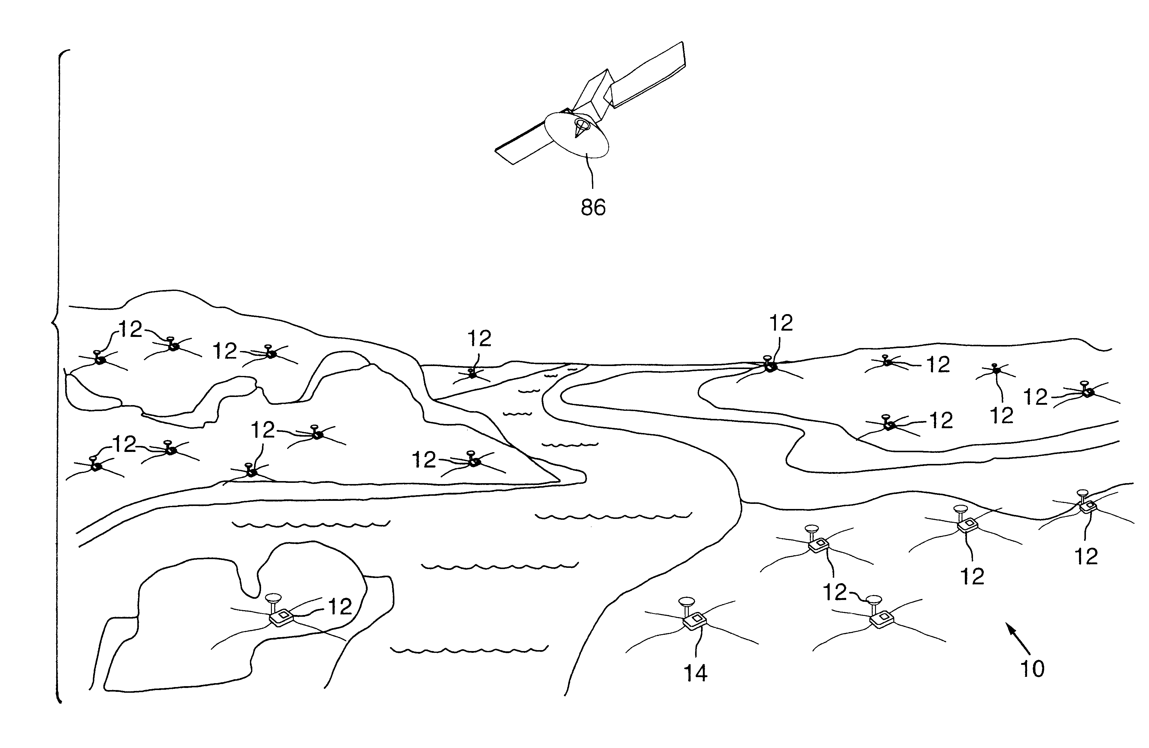
The present invention implements an innovative MT data acquisition architecture and methodology to dramatically reduce the cost of MT data acquisition, thereby solving the fundamental problem of high cost which has until now prevented MT from being more widely used.

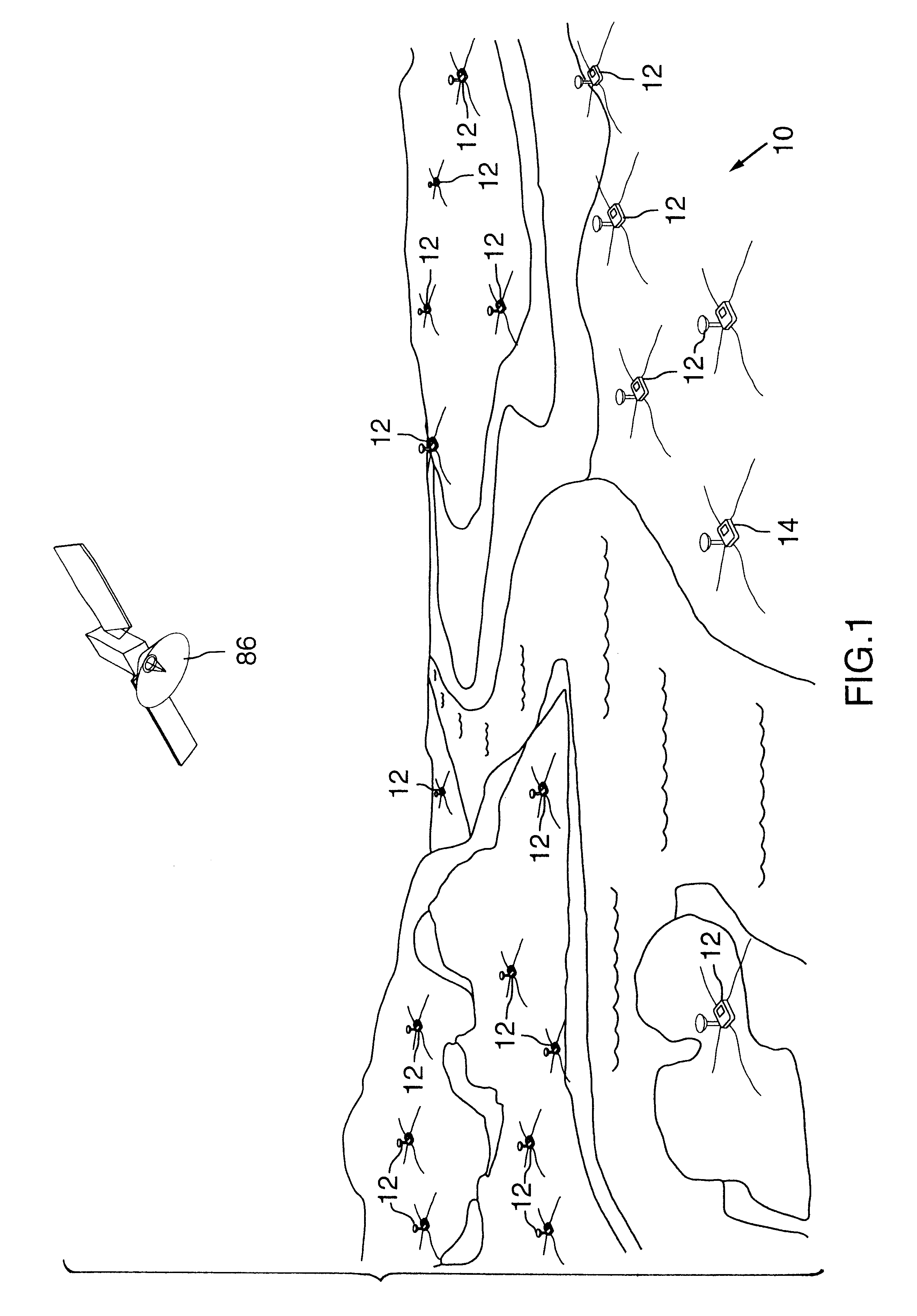
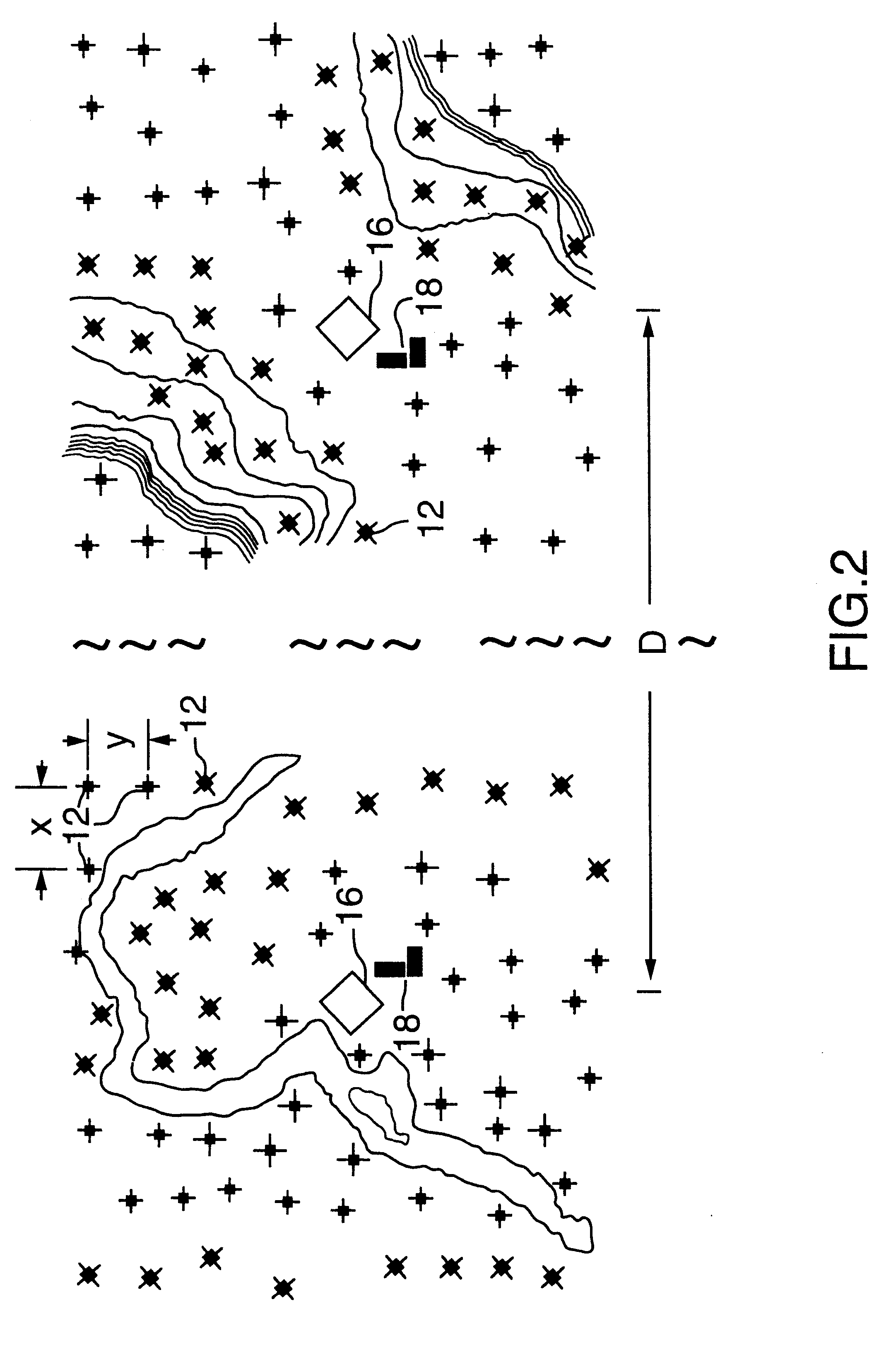
Referring to FIGS. 1 and 2, the system 10 of the present invention comprises a series of electrical sensor units or stations 12 and a magnetic sensor unit or stations 14 which are located at various locations about an area to be surveyed. As illustrated, the system 10 can be used in any surface geography, including relatively flat areas, across rivers and on mountains. As is discussed later, the system 10 is capable of being used in any terrain.

The system 10 may comprise one or more suitable 5-component recording stations 16 which combines a sensor unit 12 with a sensor unit 14. The sensor unit 12 is equipped for electric field measurement. Sensor unit 14 is equipped for magnetic field measurements. One or more of the 5-c...


PUM


Abstract

A method of data acquisition for geophysical surveys. The method includes the steps of providing a least one magnetic sensor unit for sensing and recording magnetic field fluctuations; providing a plurality of electric sensor units for sensing and recording electric currents induced by the magnetic field fluctuations; receiving a satellite based timing signal and responsively synchronizing and bag a position for each of the plurality of electric sensor units and the at least one magnetic sensor unit; and synchronously recording the positions, the magnetic field fluctuations and the electric currents for downloading for processing.

Description

This invention relates to an improved system for obtaining magnetotelluric geophysical data. In particular, this invention relates to obtaining magnetotelluric geophysical data using satellite signals for synchronizing sampling of the geophysical data and a system for analysing such data.BACKGROUND OF INVENTIONMagnetotelluricsMagnetotellurics (MT) is a geophysical technique invented in the early 1950s, which utilizes naturally-occurring fluctuations of the earth's magnetic field to obtain an image of the earth's subsurface resistivity structure. The resistivity structure can be interpreted in geological terms and converted to an image showing subsurface rock types, thicknesses, structures, etc.The fluctuations of the magnetic field arise from electric currents flowing in the earth's ionosphere. The changes in these current flows generate low-frequency electromagnetic waves, similar to radio waves, but at much lower frequencies. These waves are propagated around the earth by repeated...

Claims


Application Information

Patent Timeline
IPC IPC(8): G01V3/08G01S1/00G01V3/40G01S19/19
CPCG01V3/082
Inventor FOX, ANTHONY CHARLES LEONID
Owner FOX ANTHONY CHARLES LEONID
Why Eureka
Try Eureka