Fast reacquisition of a GPS signal

a technology of gps signal and reacquisition, applied in the field of protocols, can solve the problems of reducing the signal strength of gps satellites, affecting the accuracy of gps position determination, and now the dominant time delay, so as to avoid the penalty of always on power consumption and save time

Inactive Publication Date: 2007-03-13
CSR TECH INC
View PDF35 Cites 32 Cited by
  • Summary
  • Abstract
  • Description
  • Claims
  • Application Information

AI Technical Summary

Benefits of technology

[0018]Broadly conceptualized, the invention is an approach to rapidly, relative to known methods, identify the location of a GPS receiver. The GPS receiver receives a number of GPS signal from at least four GPS satellites and determines pseudo ranges (range measurements with a bias error that is common to all of the measurements) to each of the four satellites by resolving the code-period ambiguity of the range and determining the current received code phase bei

Problems solved by technology

The triangulation method may yield positional accuracy on the order of 30 meters, however the accuracy of GPS position determination may be degraded due to signal strength and multipath reflections of the satellite signals.
In other cases overhead foliage may red

Method used


Image

  • Fast reacquisition of a GPS signal
  • Fast reacquisition of a GPS signal
  • Fast reacquisition of a GPS signal

Examples


Embodiment Construction

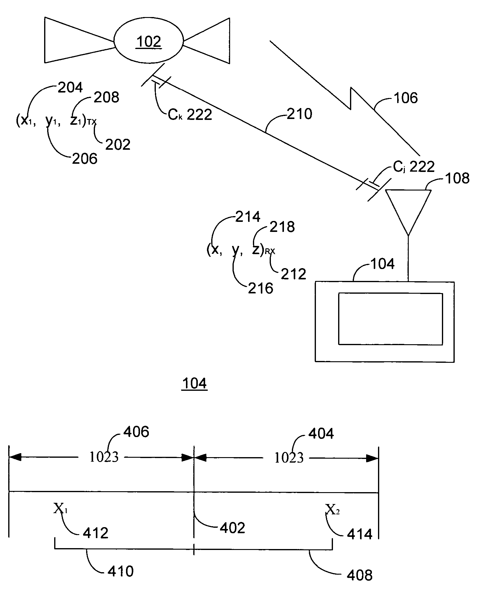
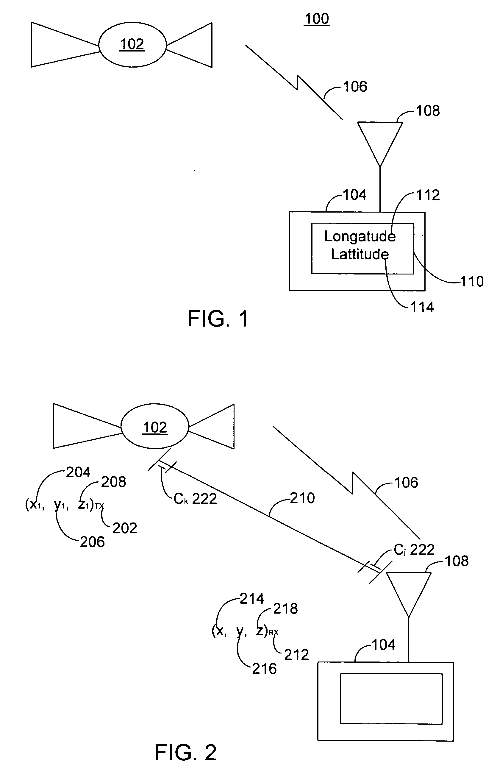
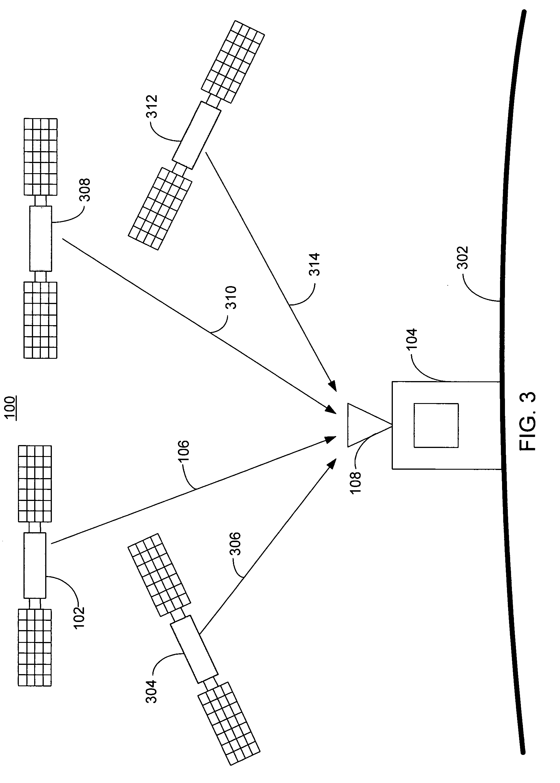
[0027]In FIG. 1, a global positing satellite (GPS) system 100 with a single satellite 102 and a single GPS receiver 104 is illustrated. The satellite 102 communicates with a GPS receiver 104 over a radio frequency (RF) GPS signal 106 that is received by GPS receiver 104 at antenna 108. Upon communication with four satellites (only one is shown in the illustration), the GPS receiver 104 calculates a position and time; for example, it may display latitude 112, longitude 114, altitude, and time.

[0028]In FIG. 2, the satellite 102 and the GPS receiver 104 of FIG. 1 at a range 210 of approximately 11,000 nautical miles is shown. The range 210 is not a constant distance because the satellite 102 circles the Earth in its orbit approximately twice per day as the earth turns on its axis once per day. The satellite 102 transmits a spread spectrum GPS signal 106 to the GPS receiver 104. The GPS signal 106 contains a data sequence imposed on the spread spectrum signal. The data sequence comprise...


PUM


Abstract

A receiver in receipt of a plurality of pseudo noise codes, where each of the pseudo noise codes originates from a GPS transmitter and a plurality of chips make tip each pseudo noise code with an offset between 511 chips before a pseudo noise code boundary and 512 chips after the pseudo noise code boundary, and a local clock having an error of less than 0.5 ms relative to a GPS time and synchronized to a GPS signal that is able to be decoded with a decoder connected to the receiver and the local clock and by simultaneously solving the four pseudo range equations for at least four GPS transmitters a determination of the location of the receiver occurs.

Description

BACKGROUND OF THE INVENTION[0001]1. Technical Field[0002]This invention relates generally to protocols and, in particular, to acquisition of global positioning signal.[0003]2. Related Art[0004]The global positioning satellite (GPS) system is a satellite based navigation system having a network of 24 satellites, plus on orbit spares, orbiting 11,000 nautical miles above the Earth. Each satellite in the system orbits the Earth every twelve hours.[0005]A prime function of GPS satellites is to serve as a clock that keeps GPS time. Each satellite derives a signal from an on board 10.23 MHz Cesium atomic clock. GPS time is kept in terms of seconds and weeks since Jan. 6, 1980. There are 604,800 seconds per week. Consequently, GPS time is stated in terms of a time of week (TOW) and a week number. TOW ranges from 0 to 604800. The week number started with week zero and is currently in excess of 1000 weeks. The TOW can have a fractional part, such as in the real time clock, where the resoluti...

Claims


Application Information

Patent Timeline
IPC IPC(8): G01S19/30G01S19/34G01C21/34G01S1/00G01S19/21G01S19/26
CPCG01S19/235G01S19/42G01S19/34G01S19/30
Inventor GRONEMEYER, STEVEN A.
Owner CSR TECH INC
Why Eureka
Try Eureka