
Terrain aided navigation using multi-channel monopulse radar imaging

a multi-channel monopulse, radar imaging technology, applied in the direction of navigation, instruments, surveying and navigation, etc., can solve the problems of limited noise reduction and bias correction of kalman filter, kalman filtering reduces but does not eliminate the growth in the uncertainty region, and tercom requires labor-intensive preparation, so as to achieve good correlation and good correlation

Active Publication Date: 2015-08-18
RAYTHEON CO
View PDF11 Cites 25 Cited by
  • Summary
  • Abstract
  • Description
  • Claims
  • Application Information

AI Technical Summary

Benefits of technology

The present invention provides a way to use monopulse radar to navigate terrain. The radar transmits a single RF pulse or multiple quick RF bursts to create a monopulse radar image that can be correlated with a digital terrain segment to update navigation when requested. The radar measures angle and range to generate a high-resolution image. The image is then correlated with the selected digital terrain segment to determine the navigation position estimate. The invention allows for efficient, accurate navigation in challenging terrain.

Problems solved by technology

The noise reduction and bias corrections a Kalman Filter provides are limited to the errors that are observable with the vehicle's IMU and a priori knowledge of the platform's dynamics in the form of a “motion model”.
Kalman filtering reduces but does not eliminate the growth in the uncertainty region.
TERCOM requires labor-intensive preparation to tailor a set of terrain maps for each mission.
PTAN requires three antennas with a significant spatial separation to get the full angular information, which limits its use to vehicles that are large enough to accommodate this spacing, and requires expensive calibration of the boresight angles to a high accuracy.
There is no way to definitely confirm an aircraft's reported position due to the statistical nature of the radar signals.

Method used


Image

  • Terrain aided navigation using multi-channel monopulse radar imaging
  • Terrain aided navigation using multi-channel monopulse radar imaging
  • Terrain aided navigation using multi-channel monopulse radar imaging

Examples


Embodiment Construction

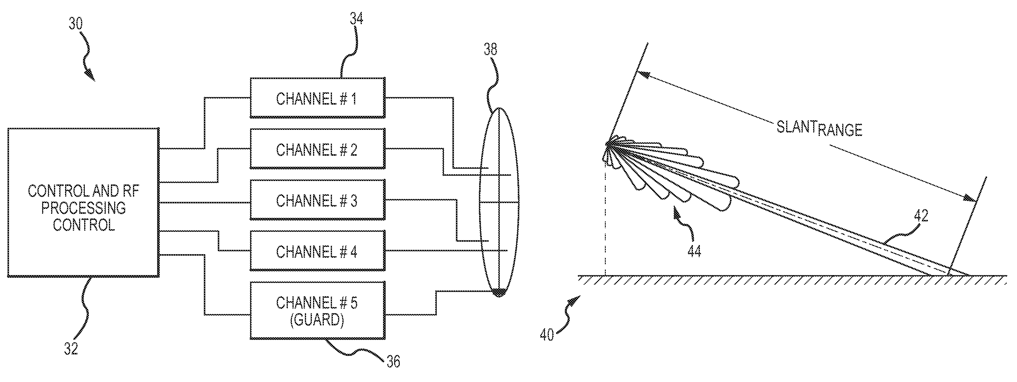
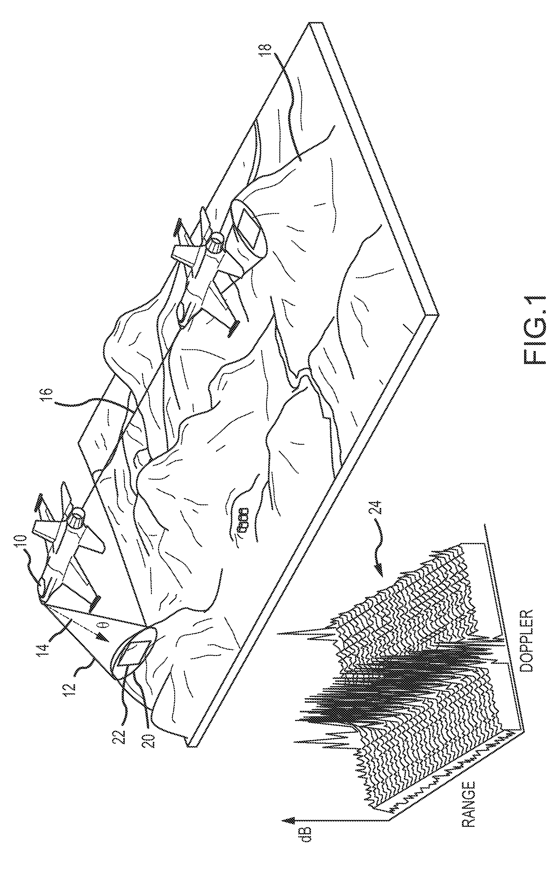
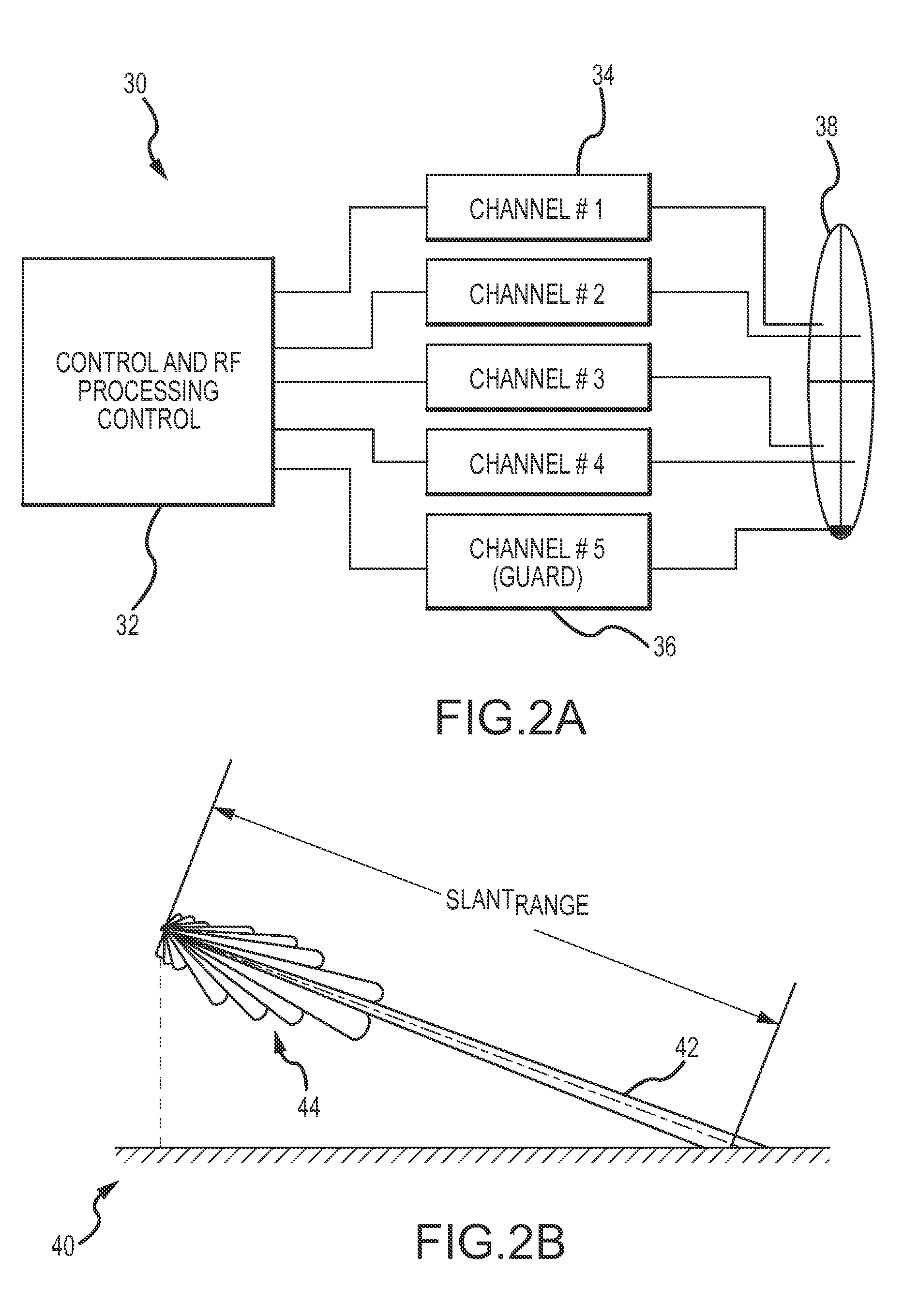
[0029]The present invention provides terrain aided navigation using multi-channel monopulse radar imaging. The monopulse radar transmits a single RF pulse transmission or multiple quick RF pulse train bursts to generate a monopulse radar image which can be correlated with a digital terrain segment by the avionics hardware to provide navigation updates when requested; updates do not require continuous RF transmissions to build a sufficient history for correlation. The radar has monopulse and off-axis scanning capability (mechanical or electrical) of the antenna main beam (fixed or variable width) that allows for selection of a terrain segment within the radar's search area that will provide a good terrain correlation (confidence and accuracy of correlation). The radar measurements on a range / Doppler cell-by-cell basis include angle information. The cells in range / Doppler map corresponding to the antenna main beam return are converted into a high resolution (x,y,z) image and correlate...


PUM


Abstract

A terrain aided navigation using multi-channel monopulse radar imaging to provide a navigation position update. The monopulse radar transmits a single RF pulse transmission or multiple quick RF pulse train bursts to generate a monopulse radar image that can be correlated with a digital terrain segment to provide navigation updates when requested. The radar has monopulse and off-axis capability that allows for selection of a terrain segment within the radar's search area that will provide a good terrain correlation. The radar measurements are made on a range / Doppler cell-by-cell basis that includes angle information. The cells in the range / Doppler map corresponding to the antenna main beam return are converted into a high resolution (x,y,z) image and correlated to the selected terrain segment in the data base reference frame to provide an updated navigation position estimate.

Description

BACKGROUND OF THE INVENTION[0001]1. Field of the Invention[0002]This invention relates to terrain aided navigation for airborne vehicles, and more particularly to the use of multi-channel monopulse radar imaging having off-axis capability for terrain aided navigation.[0003]2. Description of the Related Art[0004]Long-range navigation such as for satellites, manned or unmanned aircraft or missiles is commonly accomplished by providing an initial position, velocity and acceleration (“PVA”) and attitude, using inertial sensors on-board the air vehicle to provide inertial measurements and integrating those measurements to update a navigation PVA and attitude over time. The inertial measurements may be provided by acceleration and angular rate sensors such as in an Inertial Measurement Unit or IMU. The navigation PVA and attitude include an error component that is bounded by an uncertainty region. The uncertainty region is dependent on several factors including the accuracy of the initial...

Claims


Application Information

Patent Timeline
IPC IPC(8): G01C23/00G01S13/94G01S13/89G01S13/935
CPCG01S13/86G01S13/94G01S13/89G01C21/00G01C21/005G01S13/5244G01S13/935
Inventor WOOLLARD, BRUCE R.OWENS, MARK A.
Owner RAYTHEON CO
Learn More