Architecture physical data rapid three-dimensional sampling method
A technology of physical data, architecture, applied in the direction of measuring devices, instruments, surveying and navigation, etc.
- Summary
- Abstract
- Description
- Claims
- Application Information
AI Technical Summary
Problems solved by technology
Method used
Image
Examples
Embodiment 1
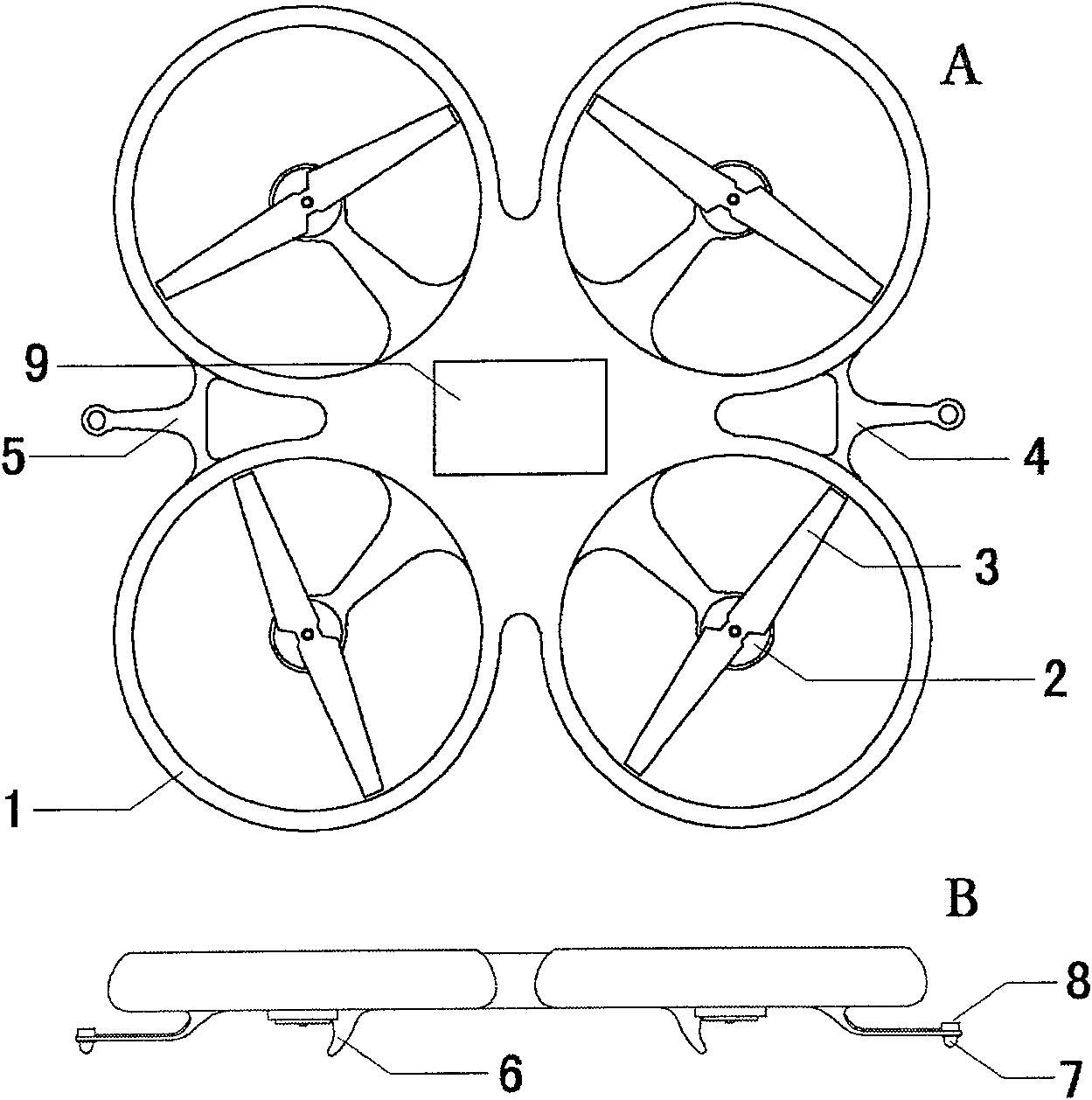
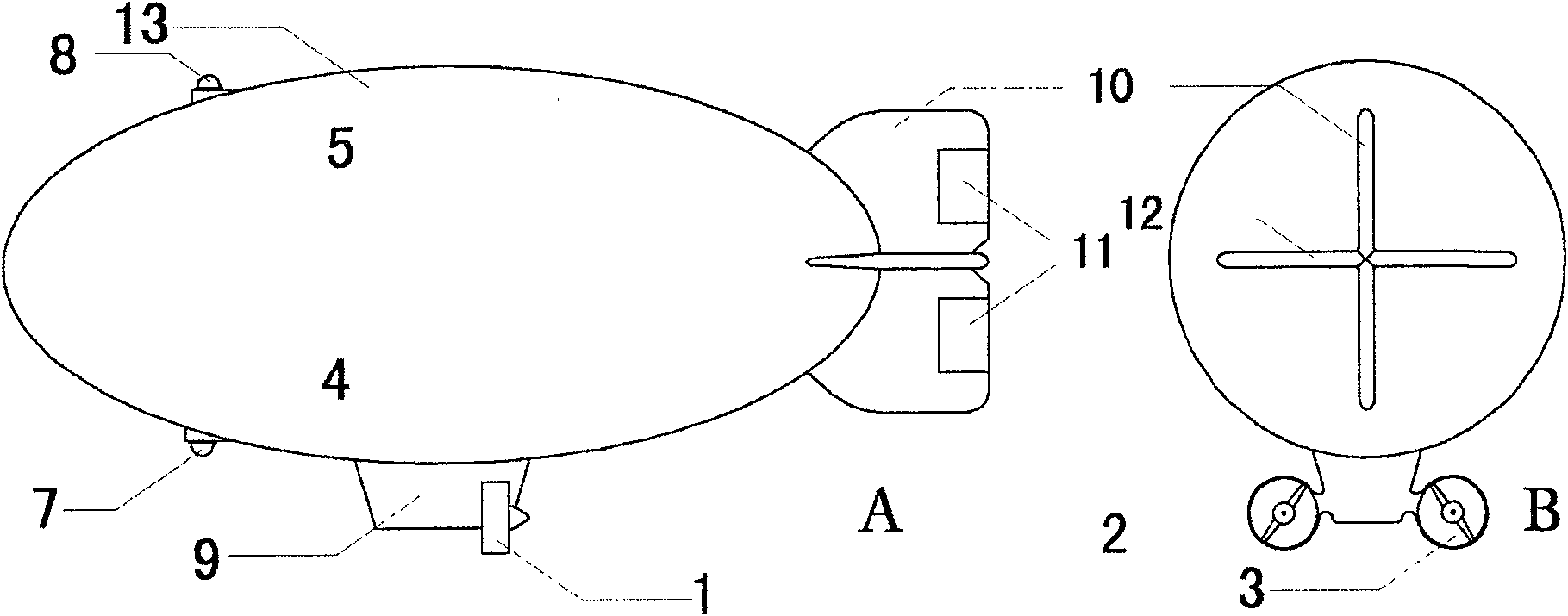
[0074] First, the choice of MAVs,
[0075] Analysis of the effects of MAVs on measurement sensing devices or sensors and the indoor environment.
[0076] Just as people dissipate heat and stir up the airflow when working indoors, micro-aircraft will also have more or less impact on the indoor environment. We minimize this impact through technical means.
[0077] Airplanes and airships fly with power, and the engine will be the main interference factor, which will generate noise, vibration, heat dissipation, internal combustion engines and other heat engines will also emit exhaust gas, and propellers will also cause changes in airflow. According to the characteristics of the task, we choose a micro brushless motor as the power source. Compared with the heat engine, the motor has small horsepower and short battery life, which are disadvantages, but this is not the main problem for indoor close-distance operations. The vibration and noise of the motor are relatively small, it i...
example 1
[0195] Example 1. Surveying and mapping of the current situation of a prehistoric settlement site in Shaanxi Province.
[0196] In June 2007, the inventor used a small fixed-wing aircraft to take aerial photography and three-dimensional mapping of the "Jinshanzhai" site (provincial cultural relics protection unit) and its surrounding local mountain environment in Zizhou County, Yulin District, Shaanxi Province. In the process of aerial photography, the aircraft flies around the circle of the target. Surveying and mapping has no special requirements for the accuracy of the route and the distance of shooting. It can be operated relatively freely according to conditions such as airflow and terrain. It should be noted that if you want to get the various positions of the target with a complex shape , then there should be many photos, and there should be no "dead angles". Most of the shooting is done in circles ( Figure 10A ). Therefore, the number of actual photos used for survey...
example 2
[0199] Example 2. Surveying and mapping of wooden pagoda tops in Ying County, Shanxi.
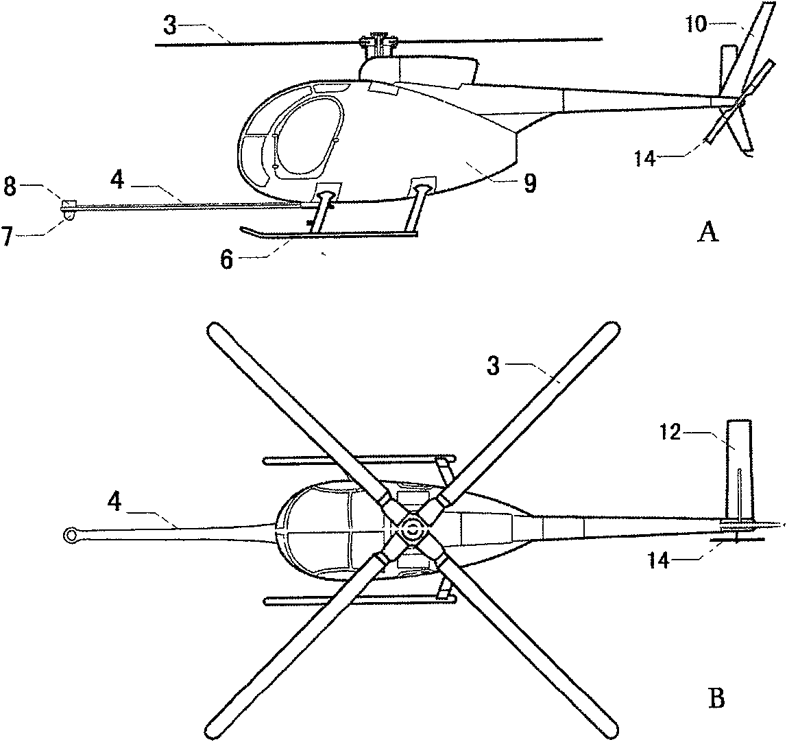
[0200] The Sakyamuni Pagoda of Fogong Temple in Yingxian County, Shanxi Province is usually called Yingxian Wooden Pagoda. It was built in the Liao Dynasty and is more than 60 meters high. It is the oldest and tallest all-wood structure building in the world. It is a national key cultural relic protection The unit has been included in the World Cultural Heritage Candidate List. This year, the national cultural relics department decided to carry out a large-scale renovation of the wooden tower. Most of the area on the tower can be climbed and observed, but there is only a small opening of tens of centimeters on the top for access, and the slope of the top is so steep that it is easy to slip and fall. Manual work is very difficult. It is dangerous, so in September this year, the inventor used a small unmanned helicopter to carry a high-resolution camera, flew to a distance of about 10-30 mete...
PUM
 Abstract
Description
Claims
Application Information
 - R&D
- Intellectual Property
- Life Sciences
- Materials
- Tech Scout
- Unparalleled Data Quality
- Higher Quality Content
- 60% Fewer Hallucinations
Browse by: Latest US Patents, China's latest patents, Technical Efficacy Thesaurus, Application Domain, Technology Topic, Popular Technical Reports.
© 2025 PatSnap. All rights reserved.Legal|Privacy policy|Modern Slavery Act Transparency Statement|Sitemap|About US| Contact US: help@patsnap.com


