Seismic data processing shot gather wave equation prestack depth deviation parallel calculating method
A pre-stack depth migration and parallel computing technology, which is applied in seismic signal processing, multi-channel program devices, etc., can solve the problems of long computing cycle and large amount of computing, and achieve good scalability, high parallel efficiency, and shorten processing time. cycle effect
- Summary
- Abstract
- Description
- Claims
- Application Information
AI Technical Summary
Problems solved by technology
Method used
Image
Examples
example 1
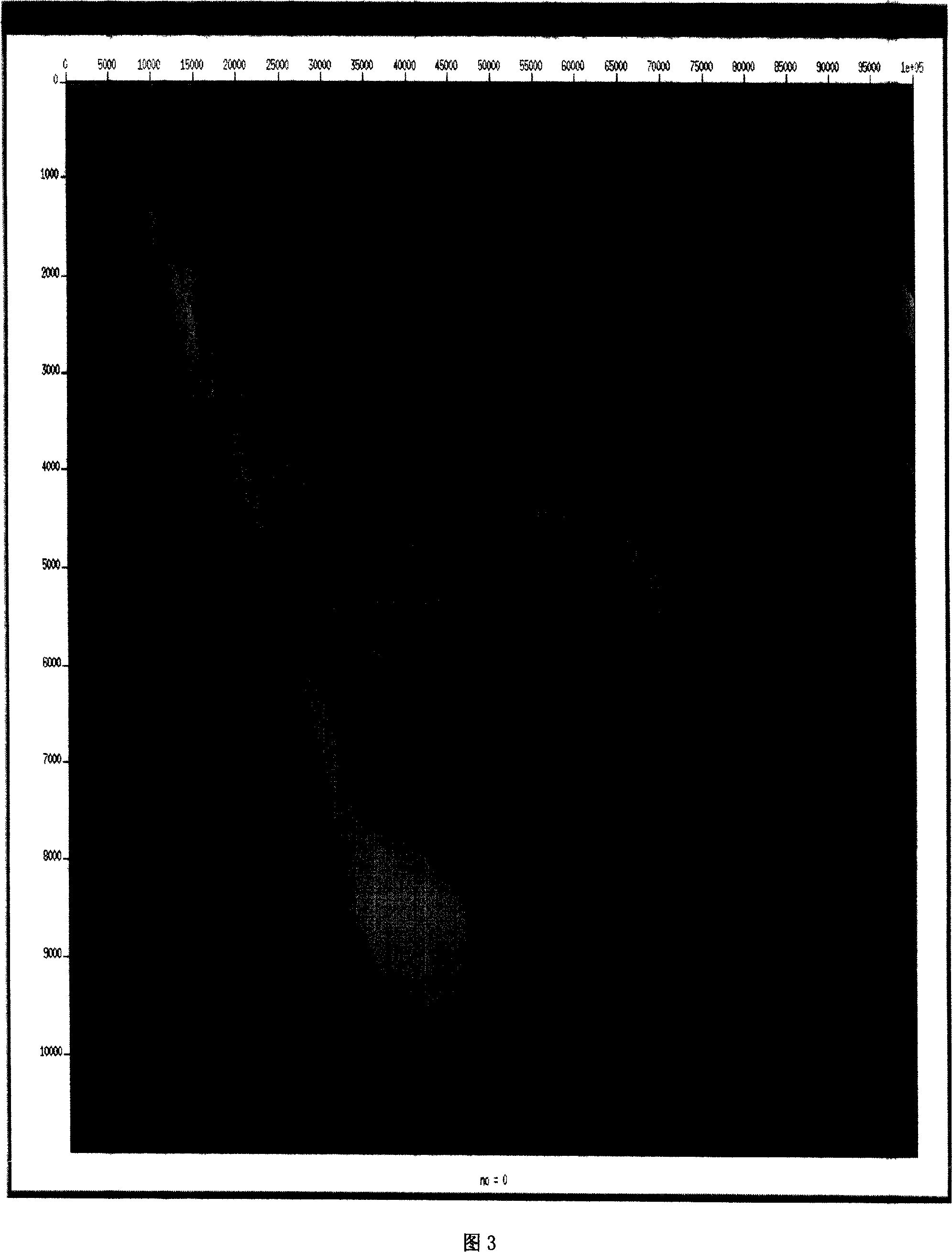
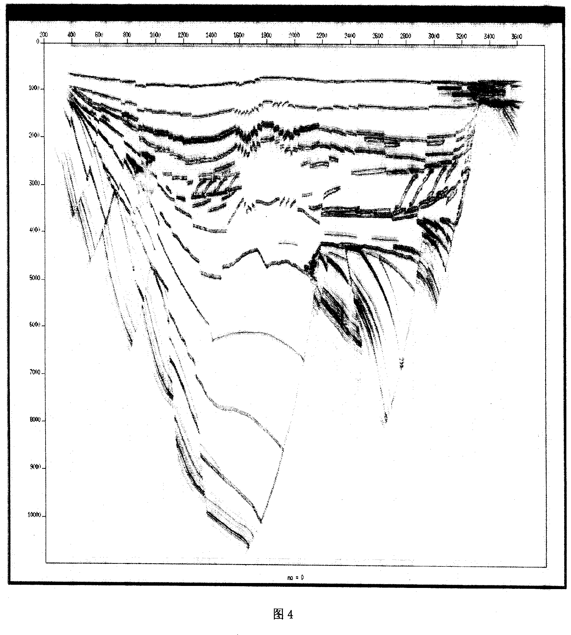
[0025] Based on the typical structural characteristics of the Jiyang Depression, the Shengli typical model and depth-velocity model were established. Figure 3 is the established depth-velocity model. It is an effective tool to test the imaging ability of the imaging algorithm suitable for complex continental structures.
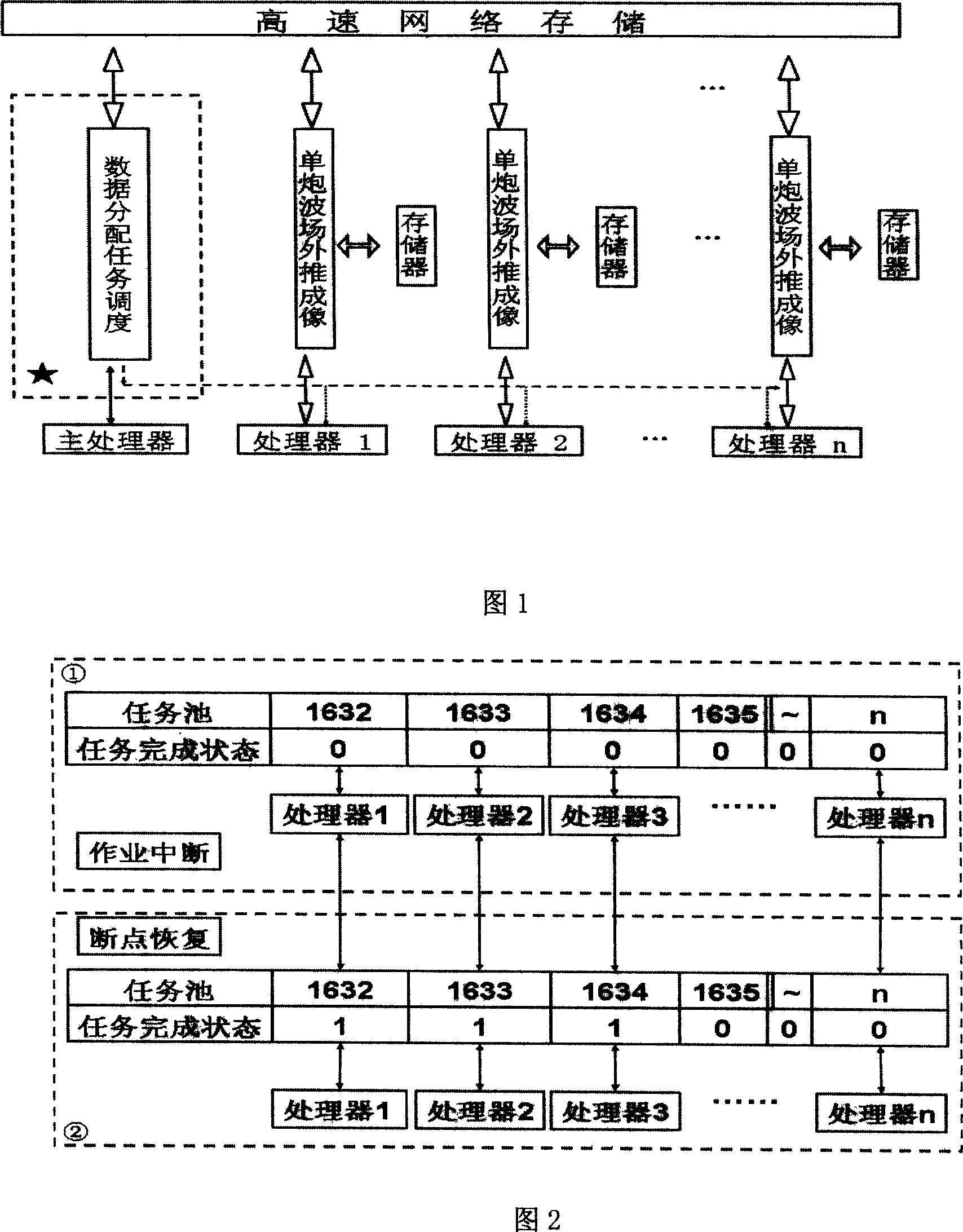
[0026] The basic process of implementation is as follows:
[0027] (1) Start the operation;
[0028] (2) The main node uses the shot record as the task unit to allocate parallel tasks;
[0029] (3) Accept the task from the node, judge the task status, and determine whether to perform breakpoint recovery;
[0030] (4) Read the shot trace record, source record and depth velocity field from the node;
[0031] (5) Shot trace collection is recorded according to the depth step, and the source record wave field is extrapolated;
[0032] (6) In the time-space domain, time-shift correction is performed;
[0033] (7) Perform fast Fourier forward transform on the ...
example 2
[0043] Salt Dome Model Data
[0044] The wave equation 3D prestack depth migration program was tested on the SEG / EAGE salt dome model. This model is another internationally accepted theoretical geological model for testing complex structure imaging and velocity model building methods. The realization process is the same as example 1.
[0045] Figures 5 and 6 show the comparison of the horizontal slice of the velocity field of the salt dome model and the migration results at the corresponding depths. It can be seen that both the fault and the boundary of the salt body are quite clear.
[0046] Fig. 7 shows the pre-stack depth imaging results of the SEG / EAGE salt dome model data for a 3D single shot set. It can be seen from the figure that the outline of the salt dome and the structure of the salt dome are quite clear, and the subsalt faults and small flats are not clear.
example 3
[0048] The actual data of the Shengli Exploration Area
[0049] Using the self-developed processing system and the method module software of this paper, the actual data of 140 square kilometers in the Shengli exploration area were processed productively (as shown in Figure 8). The realization process is the same as example 1.
[0050] Geological interpreters believe that:
[0051] Chengnan fault, Guxi fault, Gubei fault and other fault points are crisp, and the cross-section and fault system are clear;
[0052] The resolution and signal-to-noise ratio of the Mesozoic and Upper Paleozoic are relatively high, and the shape and internal structure of the Mesozoic buried hill are clearly imaged, and the geological meaning of the horizon is clear. The reflection of non-standard layers in the Mesozoic is clear and can meet the needs of fine interpretation of unconformity reservoirs and description of sand bodies;
PUM
 Abstract
Description
Claims
Application Information
 - R&D
- Intellectual Property
- Life Sciences
- Materials
- Tech Scout
- Unparalleled Data Quality
- Higher Quality Content
- 60% Fewer Hallucinations
Browse by: Latest US Patents, China's latest patents, Technical Efficacy Thesaurus, Application Domain, Technology Topic, Popular Technical Reports.
© 2025 PatSnap. All rights reserved.Legal|Privacy policy|Modern Slavery Act Transparency Statement|Sitemap|About US| Contact US: help@patsnap.com


