Method for simulating three-dimensional land scene echoes of interferometric synthetic aperture radar (InSAR)

An interferometric synthetic aperture and simulation method technology, which is applied in the field of echo simulation of interferometric synthetic aperture radar for three-dimensional land scenes, can solve the problem that it is difficult to inject various systematic errors, fails to form a complete and practical echo simulation method and process, and is difficult to solve. issues of balance

Inactive Publication Date: 2010-11-03
NAT UNIV OF DEFENSE TECH
View PDF3 Cites 17 Cited by
  • Summary
  • Abstract
  • Description
  • Claims
  • Application Information

AI Technical Summary

Problems solved by technology

The above-mentioned methods have great limitations for a specific problem in the echo signal simulation: it is difficult to reflect the relative motion between the satellite, the earth, and the target, it is not easy to inject various system errors, and the accuracy of the simulation cannot reach the actual application requirements, cannot be universally applied
In 2004, Alessandro used the method of direct time domain superposition to simulate the echo of interferometric synthetic apertu

Method used


Image

  • Method for simulating three-dimensional land scene echoes of interferometric synthetic aperture radar (InSAR)
  • Method for simulating three-dimensional land scene echoes of interferometric synthetic aperture radar (InSAR)
  • Method for simulating three-dimensional land scene echoes of interferometric synthetic aperture radar (InSAR)

Examples


Embodiment Construction

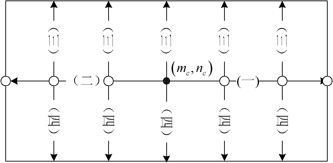
[0118] figure 2 It is the recursive sequence diagram of the slant distance recursive method. In each slant distance calculation unit, the central facet unit (m c , n c ) slope distance. Then, calculate the slant distance of other facet units in four steps: (1) Calculate the slant distance of the facet unit that is on the right side of the central facet unit; The slant distance of the facet unit to the left of the central facet unit; (3) Calculate the slant distance of the facet unit above the row where the central facet unit is located by column; (4) Calculate the facet below the row where the central facet unit is located by column The slope distance of the unit.

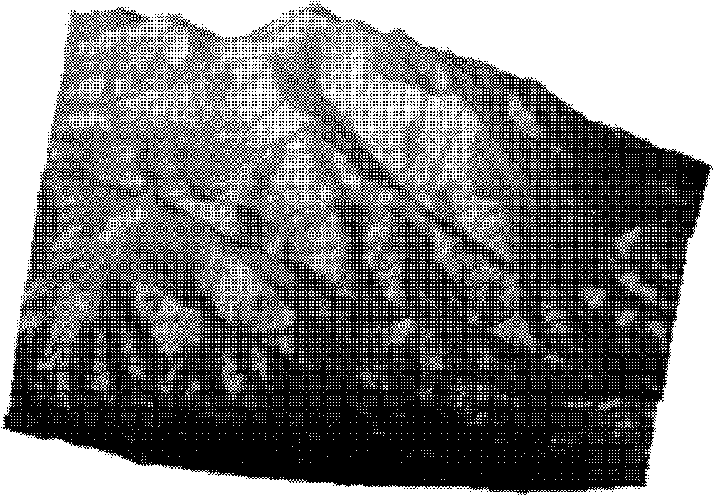
[0119] Figure 3 ~ Figure 4 It is the digital elevation model data input in the echo simulation experiment carried out in the laboratory and the grayscale image of the interferometric phase obtained. The cluster computer used in the simulation is composed of 1 master node DELL PE2650 and 15 computing nodes P...


PUM


Abstract

The invention provides a method for simulating three-dimensional land scene echoes of an interferometric synthetic aperture radar (InSAR), comprising the following steps of: firstly, performing geometric modeling on three-dimensional land scenes and dividing the three-dimensional land scenes into facets which are adjacent to each other; then, performing electromagnetic modeling by using the facets as scatterers and calculating backscattering coefficients of the scatterers; and finally, generating echoes in parallel by calculating a single echo according to a signal model of an InSAR system. The invention has small amount of calculation and can finish calculation within a shorter time under the traditional calculation capability in a parallel calculation mode. Moreover, the invention has high calculation accuracy and can meet requirements of the InSAR for simulation and research.

Description

technical field [0001] The invention belongs to the intersecting technical field of microwave remote sensing and signal processing, and in particular relates to an echo simulation method of an interference synthetic aperture radar for a three-dimensional land scene. Background technique [0002] Interferometric synthetic aperture radar can obtain a three-dimensional topographic map of the earth's surface with high spatial resolution and elevation accuracy all-weather and all-time. Using three-dimensional topographic map information, it is possible to monitor changes in the earth's land surface and ice and snow surface, to predict disasters such as earthquakes, volcanic eruptions, landslides, and major floods, to provide assistance for agricultural, forestry, and fishery production, and to provide information support for military activities. In a word, the 3D topographic map obtained by interferometric synthetic aperture radar has important application value and wide applicat...

Claims


Application Information

Patent Timeline
IPC IPC(8): G01S13/90G01S7/41G06F17/50
Inventor 董臻张永胜孙造宇余安喜黄海风何峰金光虎杜湘瑜何志华陈祺王青松李力
Owner NAT UNIV OF DEFENSE TECH
Why Eureka
Try Eureka