Statistical data and remote sensing image data based regional fertilizer application spatialization method

A technology of remote sensing images and statistical data, applied in computing, computer components, character and pattern recognition, etc.

Inactive Publication Date: 2011-08-17
CHINA AGRI UNIV
View PDF1 Cites 13 Cited by
  • Summary
  • Abstract
  • Description
  • Claims
  • Application Information

AI Technical Summary

Problems solved by technology

The farmland system is a very complex system, and agricultural input is affected by many factors. It is different from population data, and the mathematical method of simply applying auxiliary data for area weighting cannot fully reflect the spatial distribution of fertilizer input in essence.

Method used


Image

  • Statistical data and remote sensing image data based regional fertilizer application spatialization method
  • Statistical data and remote sensing image data based regional fertilizer application spatialization method
  • Statistical data and remote sensing image data based regional fertilizer application spatialization method

Examples


Embodiment Construction

[0029] The specific implementation manners of the present invention will be described in further detail below in conjunction with the accompanying drawings and examples. The following examples are used to illustrate the present invention, but are not intended to limit the scope of the present invention.

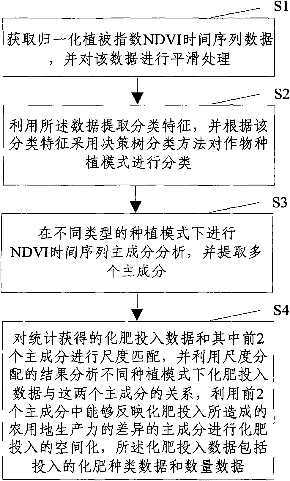
[0030] Such as figure 1 Shown, the present invention comprises the following steps:

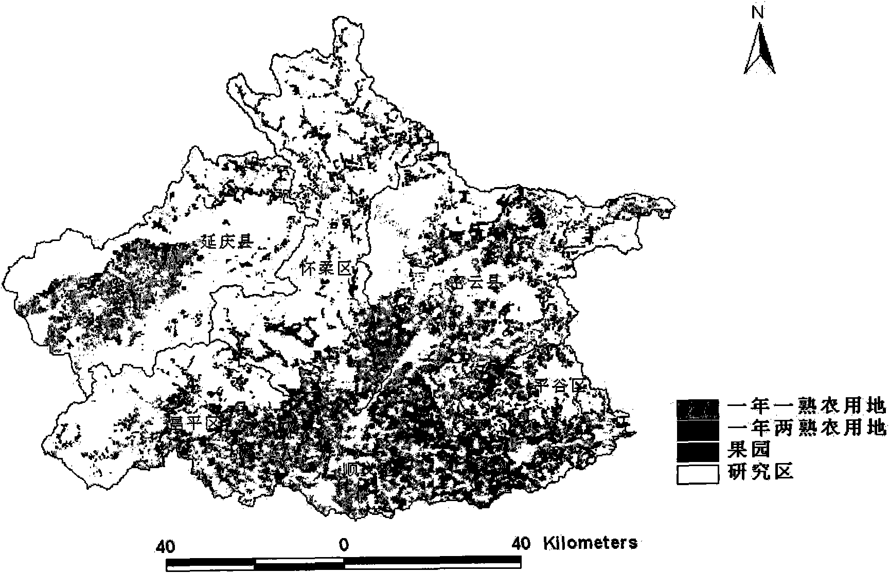
[0031] Firstly, MODIS NDVI time series data (remote sensing image data) is used to classify crop planting patterns. Including MODIS NDVI time series data acquisition and processing, crop planting model classification and classification accuracy evaluation.

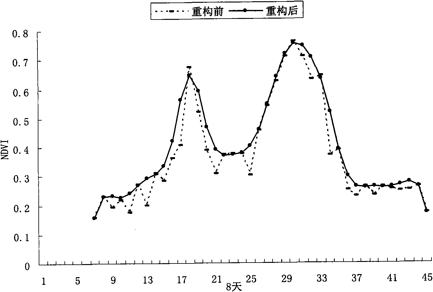
[0032] S1. Acquisition and processing of MODIS NDVI time series data

[0033] The remote sensing data of vegetation contains comprehensive information such as leaves and their growth conditions, which directly indicate the accumulation of dry matter and the amount of biomass of crops. Some studies have pointed out that NDVI has a goo...


PUM


Abstract

The invention discloses a statistical data and remote sensing image data based regional fertilizer application spatialization method. The method comprises the following steps of: 1, acquiring normalized difference vegetation index (NDVI) time sequence data and performing smooth processing; 2, extracting classification characteristic by using the data and classifying a planting mode by using a decision tree classification method; 3, performing principal component analysis of the NDVI time sequence in different planting modes and extracting a plurality of principal components; 4, performing size matching on fertilizer application data and two principal components, analyzing relation between the fertilizer application data and the two principal components in different planting modes by using a size matching result, and selecting the principal components which can reflect productivity difference caused by fertilizer application for spatialization of the fertilizer application. By adopting the method, spatial distribution of the fertilizer application is substantially and completely reflected, and high discrimination can be achieved.

Description

technical field [0001] The invention relates to the technical field of agricultural non-point source pollution and remote sensing spatialization. In particular, it relates to a spatialization method of regional fertilizer input combined with statistical data and remote sensing image data. Background technique [0002] Fertilizer is a vital productive resource in agricultural production and plays an important role in increasing grain production. The substantial increase in chemical fertilizer input has brought about a series of serious ecological and environmental problems such as eutrophication of water bodies, deterioration of soil physical and chemical properties, groundwater pollution, and loss of biodiversity while continuously increasing crop yields. One of the main types of point source pollution. Coupled with the fact that people are paying more and more attention to environmental protection and food safety issues, the use of chemical fertilizers will be strictly li...

Claims


Application Information

Patent Timeline
Patent Type & Authority Applications(China)
IPC IPC(8): G06K9/66
Inventor 孙丹峰李红张微微周连第王雅刘建光
Owner CHINA AGRI UNIV
Why Eureka
Try Eureka