

Cloud server platform capable of efficiently processing and analyzing remote sensing data
A cloud service platform and remote sensing data technology, applied in the direction of electrical digital data processing, special data processing applications, instruments, etc., can solve the problems that hinder the timely assessment of disaster situations and the rapid development of disaster relief operations, and achieve high-efficiency remote sensing data processing and analysis services, The effect of good compatibility and easy expansion
- Summary
- Abstract
- Description
- Claims
- Application Information
AI Technical Summary
Problems solved by technology
Method used
Image

Examples
Embodiment Construction
[0042] In order to make the object, technical solution and advantages of the present invention clearer, the present invention will be further described in detail below in conjunction with the accompanying drawings and embodiments. It should be understood that the specific embodiments described here are only used to explain the present invention, not to limit the present invention.
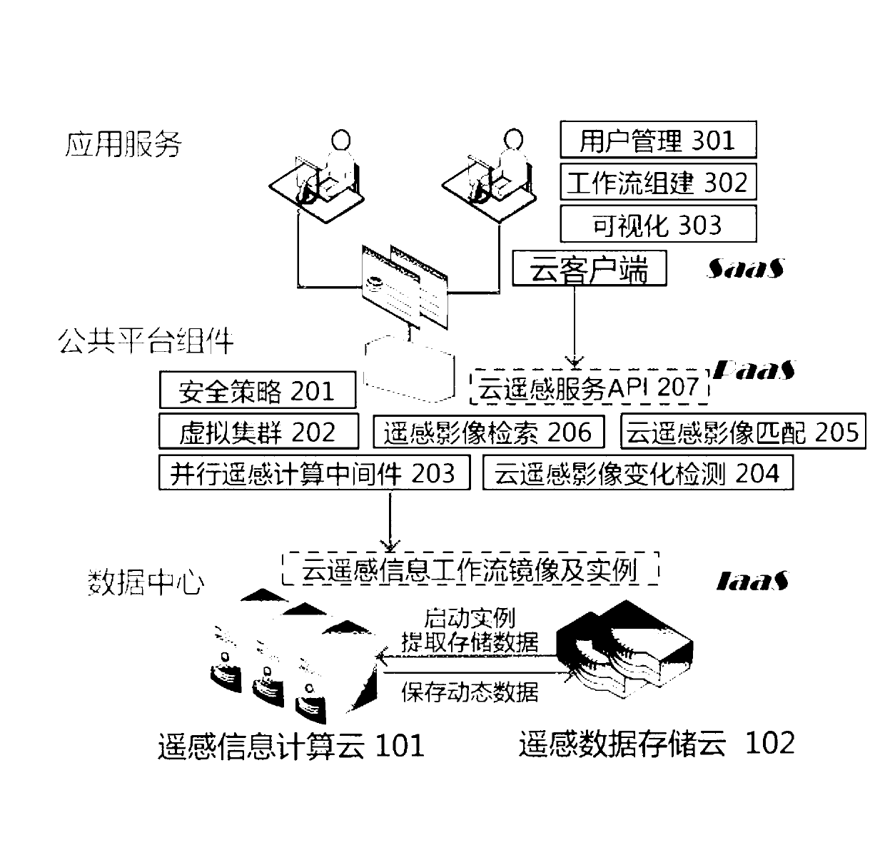
[0043] Such as figure 1 As shown, the present invention provides a cloud service platform architecture for high-efficiency remote sensing data processing and analysis, including
[0044] Cloud remote sensing data storage and computing center, used for storage and computing of remote sensing data;
[0045] Cloud remote sensing intermediate service platform public middleware for remote sensing data processing and analysis;
[0046] Lightweight cloud remote sensing information service client, used to configure remote cloud computing resources, create and manage remote sensing information service cha...
PUM
 Abstract
Description
Claims
Application Information