Correcting method for global satellite navigation system troposphere zenith delay

A global satellite navigation and tropospheric technology, applied in the field of tropospheric zenith delay correction, can solve the problems of unfavorable navigation and positioning applications, large number of parameters in the parameter table, low calculation efficiency, etc., achieve high calculation and storage efficiency, high correction accuracy, and calculation high efficiency effect

Inactive Publication Date: 2014-02-05
INST OF GEODESY & GEOPHYSICS CHINESE ACADEMY OF SCI
View PDF2 Cites 17 Cited by
  • Summary
  • Abstract
  • Description
  • Claims
  • Application Information

AI Technical Summary

Problems solved by technology

However, the IGGtrop method also has some obvious problems. For example, it takes into account the detailed seasonal variation of the tropospheric zenith delay in the equatorial region. The algorithm is more complicated, but it does not bring significant improvement in accuracy.
The three-dimensional spatial grid of the IGGtrop method is not designed according to the spatial characteristics of the tropospheric zenith delay, but simply adopts a globally uniform grid point spacing, which causes a lot of waste of parameters, and leads to a large number of parameters in the parameter table and a large storage space. Large and low computational efficiency, not conducive to the actual application of navigation and positioning
In addition, the IGGtrop correction technology currently uses a floating-point parameter storage method, and the storage efficiency is relatively low

Method used


Image

  • Correcting method for global satellite navigation system troposphere zenith delay
  • Correcting method for global satellite navigation system troposphere zenith delay
  • Correcting method for global satellite navigation system troposphere zenith delay

Examples


Embodiment 1

[0040] A method for correcting the tropospheric zenith delay of the global satellite navigation system, the method comprises the following steps:

[0041] a. Establishment of the original database of global tropospheric zenith delays

[0042] The NCEP global reanalysis atmospheric data divides the atmospheric space into a three-dimensional grid of 2.5 degrees latitude x 2.5 degrees longitude x height. The grid has 17 isobaric surfaces in height, and provides the height, atmospheric pressure intensity, temperature and relative humidity data;

[0043] From the relative humidity of each three-dimensional grid, the water vapor pressure of the grid is calculated by the following formula:

[0044] e s =exp(-37.2465+0.213166T-0.000256908T 2 ) (1)

[0045] e=0.01·RH·e s (2)

[0046] Among them: e s is saturated water vapor pressure, unit: hPa, RH is relative humidity, T is absolute temperature K, e is water vapor pressure, unit: hPa;

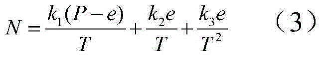
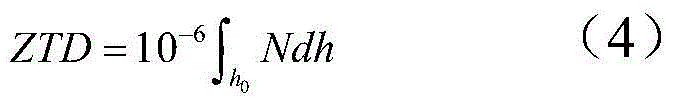
[0047] Then the atmospheric refracti...

Embodiment 2

[0071] The present invention is used to correct the tropospheric zenith delay of the global satellite navigation system, and its correction accuracy is shown in Tables 1-4. The basic effects of the present invention are: the average correction accuracy for the global tropospheric zenith delay is about 4.0 centimeters, and the correction errors in all regions of the world are within 8.0 centimeters, which is better than the correction effect of the EGNOS technology; use this technology to perform tropospheric zenith delay The average precision of the correction and the correction precision in each altitude and latitude interval are basically equivalent to the IGGtrop technology.

[0072] In the statistical results in the following tables, the observed values ​​of tropospheric zenith delay are used to evaluate the correction accuracy of various tropospheric zenith delay correction methods. The observed value of the tropospheric zenith delay, or the "true value", is the high-prec...


PUM


Abstract

The invention discloses a correcting method for global satellite navigation system troposphere zenith delay, and relates to correcting technologies for troposphere zenith delay of radio signals in satellite navigation application. The method includes the following steps that (1), a global troposphere zenith delay original data base is built; (2), a global troposphere zenith delay data base is built; (3), a reseau and global troposphere zenith delay simplifying data base is built; (4), the annual mean value and annual variation amplitude of the troposphere zenith delay are calculated; (5), a global troposphere zenith delay correcting parameter table is stored; (6), the troposphere zenith delay is corrected through a receiver end. The correcting method for the global satellite navigation system troposphere zenith delay has the advantage that elaborate space and time changes of the global troposphere zenith delay are fully considered, simple calculation formulas and a reasonably optimized space reseau and parameter table storing method are adopted, so that the correcting method has the advantages of being high in accuracy, easy and convenient in calculation and high in efficiency, and meanwhile requirements for storing space of the receiver end are lowered.

Description

technical field [0001] The invention relates to the tropospheric zenith delay correction of radio signals, in particular to the tropospheric zenith delay correction technology of the global satellite navigation system. Background technique [0002] Global Navigation Satellite System (Global Navigation Satellite System), referred to as GNSS, its working principle is: multiple satellites continuously operating in orbit at a distance of 20,000 to 40,000 kilometers from the earth's surface continuously send L-band radio signals, passing through the earth's atmosphere (including the ionosphere and Neutral atmosphere) reaches the ground and is captured by GNSS receivers, and the captured signals can be used for navigation, positioning and timing by processing and measuring them. At present, the global satellite navigation system mainly includes: GPS of the United States, GLONASS of Russia, GALILEO of the European Union and Beidou system of China which are under construction. [0...

Claims


Application Information

Patent Timeline
Patent Type & Authority Applications(China)
IPC IPC(8): G01S19/07
CPCG01S19/23G01S19/40
Inventor 袁运斌李薇欧吉坤张宝成李子申
Owner INST OF GEODESY & GEOPHYSICS CHINESE ACADEMY OF SCI
Why Eureka
Try Eureka