Sub-basin dividing and information extracting method based on IDL and Mapinfo

An information extraction and sub-basin technology, applied in the field of hydrology under geophysics, can solve the problems that cannot meet the application requirements, and achieve the effect of simple IDL and high calculation efficiency

Active Publication Date: 2014-03-26
HOHAI UNIV
View PDF5 Cites 16 Cited by
  • Summary
  • Abstract
  • Description
  • Claims
  • Application Information

AI Technical Summary

Problems solved by technology

The most basic method of sub-basin division is to use ArcGIS for sub-basin division. However, as people have higher and higher requirements for the results of sub-basin division, the sub-basin division based on ArcGIS alone cannot meet the application requirements.

Method used


Image

  • Sub-basin dividing and information extracting method based on IDL and Mapinfo
  • Sub-basin dividing and information extracting method based on IDL and Mapinfo
  • Sub-basin dividing and information extracting method based on IDL and Mapinfo

Examples


example 1

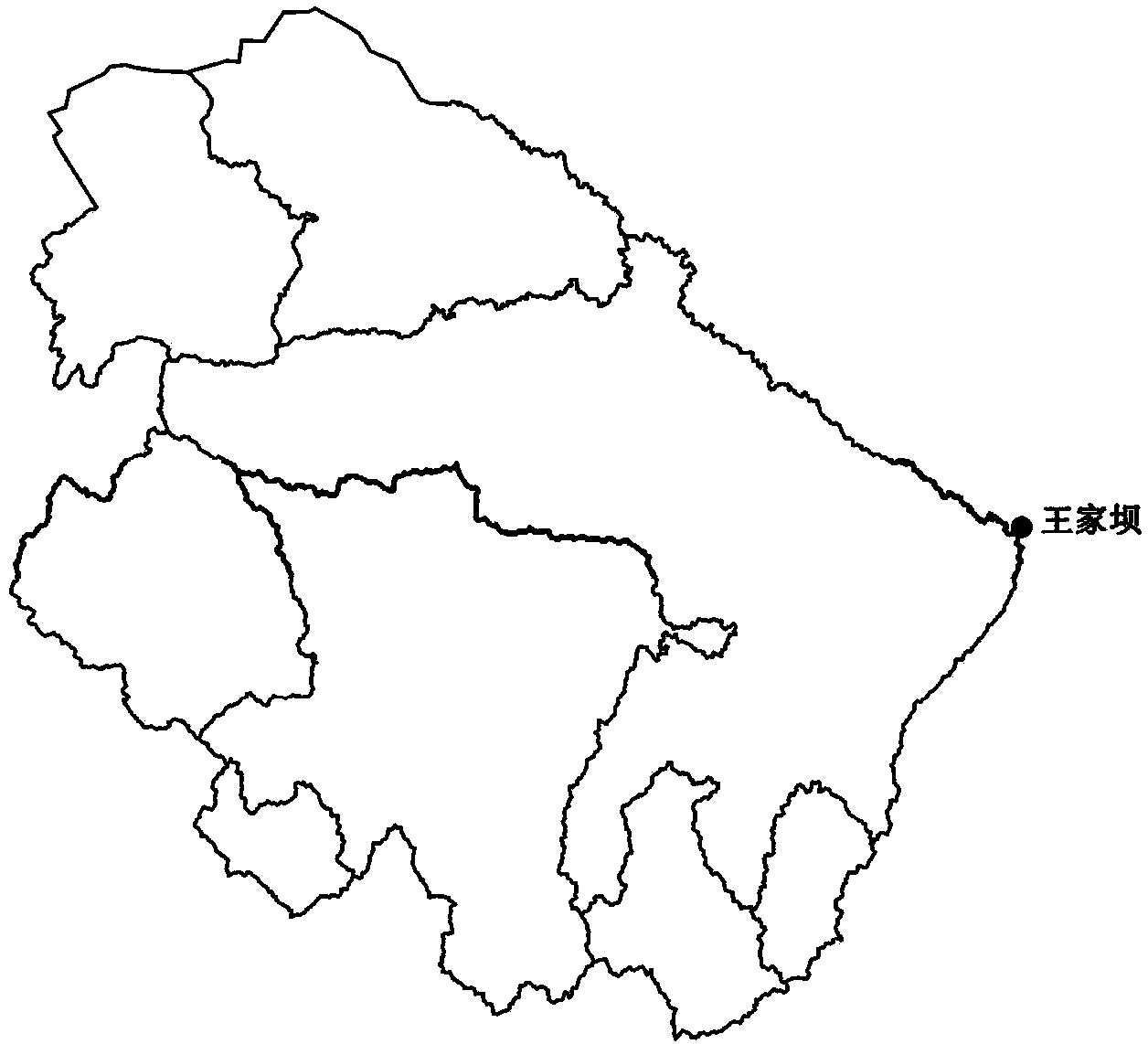
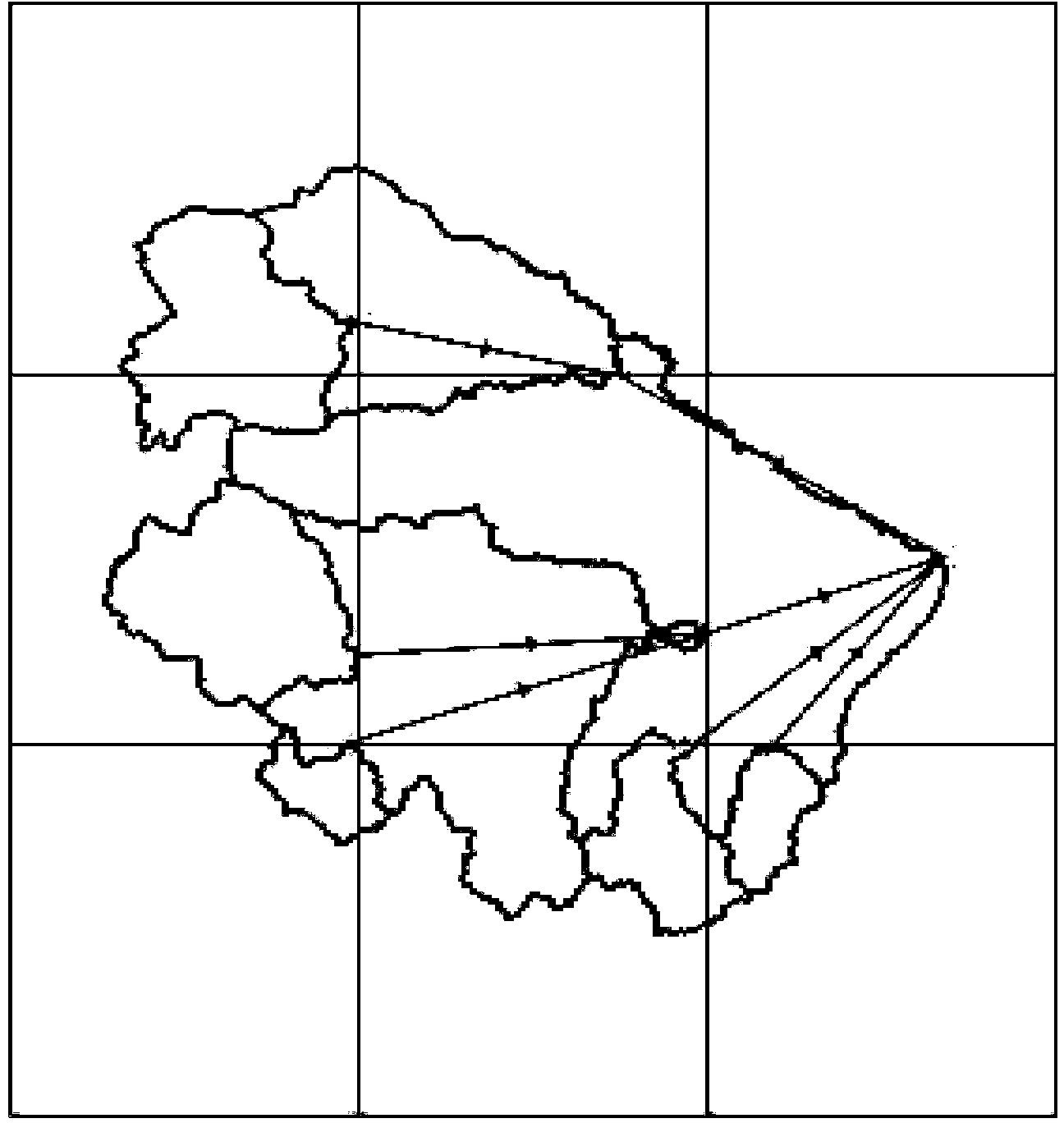
[0049] Example 1: Select the watershed above the Wangjiaba hydrological station (such as figure 1 shown), the Wangjiaba hydrological station is located at the junction of Henan and Anhui provinces in the middle reaches of the Huaihe River, with a catchment area of ​​36,000 km 2 , is the largest station on the main stream of the Huaihe River, it is the barometer of the Huaihe River, and has played a huge role in the previous flood fighting and rescue work in the Huaihe River Basin.

[0050] The Huaihe River is located in the climate transition zone between the north and the south of my country. The north of the Huaihe River belongs to the warm temperate zone, and the south of the Huaihe River belongs to the northern subtropical zone. The climate is mild, and the annual average precipitation is about 830mm. Twice the minimum annual precipitation, and the precipitation in the flood season (June to September) accounts for about 60% of the annual precipitation 80%, catchment area ...

example 2

[0065] Example 2: Select the watershed above the Waizhou hydrological station to divide into sub-watersheds. It is the control station of the Ganjiang River system. The watershed is located between 113.7°-116.6° east longitude and 24.5°-28.7° north latitude, with a control area of ​​80948km2. The Ganjiang River is the largest river in Jiangxi Province, China, and one of the most important tributaries of the lower reaches of the Yangtze River. The total length is 991km, and the drainage area is 83,500km2. The Ganjiang River Basin belongs to the subtropical humid monsoon climate, with a mild climate and abundant rainfall, which is very suitable for the growth of plants, animals and humans. The average annual precipitation is 1400-1800 mm.

[0066] The specific implementation steps are shown in Example 1, and the final division results are shown in the appendix Figure 4-6 , The extracted information is shown in Table 5-8.

[0067] Table 5 Area information of sub-basins extract...


PUM


Abstract

The invention discloses a sub-basin dividing and information extracting method based on IDL and Mapinfo and belongs to the hydrology science of physical geography science. According to the sub-basin dividing method, high-accuracy DEM data are used for dividing basins in an upscaling mode through an IDL program language, and the characteristics of IDL matrix orientation and high operation efficiency are well used. Through analysis of DEM, the geology and geomorphic features such as sub-basin dividing structures, the topological relation between sub-basins, sub-basin control points, the control range, water-collecting area, riverway length between sub-basins and gradients are obtained, and support is provided for basin runoff simulation. Meanwhile, powerful geographic information system software MapInfo is used for displaying sub-basin dividing results. Based on the IDL, the sub-basin topological relation and the sub-basin control point position are generated, and the sub-basin topological relation is shown through the MapInfo programming language MapBasic.

Description

[0001] technical field [0002] The invention relates to a method for dividing, analyzing and displaying sub-watersheds by using the programming language IDL and MapInfo, and belongs to the technical field of hydrology under geophysics. Background technique [0003] The distributed hydrological model is to predict the spatial distribution of the hydrological situation in the basin, evaluate the impact of human activities (water resources development and utilization, land use, non-point source pollution, etc.), and provide scientific guidance for basin planning and governance, and sustainable development and utilization of water resources. method. The distributed hydrological model based on DEM is a hot issue in hydrological model research. The division of sub-units in the watershed based on DEM has an important impact on the simulation accuracy, and it is of great significance to effectively divide the watershed according to the needs. The traditional subunit division i...

Claims


Application Information

Patent Timeline
Patent Type & Authority Applications(China)
IPC IPC(8): G06F9/44
Inventor 刘京京吴志勇何海鞠琴董亮吴晓韬
Owner HOHAI UNIV
Why Eureka
Try Eureka