Satellite remote sensing image fusion method

A technology of satellite remote sensing image and fusion method, which is applied in image enhancement, image analysis, image data processing, etc., can solve problems such as difficulty, influence application effect, and impossibility, and achieve the effect of simple method and fast calculation

Active Publication Date: 2014-07-23
PEARL RIVER HYDRAULIC RES INST OF PEARL RIVER WATER RESOURCES COMMISSION
View PDF2 Cites 20 Cited by
  • Summary
  • Abstract
  • Description
  • Claims
  • Application Information

AI Technical Summary

Problems solved by technology

[0011] Nevertheless, the inherent and external defects of natural color (true color) images remain the same, seriously affecting its application effect
Direct use of general enhancement techniques such as traditional histogram adjustment can

Method used


Image

  • Satellite remote sensing image fusion method
  • Satellite remote sensing image fusion method
  • Satellite remote sensing image fusion method

Examples


Embodiment

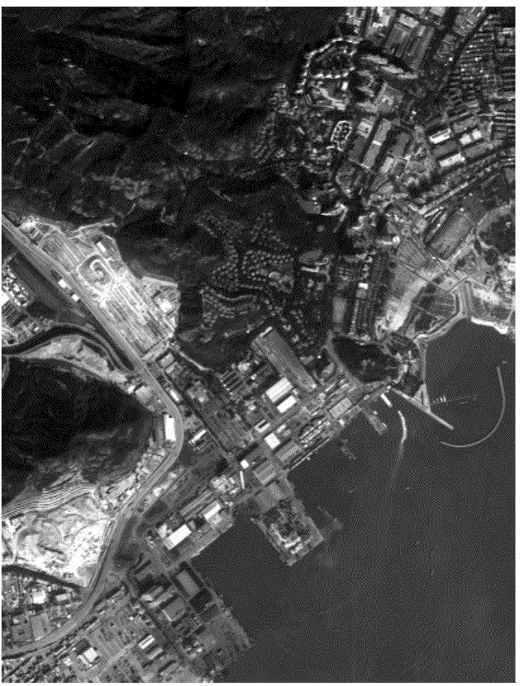
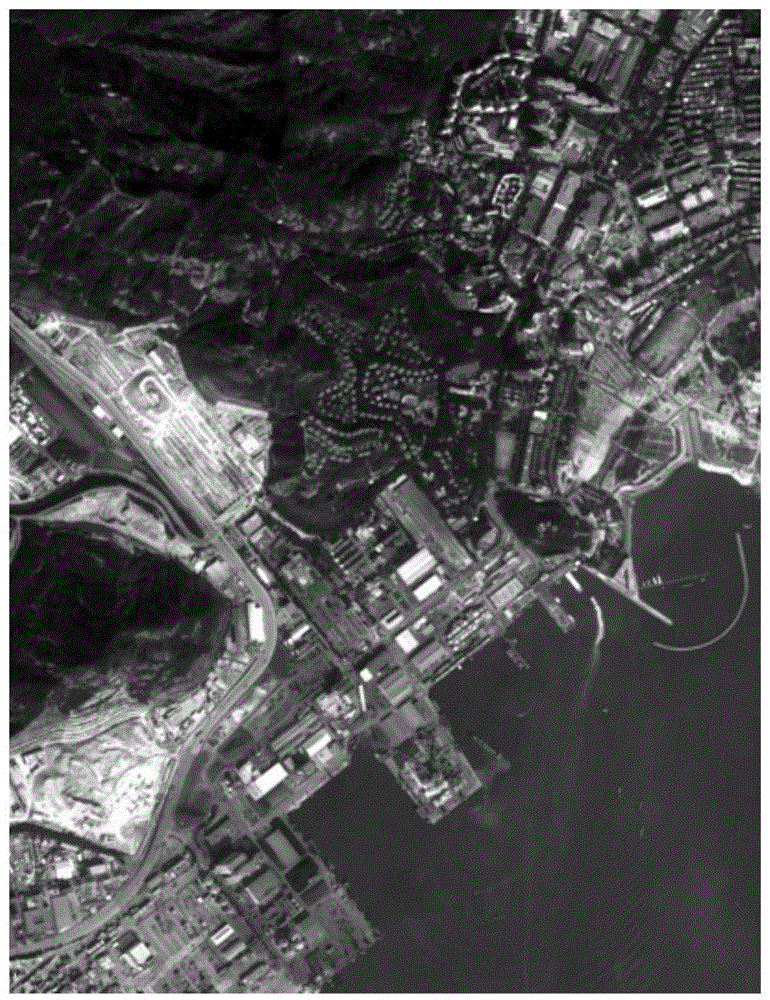
[0047] In this embodiment, a picture such as figure 2 The shown remote sensing images with near infrared band (NIR), red band (R), green band (G) and blue band (B) describe the fusion method in the present invention. The specific flow chart is as figure 1 shown.

[0048] 1. Input remote sensing images

[0049] Open a multispectral remote sensing image with near-infrared (NIR), red (R), green (G) and blue (B) bands, such as figure 2 As shown, all are 1% stretch effect diagrams.

[0050] 2. Calculate the basic parameters of fusion enhancement

[0051] The basic parameters of fusion enhancement specifically refer to: natural color band combined intensity I, ratio R of near-infrared band intensity to natural color band combined intensity I, and normalized difference vegetation index NDVI. The specific calculation process of each parameter is as follows.

[0052] For the natural color band combination intensity I,

[0053] I = ...


PUM


Abstract

The invention discloses a satellite remote sensing image fusion method comprising that: natural color waveband combined intensity I, a ratio R of near-infrared waveband intensity to the natural color waveband combined intensity I, and a normalized difference vegetation index NDVI are respectively calculated with regard to a multispectral remote sensing image with a near-infrared waveband, a red light waveband, a green light waveband and a blue light waveband, and then a basic enhancement operator k1 is established according to the ratio R. A characteristic selection operator k2 and a characteristic smooth operator k3 are established according to the NDVI. A spectrum integrated compensation coefficient S is formed by the production of k1, k2 and k3, and then each waveband value in the image is multiplied by (1+S) so that the obtained result is the result after fusion of all the wavebands. The near-infrared waveband acts as a data source for enhancement processing, and the enhancement operator with clear physical meaning is designed to perform selective characteristic fusion enhancement on the remote sensing image so that the method is simple, operation is rapid, and the method is applicable to multiband satellite images with near-infrared, red, green, and blue spectral data.

Description

technical field [0001] The invention relates to the field of satellite remote sensing image processing research, in particular to a satellite remote sensing image fusion method. Background technique [0002] Generalized remote sensing image enhancement includes image processing techniques such as image radiation correction, band combination, band operation, filtering, denoising, color transformation, and histogram adjustment. Image enhancement in a narrow sense refers specifically to the process of histogram adjustment of images that have undergone radiation correction and band combination. Traditional image enhancement methods include segmented linear stretching, brightness / contrast adjustment, color balance, color scale and curve adjustment, etc. Certain principles should be followed in the process of image enhancement, mainly including the following points: (1) Difference principle: The basic principle of image enhancement is to highlight the differences between differen...

Claims


Application Information

Patent Timeline
IPC IPC(8): G06T5/50G06T5/00G06T7/40
Inventor 余顺超卢敬德刘超群余文波
Owner PEARL RIVER HYDRAULIC RES INST OF PEARL RIVER WATER RESOURCES COMMISSION
Why Eureka
Try Eureka