
Water environment analysis method and system based on geographic information system and Delft3D-FLOW calculation engine

A geographic information system and computing engine technology, applied in the field of water environment analysis methods and systems, can solve problems such as inability to combine spatial analysis and environmental simulation, configuration models, and unsatisfaction, so as to optimize the friendliness of human-computer interaction and improve accuracy Effect

Active Publication Date: 2014-12-10
BEIJING SANYI SICHUAN TECH CO LTD
View PDF2 Cites 6 Cited by
  • Summary
  • Abstract
  • Description
  • Claims
  • Application Information

AI Technical Summary

Problems solved by technology

The main problems of the FLOW-GUI user interface: 1) User-friendliness. It is in English, which is not only cumbersome to use, but also contains a large number of English professional terms and professional definitions, and lacks explanations, making it difficult for users to use; 2) Although it can open the grid model of the water body, the grid model exists independently and cannot be directly combined with the actual geospatial information, resulting in the separation of the real geographic environment and the mathematical model during use, and the user cannot use it according to the actual situation. 3) The calculation results of the model can be displayed under Matlab, but only the outline of the model can be seen, and cannot be combined with the real geographical environment. Therefore, when observing the migration of pollutants, the user cannot have a good understanding To what address the pollutants have migrated to
[0004] Use Matlab to develop user-computer interaction interface. Both Fortarn and Matlab are computing languages, and environmental problems are related to geographic information. Their approach is to use data conversion programs to enable the system to recognize part of the spatial data format. This model The simulation system and the geographic information system are separated from each other, and it is impossible to perform human-computer interactive modeling, calculation and post-processing in the geographic information system, and it is impossible to combine spatial analysis and environmental simulation
Unable to meet the needs of users for an integrated geographic information system and environmental simulation system
[0005] Furthermore, the direct use of the DELFT3D environmental simulation system can only carry out environmental modeling, calculation and display within its independent system, and cannot be integrated with other information systems, and people need to use it in an integrated manner based on geographic information systems Environmental simulation analysis technology serves the complete system function, which cannot be satisfied at present

Method used

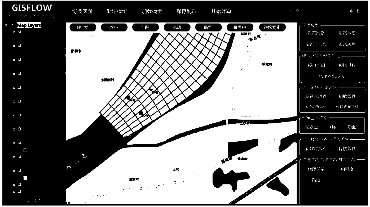
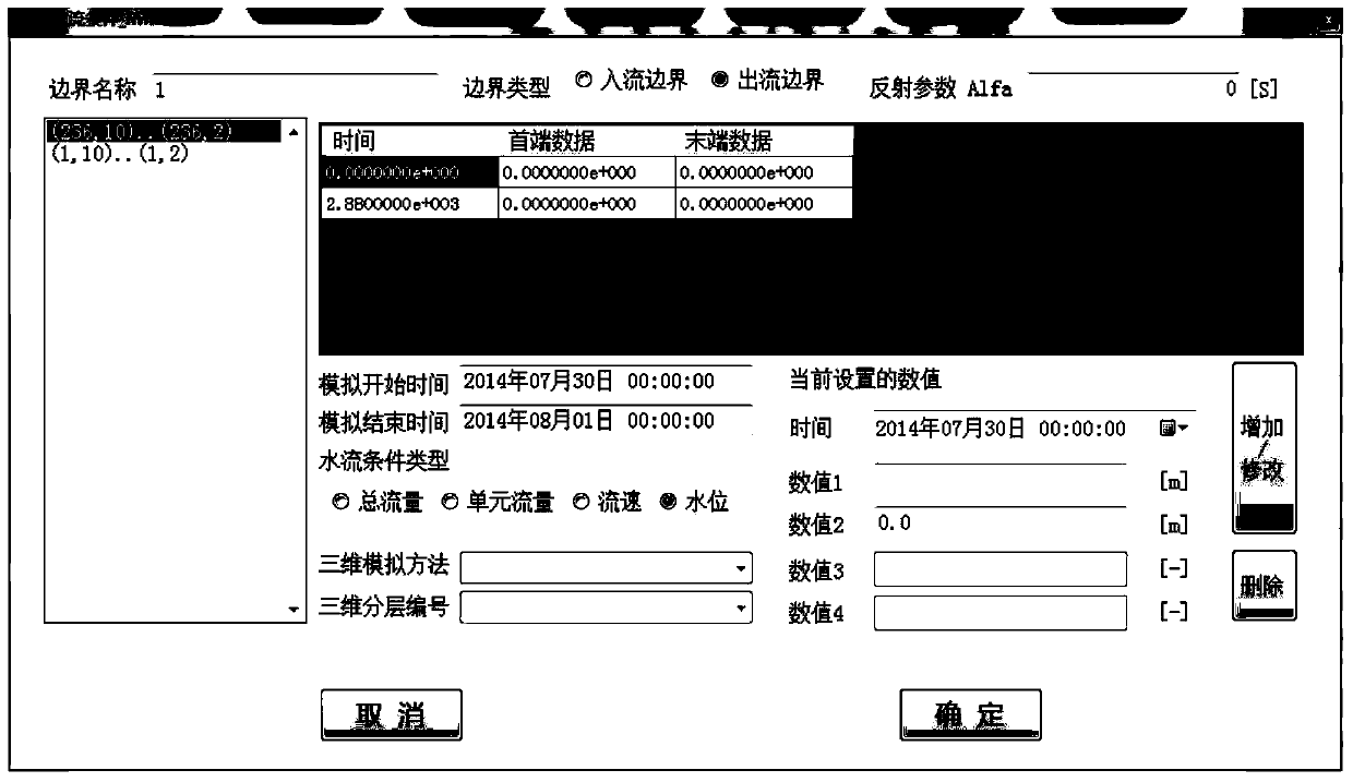

Image

  • Water environment analysis method and system based on geographic information system and Delft3D-FLOW calculation engine
  • Water environment analysis method and system based on geographic information system and Delft3D-FLOW calculation engine
  • Water environment analysis method and system based on geographic information system and Delft3D-FLOW calculation engine

Examples


Embodiment Construction

[0042] Embodiments of the present invention will be described in detail below with reference to the accompanying drawings.

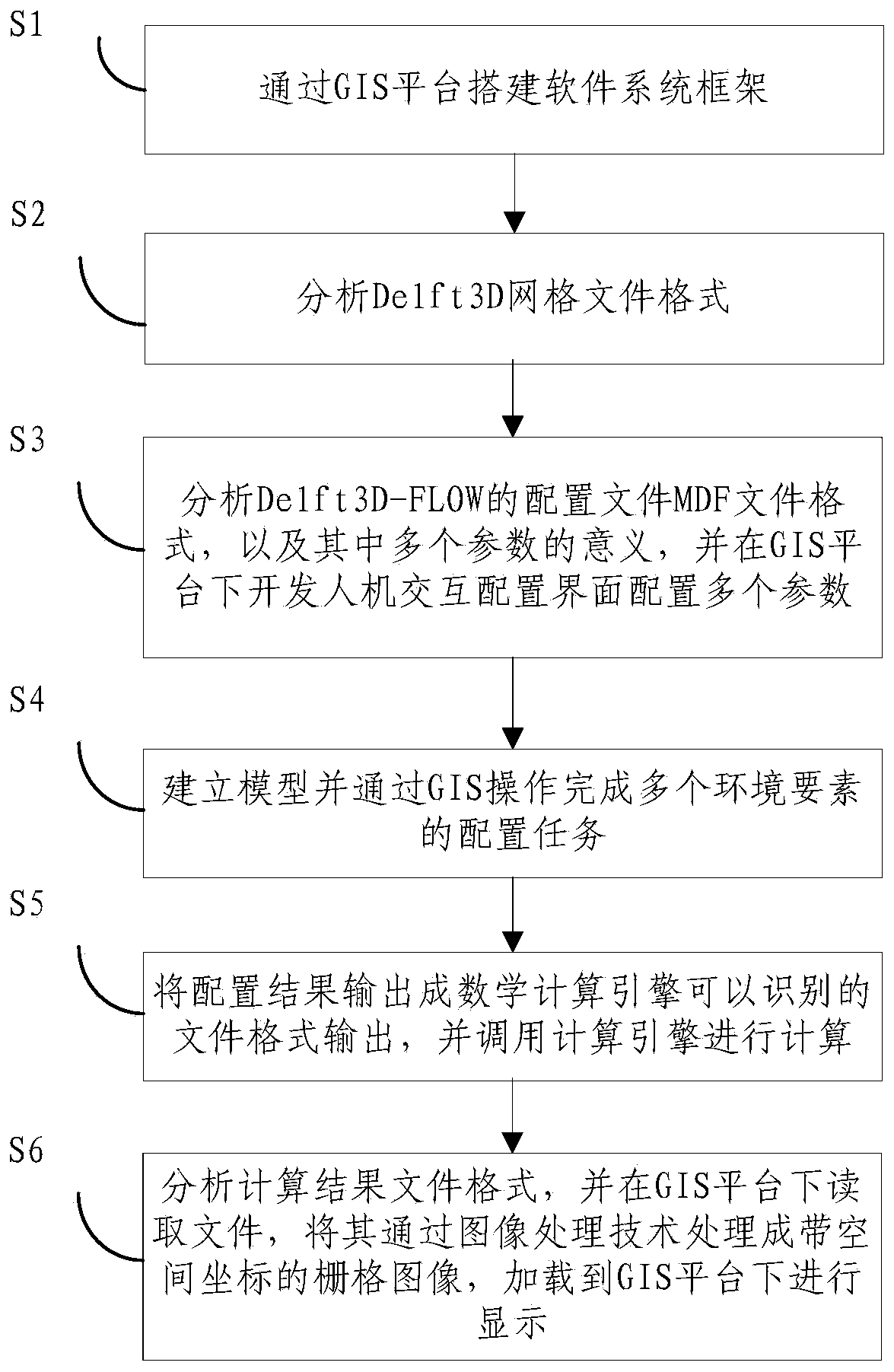
[0043] Such as figure 1 As shown, the present invention provides a water environment analysis method based on geographic information system and DELFT3D-FLOW computing engine, comprising the following specific steps:

[0044] Step S1: Build the software system framework through the GIS platform.

[0045]Step S2: Analyze the Delft3D grid file format. Further, step S2 further includes: reading the grid file; converting the read grid file into a polygonal grid with spatial coordinates; and loading the polygonal grid onto the GIS platform.

[0046] Furthermore, the same type of hydrodynamic-water quality models, in addition to Delft3D in the Netherlands, also includes PART, ECO, WAQ, EFDC, SELFE in the United States, etc. For the above-mentioned different models, the different operations lie in the analysis and reading and writing of grid files in the back...


PUM


Abstract

The invention relates to a water environment analysis method based on a geographic information system and a Delft3D-FLOW calculation engine. The water environment analysis method comprises the steps that a software system framework is built through a GIS platform; a Delft3D mesh file format is analyzed; a configuration file MDF file format of the Delft3D-FLOW and meanings of multiple parameters in the configuration file MDF file format are analyzed, and a human-computer interaction configuration interface is developed for configuring the multiple parameters under the GIS platform; a model is built, configuration tasks of a plurality of environmental elements are completed through GIS operation; a configuration result is output as a file format which can be identified by the mathematical calculation engine, and the calculation engine is called to conduct calculation; a calculation result file format is analyzed, a file is read under the GIS platform and processed into a raster image with space coordinates through the image processing technology, and the raster image is loaded into the GIS platform for display. The water environment analysis method combines the mathematical model with spatial and geographic information, thereby improving analysis accuracy. The invention further provides a water environment analysis system based on the geographic information system and the Delft3D-FLOW calculation engine.

Description

technical field [0001] The invention relates to the field of computer technology, in particular to a water environment analysis method and system based on a geographic information system and a Delft3D-FLOW computing engine. Background technique [0002] At present, water environment simulation technology is an effective tool for predicting and analyzing various complex problems in the real water environment by using a series of mathematical models in a virtual environment, and can provide a strong scientific basis for solving environmental problems. Currently commonly used water environment simulation analysis systems such as EFDC and DELFT3D use Fortarn language to develop calculation engines. [0003] Specifically, DELFT3D is a complete three-dimensional hydrodynamic-water quality model system developed by Deltares in the Netherlands, including water flow (FLOW), particle tracking (PART), water quality (WAQ), ecology (ECO) and other components. Technically, DELFT3D-FLOW T...

Claims


Application Information

Patent Timeline
IPC IPC(8): G06F17/30G06F17/50
CPCG06F16/957G06F30/20
Inventor 周迅
Owner BEIJING SANYI SICHUAN TECH CO LTD
Learn More