Method for modeling cumulus cloud scene based on Landsat8 satellite image
A technology of satellite images and cumulus clouds, applied in 3D modeling, image analysis, image data processing, etc., can solve the problems of large geometric thickness error, difficulty in recording cumulus clouds, and exceeding the typical size of cumulus clouds, etc. The effect of high mold efficiency
- Summary
- Abstract
- Description
- Claims
- Application Information
AI Technical Summary
Problems solved by technology
Method used
Image
Examples
Embodiment Construction
[0030] Below in conjunction with accompanying drawing and example the present invention is described in further detail:
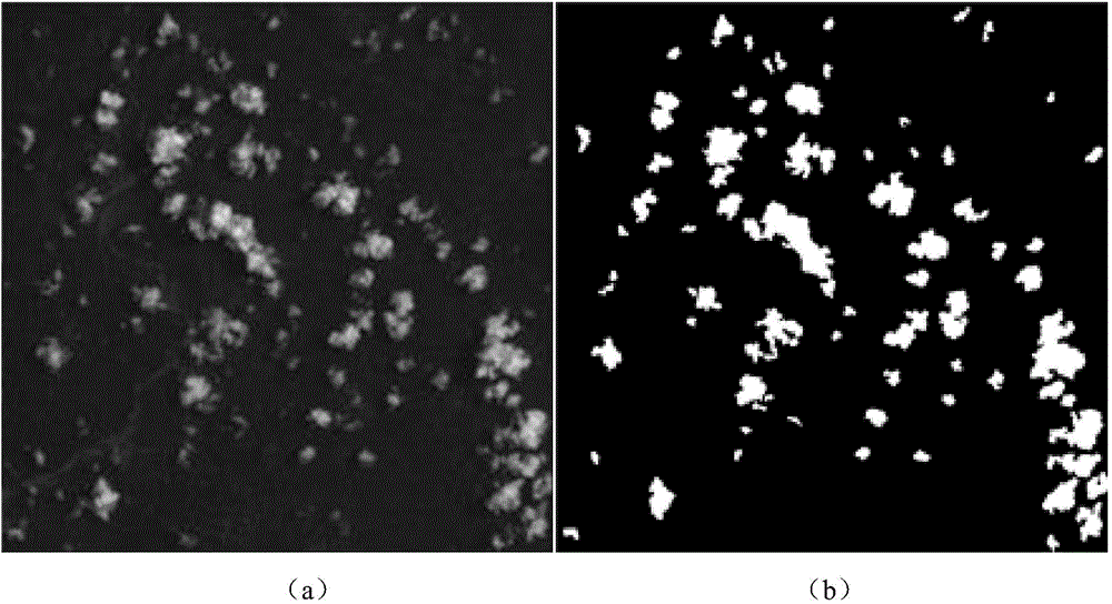
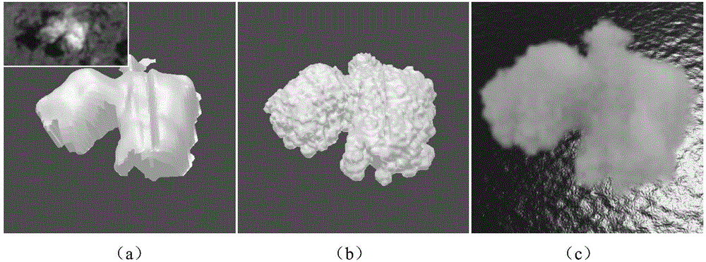
[0031] The invention adopts the visible light image and the long-wave infrared image provided by the Landsat8 satellite, the wave bands of these two images are 0.63um-0.68um and 10.60um-11.20um respectively, and the horizontal resolutions are 30m and 100m. The long-wave infrared image records the temperature of the cloud or the surface, the unit is Kelvin temperature K, denoted as T; the visible light image records the albedo, which means the ratio of the radiation received by the satellite to the incident radiation of the sun, which is dimensionless and denoted as ( figure 2 (a)). Based on the satellite images of these two bands, such as figure 1 As shown, the implementation process of the present invention includes four main steps: cloud-ground separation, using visible light images and long-wave infrared images, and combining the threshold method to ...
PUM
 Abstract
Description
Claims
Application Information
 - R&D
- Intellectual Property
- Life Sciences
- Materials
- Tech Scout
- Unparalleled Data Quality
- Higher Quality Content
- 60% Fewer Hallucinations
Browse by: Latest US Patents, China's latest patents, Technical Efficacy Thesaurus, Application Domain, Technology Topic, Popular Technical Reports.
© 2025 PatSnap. All rights reserved.Legal|Privacy policy|Modern Slavery Act Transparency Statement|Sitemap|About US| Contact US: help@patsnap.com


