
Distributed underwater network localization method based on mobile beacon

A network positioning and mobile beacon technology, applied in the field of distributed underwater network positioning based on mobile beacons, can solve the problems of large average positioning error, high communication overhead, and reduced node coverage

Active Publication Date: 2016-10-12
HARBIN ENG UNIV
View PDF4 Cites 21 Cited by
  • Summary
  • Abstract
  • Description
  • Claims
  • Application Information

AI Technical Summary

Problems solved by technology

This algorithm uses two-way TOA ranging to avoid time synchronization, but the communication overhead is high and the positioning delay is large
[0005] Hanjiang Luo et al. proposed the Localization with Directional Beacons (LDB) positioning algorithm, which is a distributed three-dimensional positioning algorithm that uses AUV as a mobile anchor node to help unknown nodes locate, which can effectively overcome unknown nodes. Failure problem, but when the interval between AUV transmission signals becomes larger, the node coverage rate decreases rapidly, and the average positioning error becomes larger rapidly

Method used


Image

  • Distributed underwater network localization method based on mobile beacon
  • Distributed underwater network localization method based on mobile beacon
  • Distributed underwater network localization method based on mobile beacon

Examples


Embodiment Construction

[0051] The present invention will be described in further detail below in conjunction with the accompanying drawings.

[0052] The purpose of the present invention is to provide a distributed underwater network positioning method based on mobile beacons, which is a three-dimensional underwater positioning method; no time synchronization is required; when the AUV transmit signal time interval increases, the node positioning coverage rate is high , the average positioning error is small; the deployment of beacon nodes is not required, which reduces communication overhead.

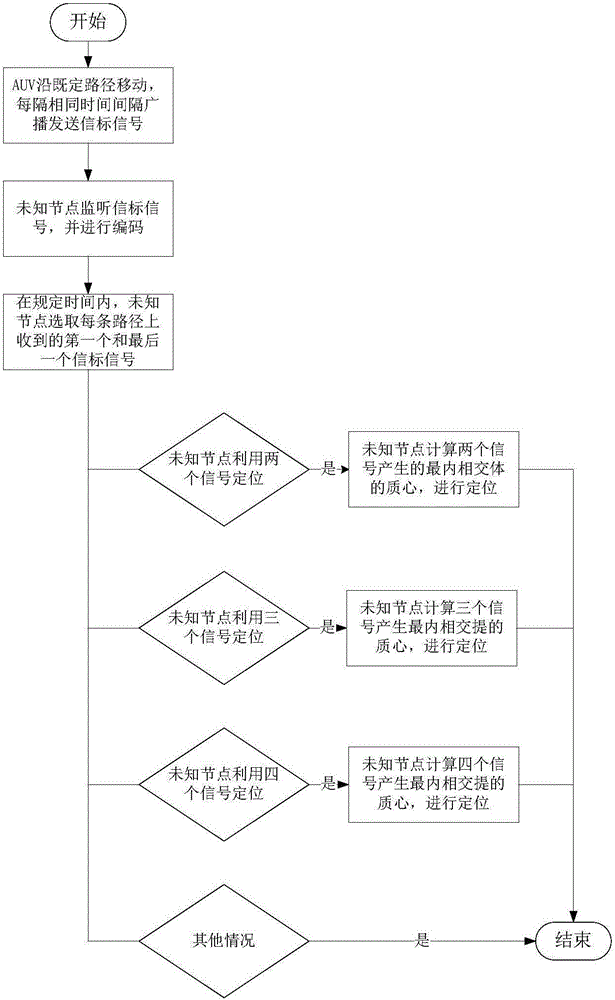
[0053] figure 1 Be a flow chart of the present invention, in conjunction with accompanying drawing, concrete process of the present invention is realized like this:

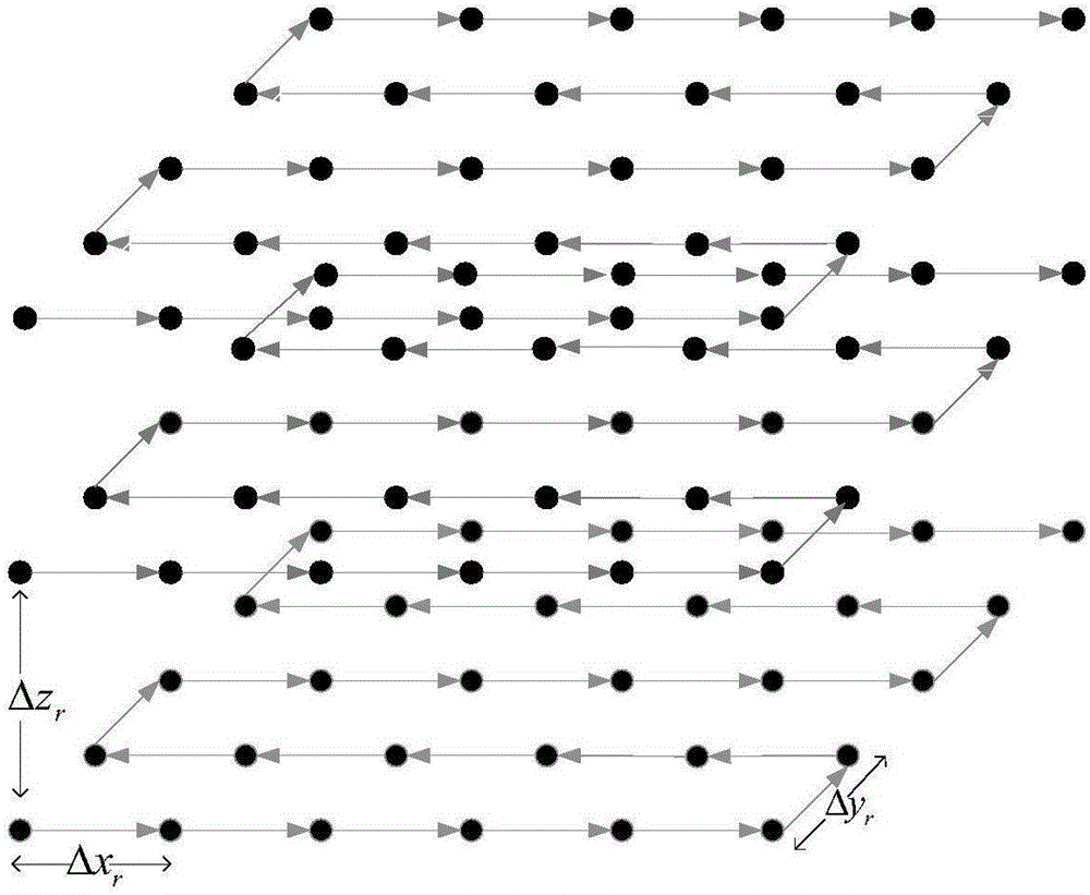
[0054] (1) The AUV dives to the specified depth after obtaining the instruction, moves along the predetermined path on this depth plane, and broadcasts and sends beacon signals at the same time intervals. The signal contains the position inform...


PUM


Abstract

The invention discloses a distributed underwater network localization method based on a mobile beacon, and belongs to the technical field of an underwater wireless sensor network. The method comprises the steps that 1), an autonomous underwater vehicle AUV moves layer by layer and broadcasts and sends beacon signals at intervals of same time, and an unknown node encodes the signals according to the sequence of receiving the signals transmitted by the AUV; and 2), geometric models which are received by the unknown node in the signal coverage on adjacent paths are intersected to generate an innermost intersection body, and the mass center of the innermost intersection body is estimated as the location of the unknown node. The method is a three-dimensional distributed location method. The location of the unknown node is determined by calculating the mass center of the innermost intersection body. The experiment shows that the method has the advantages of relatively high node location accuracy and node location coverage.

Description

technical field [0001] The invention belongs to the technical field of underwater sensor networks, in particular to a mobile beacon-based distributed underwater network positioning method. Background technique [0002] As the development and utilization of marine resources has become the focus of attention of all countries in the world, underwater sensor networks have also become a research hotspot in various countries, and have been applied in various aspects such as environmental monitoring, disaster forecasting, and resource development. At the end of the 20th century, the Seaweb annual experiment carried out by the United States demonstrated the concept of underwater sensor networks and explored its practical application value. Today, more and more schools and research institutes have joined the research, such as: American Computing Machinery Association, Massachusetts Institute of Technology, University of Connecticut, Woods Hole Oceanographic Institution (WHOI), Georgi...

Claims


Application Information

Patent Timeline
Patent Type & Authority Applications(China)
IPC IPC(8): H04W4/02H04W64/00
CPCH04W4/029H04W16/22H04W64/006
Inventor 冯晓宁王卓张文朱晓龙蔡绍滨曲立平孟宇龙
Owner HARBIN ENG UNIV
Learn More