Satellite remote sensing monitoring method for the content of chlorophyll a of jujube tree canopy

A technology of satellite remote sensing and satellite remote sensing images, which is applied in the field of satellite remote sensing monitoring, can solve the problems of lack of inversion model of jujube chlorophyll a content, and achieve the effects of avoiding pollution and harm to human body, shortening monitoring time, and simplifying operation steps

Inactive Publication Date: 2017-03-15
TARIM UNIV
View PDF5 Cites 3 Cited by
  • Summary
  • Abstract
  • Description
  • Claims
  • Application Information

AI Technical Summary

Problems solved by technology

However, there are very few studies on the application of satellite remote sensing data to the chlorophyll-a content of jujube tree canopy, especially the lack of corresponding inversion model of chlorophyll-a content in jujube tree

Method used


Image

  • Satellite remote sensing monitoring method for the content of chlorophyll a of jujube tree canopy
  • Satellite remote sensing monitoring method for the content of chlorophyll a of jujube tree canopy

Examples


Embodiment Construction

[0025] In order to enable those skilled in the art to better understand that the technical solutions of the present invention can be implemented, the present invention will be further described below in conjunction with specific examples, but the given examples are not intended to limit the present invention.

[0026] A satellite remote sensing monitoring method for jujube canopy chlorophyll a content, specifically comprising the following steps:

[0027] Query the transit time of the Landsat8 satellite in the area to be monitored. The resolution of the Landsat8 satellite is 30 meters. If the weather is clear and cloudless when the satellite passes, download the remote sensing image of the Landsat8 satellite in the area to be monitored that day. The specific implementation time of this embodiment is on August 9, 2016. The area to be monitored is the red date base of Bashan Company in the 11th regiment of Xinjiang First Division. The sky was clear and cloudless that day. In thi...


PUM


Abstract

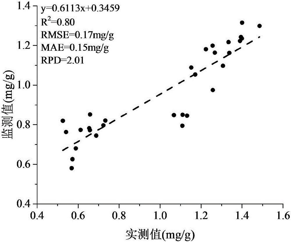
The invention provides a satellite remote sensing monitoring method for the content of chlorophyll a of jujube tree canopy, comprising: determining a to-be-monitored area; downloading the satellite remote sensing image of the to-be-monitored area; performing geometric correction, radiation correction and atmospheric correction to the downloaded satellite remote sensing image; cutting the satellite remote sensing image after atmospheric correction to obtain the image of the monitored area; using ENVI5.1 to calculate the five vegetation indexes for the selected pixels of the monitored area; and substituting the five vegetation indexes into a model through band wave operation to calculate the content of chlorophyll a of jujube tree canopy in each pixel wherein Y represents the content of chlorophyll a of jujube tree canopy and the mass is mg / g. The method provided by the invention realizes the rapid, accurate, economical and environmentally friendly acquisition of the content data of chlorophyll a of the jujube canopy by a regional scale, and avoids the environmental pollution and the damage to the human body in the process of measuring the exhausted chemical liquid, greatly simplifying the operation steps and shortening the monitoring time.

Description

technical field [0001] The invention belongs to the technical field of satellite remote sensing monitoring, and in particular relates to a satellite remote sensing monitoring method for the content of chlorophyll a in jujube canopy. Background technique [0002] Chlorophyll is the main pigment in plants and the most important pigment. There are two types of chlorophyll in higher plants, chlorophyll a and chlorophyll b. They participate in the absorption, transmission and conversion of light energy, and control the amount of solar radiation absorbed by leaves, thereby controlling photosynthesis. potential and primary productivity. Chlorophyll content can also be used to accurately and indirectly estimate plant nutritional status. The change of chlorophyll is an indicator of environmental stress and phenological period. When the plant is under stress and in the aging process, the content of chlorophyll will decrease, and the wallpaper of chlorophyll a and chlorophyll b will a...

Claims


Application Information

Patent Timeline
IPC IPC(8): G06T7/00G06K9/00
CPCG06T7/0002G06T2207/30188G06T2207/10032G06V20/188
Inventor 彭杰刘新路柳维扬周煊曲浩亮
Owner TARIM UNIV
Why Eureka
Try Eureka