
Satellite remote sensing monitoring method for chlorophyll content of cotton canopy

A technology of chlorophyll content and satellite remote sensing, which is applied in the field of satellite remote sensing monitoring, can solve the problems of inability to quickly obtain large-area cotton canopy chlorophyll content data, shorten monitoring time, etc., so as to avoid pollution and harm to human body, shorten monitoring time, Easy to use effect

Inactive Publication Date: 2020-05-19
TARIM UNIV
View PDF6 Cites 0 Cited by
  • Summary
  • Abstract
  • Description
  • Claims
  • Application Information

AI Technical Summary

Problems solved by technology

[0003] In order to overcome the deficiency in the prior art that the chlorophyll content data of the large-area cotton canopy cannot be quickly obtained, the present invention proposes a pollution-free, easy-to-operate, fast and accurate monitoring method for the chlorophyll content of the cotton canopy. The rapid and accurate detection of chlorophyll content in the cotton canopy does not require the preparation of any chemical reagents, which avoids environmental pollution and harm to the human body caused by the discharge of chemical tail liquid during the measurement process, and also greatly simplifies the operation steps and shortens the monitoring time. It meets the needs of rapid acquisition of canopy chlorophyll content data in cotton fields at the regional scale in agricultural production, and provides a basis for rapid acquisition of fertilizer amounts for the precise application of chemical fertilizers in cotton field management

Method used


Image

  • Satellite remote sensing monitoring method for chlorophyll content of cotton canopy
  • Satellite remote sensing monitoring method for chlorophyll content of cotton canopy

Examples


Embodiment 1

[0035] A satellite remote sensing monitoring method of chlorophyll content in cotton canopy, comprising the following steps:

[0036] (1) Determining the detection area: the monitoring area of ​​the present invention is the large-area cotton planting area within the 10th regiment of the 1st Division of the Xinjiang Production and Construction Corps.

[0037] (2) Obtain the satellite remote sensing image of the monitoring area: after determining the monitoring area, query the transit time of the Landsat8 satellite in the monitoring area. Satellite remote sensing images of the monitoring area. The specific implementation time of this embodiment is August 15, 2018.

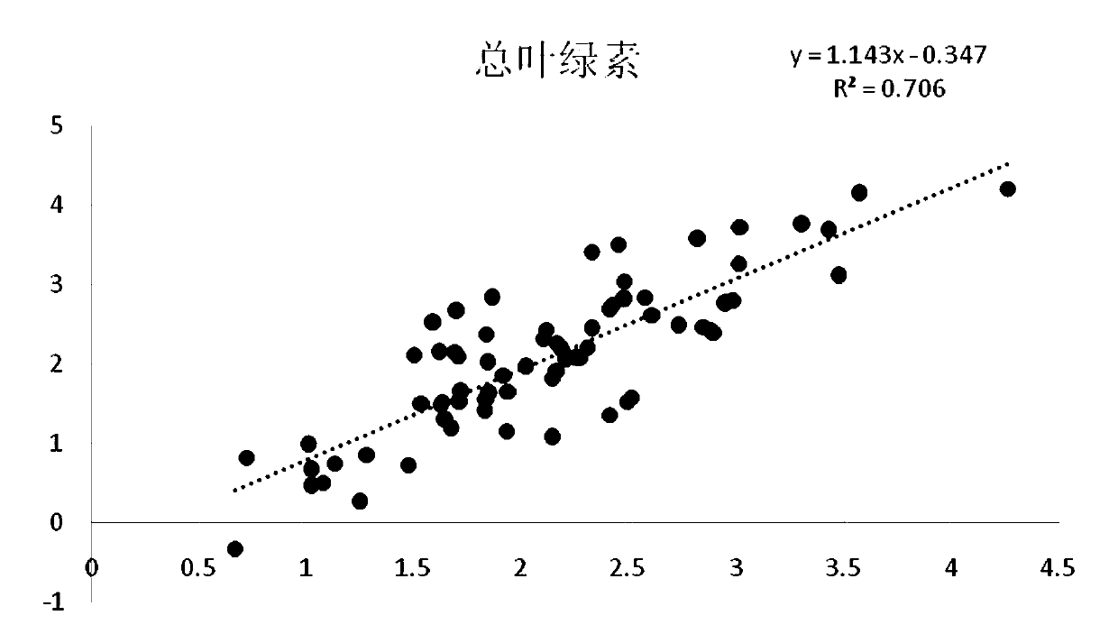
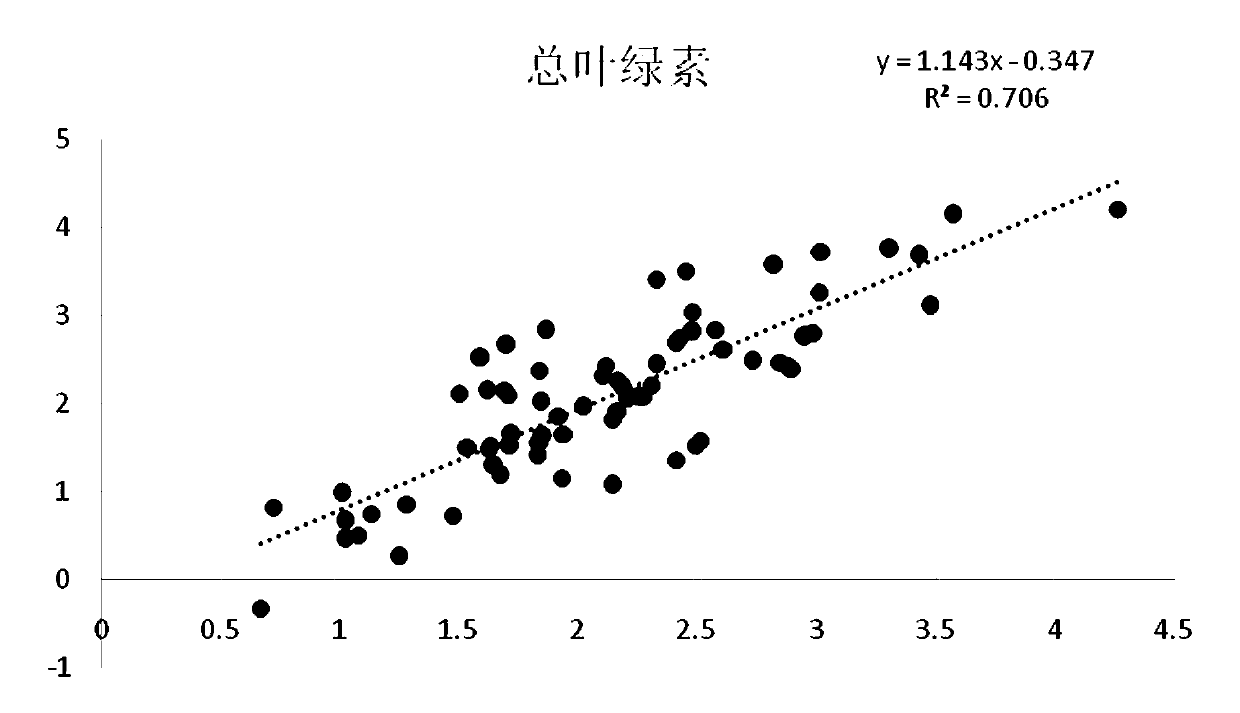
[0038] In this example, a total of 70 cotton canopy samples were collected, 35 of which were used to construct the inversion model of chlorophyll content in cotton canopy, and the other 35 were used to test the inversion accuracy of the model. The specific method of sample collection is: determine the area of ​​the...


PUM


Abstract

The invention belongs to the technical field of satellite remote sensing monitoring, and provides a satellite remote sensing monitoring method for the chlorophyll content of a cotton canopy. The method comprises the following steps: determining a monitoring area, acquiring a satellite remote sensing image of the monitoring area, correcting the acquired satellite remote sensing image and cutting the corrected satellite remote sensing image, and substituting the obtained five vegetation indexes of TGI, GLI, IO, RGRI and VARI and the reflectivity data of the four wave bands of SWIR2, NIR, Rb andCoast into a model through wave band operation, thereby obtaining the green content data of the cotton canopy leaves through calculation. The method has the advantages that the chlorophyll content ofthe large-area cotton field can be monitored more quickly and economically in a labor-saving manner, the requirement for quickly acquiring canopy chlorophyll content data of the cotton field of a regional scale in agricultural production can be met, and a basis is provided for accurate management of cotton field management.

Description

technical field [0001] The invention belongs to the technical field of satellite remote sensing monitoring, in particular to a satellite remote sensing monitoring method for chlorophyll content of cotton canopy. Background technique [0002] Chlorophyll is an essential element for photosynthesis in cotton. Rapid acquisition of chlorophyll content information is a prerequisite for monitoring cotton growth and quality assurance, and is also the most reliable digital basis for observing cotton growth. Chlorophyll content is therefore a very important biochemical parameter. Existing methods for measuring chlorophyll content in cotton canopy can be roughly divided into two techniques: spectral measurement and indoor chemical analysis. Although spectral measurement has the advantages of environmental protection, rapidity, and non-destructiveness, it is only applicable to the field scale and is aimed at regional In terms of monitoring the chlorophyll content of the cotton canopy a...

Claims


Application Information

Patent Timeline
IPC IPC(8): G01S17/89
CPCG01S17/89
Inventor 彭杰白子金白建铎蒋青松王家强柳维扬王俊珍殷彩云
Owner TARIM UNIV
Learn More