Intelligent edge recognition method of seabed geomorphic unit based on image processing

An image processing and intelligent recognition technology, applied in the fields of offshore oil and gas resources, marine surveying and mapping, and marine engineering, can solve the problems of poor timeliness, poor repeatability, high labor intensity, etc., and achieve the effect of small calculation amount, simple method and labor saving.

Active Publication Date: 2018-03-16
INST OF DEEP SEA SCI & ENG CHINESE ACADEMY OF SCI +1
View PDF5 Cites 0 Cited by
  • Summary
  • Abstract
  • Description
  • Claims
  • Application Information

AI Technical Summary

Problems solved by technology

However, this method is highly subjective, and has disadvantages such as inaccurate positioning, poor timeliness, poor repeatability, long information acquisition cycle, and high labor intensity.
In particular, due to the massive level of seabed data, it is far from being able to undertake the processing tasks of massive data only by relying on the manual capabilities of professionals.

Method used


Image

  • Intelligent edge recognition method of seabed geomorphic unit based on image processing
  • Intelligent edge recognition method of seabed geomorphic unit based on image processing
  • Intelligent edge recognition method of seabed geomorphic unit based on image processing

Examples


Embodiment Construction

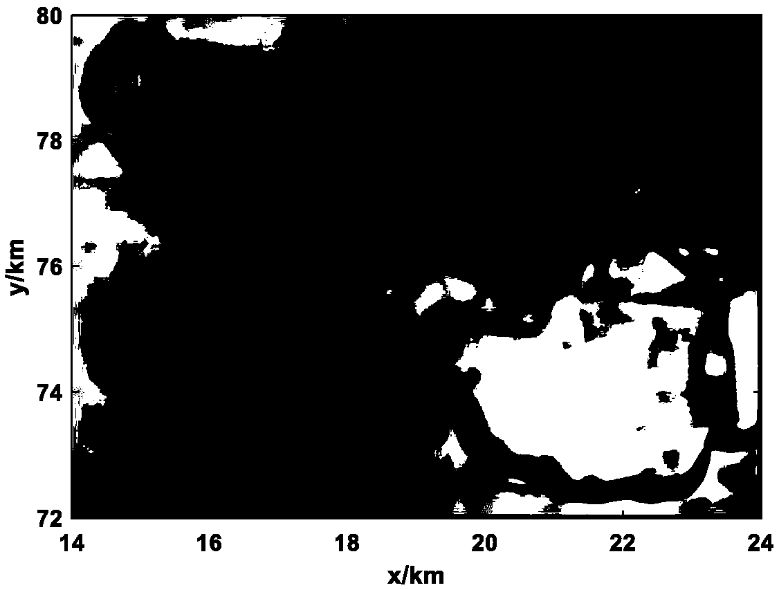
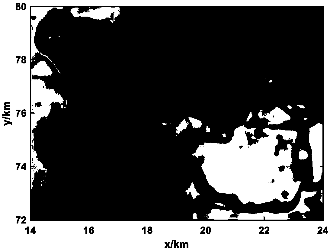
[0037] In this embodiment, based on the multi-beam seabed bathymetric data, the intelligent recognition of the edge of the seabed landslide is realized by analyzing and processing the pixel values ​​of the seabed depth distribution grayscale image. The specific identification steps are as follows:

[0038] (1) Terrain RGB color map

[0039] Draw a color map of the seabed depth distribution based on the seabed depth measurement data, and obtain the RGB three primary color values ​​R(i,j), G(i,j), and B(i,j) of each pixel in the color map, where R( i, j), G(i, j), B(i, j) are the red, green and blue component values ​​of pixel (i, j) in the depth distribution color map, i, j are integers, and satisfy i ∈[1,w], j∈[1,h], w and h are the horizontal resolution and vertical resolution of RGB color image respectively.

[0040] In this embodiment, the seabed depth data is measured by a multi-beam method, w=400, h=500.

[0041] (2) Image grayscale

[0042] The weighted average method ...


PUM


Abstract

The invention discloses an image processing-based intelligent recognition method for the edge of a seabed geomorphic unit. The method comprises the following steps: 1) drawing a color map of seabed depth distribution according to the seabed depth measurement data, and obtaining the RGB three primary color values ​​of each pixel in the color map; 2) adopting a weighted average method to perform grayscale calculation on the color map to obtain a grayscale image ; 3) Use different filtering methods to filter the grayscale image, then calculate the peak signal-to-noise ratio (PSNR) value of each filtering method, and take the filtering method corresponding to the maximum PSNR value as the best image filtering method; 4) According to the adjacent pixel gray The probability cumulative value of the degree difference determines the threshold, and realizes image binarization according to the threshold; 5) binary image boundary refinement; 6) realizes boundary connection according to the 8-neighborhood tracking method; 7) extracts according to the 8-neighborhood contour method to extract terrain boundaries. The invention has the advantages of simple method, small amount of calculation, saving manpower and the like. The invention is applicable to the boundary recognition of the typical landform unit of the seabed.

Description

technical field [0001] The invention relates to the technical fields of marine surveying and mapping, marine engineering, marine oil and gas resources, etc., and specifically refers to an image processing-based intelligent recognition method for the edge of a seabed geomorphic unit. Background technique [0002] The vast oceans on Earth cover about 70% of the Earth's surface. In recent years, offshore oil exploration studies have shown that the seabed is rich in oil and natural gas resources. However, due to the complex and harsh marine environment, it is very difficult to conduct seabed exploration directly, and the development and utilization of marine resources is more expensive than the development and utilization of land resources. From 1925 to 1927, the German "Meteor" used the echo sounder system to measure the seabed topography of the South Atlantic Ocean for the first time, which changed the previous understanding of the monotonous topography of the ocean bottom an...

Claims


Application Information

Patent Timeline
Patent Type & Authority Patents(China)
IPC IPC(8): G06K9/46G06K9/38G06K9/54G06T7/13G06T5/00
CPCG06T5/00G06T2207/20024G06T2207/30181G06V10/443G06V10/28G06V10/20G06V10/44G06V20/05
Inventor 王大伟吴时国郭婧王微微张汉羽
Owner INST OF DEEP SEA SCI & ENG CHINESE ACADEMY OF SCI
Why Eureka
Try Eureka