

Method for rapidly converting geographic coordinates into spherical triangle discretization grid codes
A spherical triangle, geographic coordinate technology, applied in the field of geographic information, can solve problems such as low efficiency, and achieve the effect of improving conversion efficiency
- Summary
- Abstract
- Description
- Claims
- Application Information
AI Technical Summary
Problems solved by technology
Method used
Image

Examples
Embodiment 1
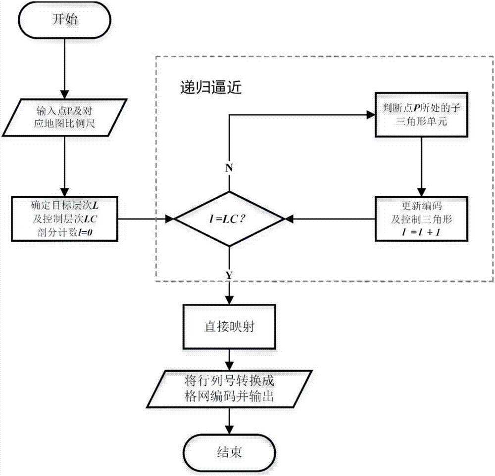
[0067] In this embodiment, the longitude and latitude coordinates P (118.9139003°E, 32.1145815°N) of the School of Geographical Sciences, Xianlin Campus, Nanjing Normal University are converted into a 1:10,000 scale map (the target subdivision level is 22, and the control subdivision level is 7 ) corresponding to the regular icosahedral triangular discrete grid SQC code as an example.
[0068] The conversion process in this embodiment is divided into two parts, the recursive approximation before controlling the subdivision level and the direct mapping after controlling the subdivision level.
[0069] 1. The steps of the recursive approximation process are as follows:
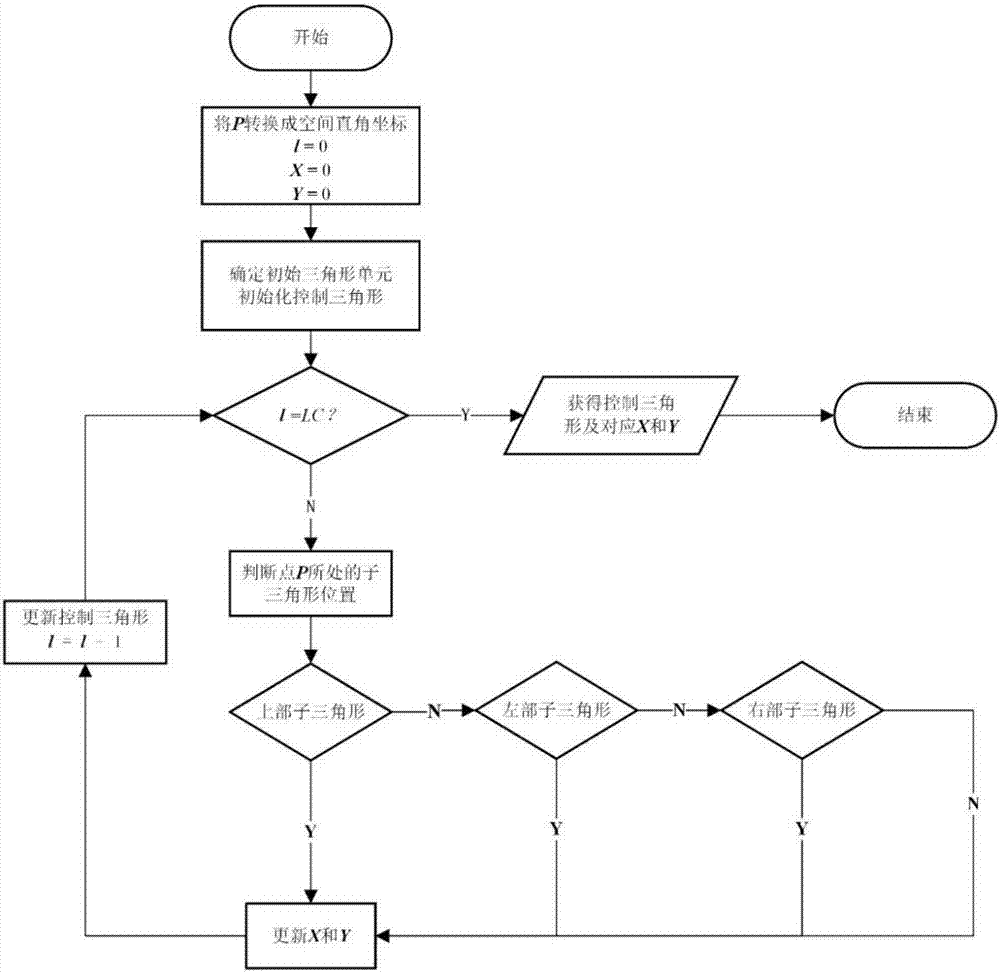
[0070] Step 1: Convert P(118.9139003°E,32.1145815°N) into space Cartesian coordinates P(-2620.8871131827618,4745.0076361872807,3402.3305648447690), and initialize the row, column number and subdivision level of the grid code: X=0, Y=0 , l=0;
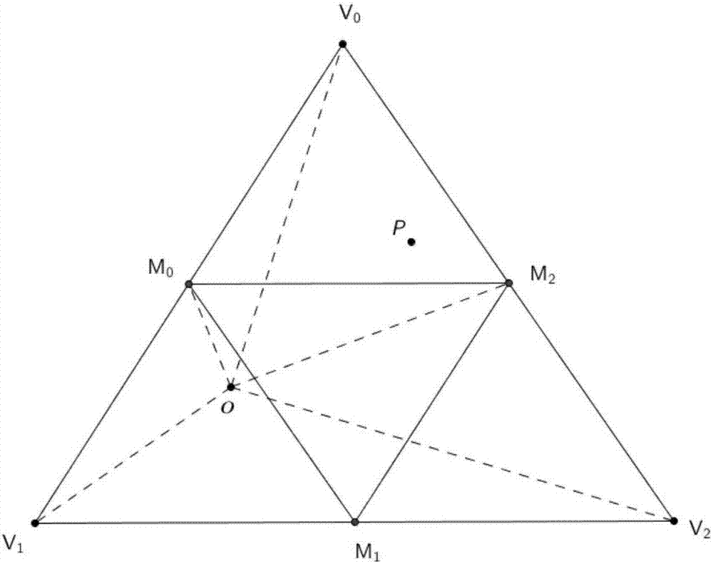
[0071] Step 2: According to the relationship between point P and th...
PUM
 Abstract
Description
Claims
Application Information