Three-dimensional laser panoramic railway line plotting method

A three-dimensional laser and panoramic technology, applied in the direction of using optical devices, instruments, measuring devices, etc., can solve the problems of high verification cost, affecting the technical accuracy of existing railway lines, errors and omissions in mapping results, etc., to improve survey efficiency and facilitate implementation , the effect of improving accuracy and safety

Active Publication Date: 2018-03-13
CHINA RAILWAY ERYUAN ENG GRP CO LTD
View PDF9 Cites 14 Cited by
  • Summary
  • Abstract
  • Description
  • Claims
  • Application Information

AI Technical Summary

Problems solved by technology

At the same time, subject to the technical level and sense of responsibility of the on-line personnel, there are errors and omissions in the sur

Method used


Image

  • Three-dimensional laser panoramic railway line plotting method
  • Three-dimensional laser panoramic railway line plotting method
  • Three-dimensional laser panoramic railway line plotting method

Examples


Embodiment Construction

[0019] The present invention will be further described below in conjunction with the accompanying drawings and embodiments.

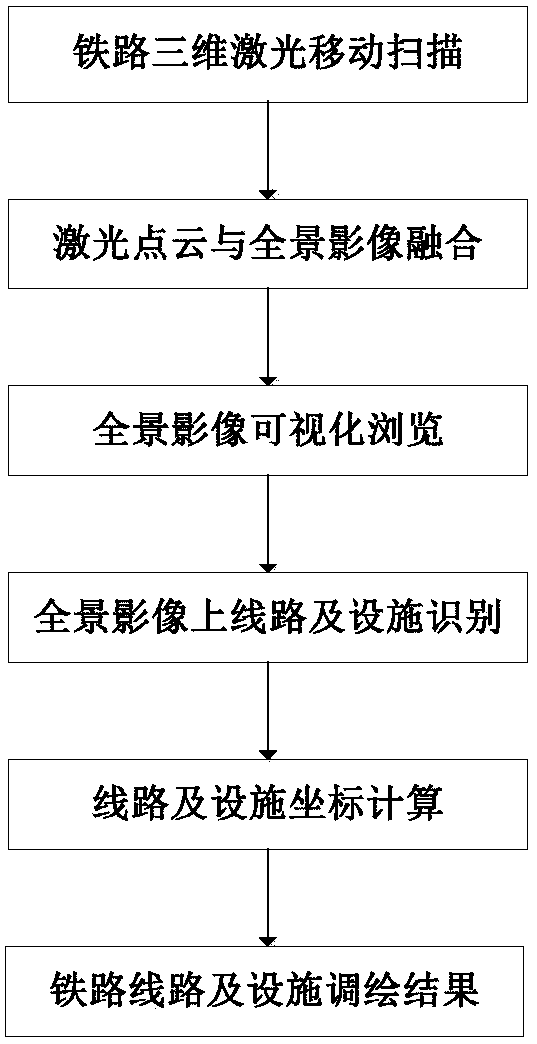
[0020] refer to figure 1 , the present invention a kind of three-dimensional laser panorama railway route mapping method, comprises the following steps:

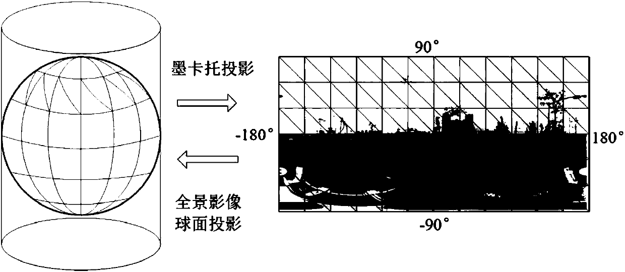
[0021] 1) Three-dimensional laser mobile scanning of railways, using a three-dimensional laser mobile scanning system to obtain high-density three-dimensional laser point cloud data and high-definition 360-degree panoramic image data of railway lines and facilities, and obtain three-dimensional laser mobile scanning through differential GPS / IMU fusion processing The trajectory and attitude of the system; the trajectory and attitude data, laser scanning data, and panoramic image data are georeferenced respectively to obtain 3D laser point cloud data of railway lines and facilities, and the accurate position and attitude of each panorama site, in order to construct a 3D laser panorama The data model pr...


PUM


Abstract

The invention provides a three-dimensional laser panoramic railway line plotting method to realize surveying and mapping of existing railway lines and facilities, thereby providing a technical supportfor application of three-dimensional laser scanning and moving mapping and surveying to technical transformation, asset investigation and informationized operation management of the existing railwaylines. The method comprises the following steps: step one, carrying out three-dimensional mobile laser railway scanning to obtain a moving trajectory and a moving attitude of a three-dimensional mobile laser scanning system; and carrying out geographic reference processing to obtain three-dimensional laser point cloud data of railway lines and facilities and accurate locations and attitudes of allpanoramic stations to provide a data support for building a three-dimensional laser panoramic data model; step two, carrying out laser point cloud and panoramic image fusion to construct a three-dimensional laser panoramic data model; step three, carrying out visualized browsing of a panoramic image and building a spherical visualized browsing frame of the panoramic image based on characteristicsof the panoramic image spherical model; step four, carrying out line and facility recognition on the panoramic image; and step five, carrying out geodetic coordinate calculation of the lines and facilities.

Description

technical field [0001] The invention belongs to the technical field of railway surveying on existing railway lines, and in particular aims at surveying and mapping railway lines on a three-dimensional laser panorama obtained through three-dimensional laser scanning and moving measurement, so as to realize the survey of the lines and their facilities in the surveying of existing railway lines. Background technique [0002] In order to meet the needs of increasing railway speed and increasing transport capacity, the current focus of railway construction is to carry out technical transformation of existing lines or to add second lines. The technical transformation of existing railway lines needs to be based on a full understanding of the current situation of the railway. How to quickly, efficiently and safely conduct mapping surveys on existing railway lines is very important for the planning, design, construction and operation of technical transformation of existing railway lin...

Claims


Application Information

Patent Timeline
IPC IPC(8): G01B11/00
CPCG01B11/002
Inventor 卢建康周玉辉周世明杨锋胡庆武梅熙林春峰冯树波黄华平陈海军
Owner CHINA RAILWAY ERYUAN ENG GRP CO LTD
Why Eureka
Try Eureka