Multi-modal remote sensing image high-rise feature fusion classification method based on deep learning

A technology of high-level features and remote sensing images, applied in the field of machine learning, can solve the problems of difficulty in remote sensing images and limitations in the selection of multiple modes, and achieve the effect of high precision and improved utilization

Active Publication Date: 2018-05-18
SHANGHAI OCEAN UNIV
View PDF8 Cites 30 Cited by
  • Summary
  • Abstract
  • Description
  • Claims
  • Application Information

AI Technical Summary

Problems solved by technology

When dealing with multimodal remote sensing images from multiple sensors, different resolutions, and different physical representations, although machine learning has been widely used in remote sensing image classification, there are still four problems in this type of method: (1) The choice of multiple modalities is limited; (2) The spectrum, dimension, time phase, resolution and other characteristics of remote sensing images make data processing a severe challenge; (3) How to establish the interaction between multiple modalities It is difficult to improve the classification accuracy of remote sensing images; (4) With the development of remote sensing technology, massive remote sensing image processing is facing challenges
[0010] However, there is no method that can effectively overcome the four problems in the application of machine learning to remote sensing image classification as mentioned above, and can quickly, efficiently and safely classify complex and massive remote sensing data.

Method used


Image

  • Multi-modal remote sensing image high-rise feature fusion classification method based on deep learning
  • Multi-modal remote sensing image high-rise feature fusion classification method based on deep learning
  • Multi-modal remote sensing image high-rise feature fusion classification method based on deep learning

Examples


Embodiment 1

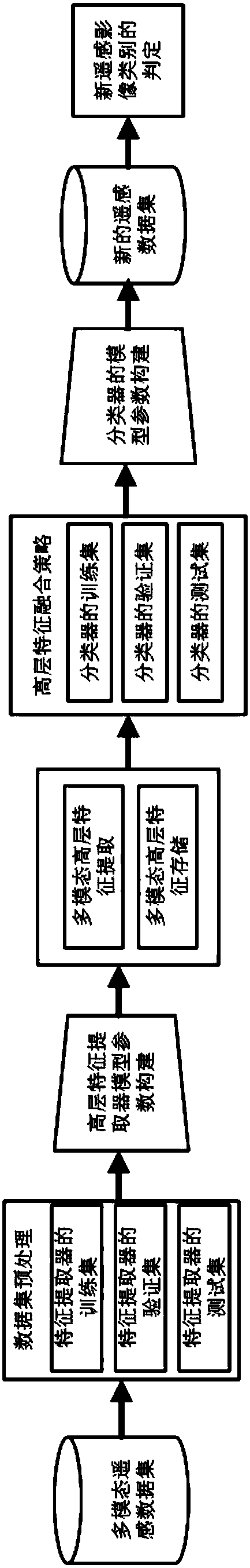
[0063] See figure 1 , figure 1 It is the construction and application process of the deep learning-based multi-modal remote sensing image high-level feature fusion classification method of the present invention. The described deep learning-based multimodal remote sensing image high-level feature fusion classification method has the following components:

[0064] Step 1, preprocessing of multimodal remote sensing data sets, making training sets, verification sets, and test sets of high-level feature extractors for the construction of high-level feature extractor model parameters;

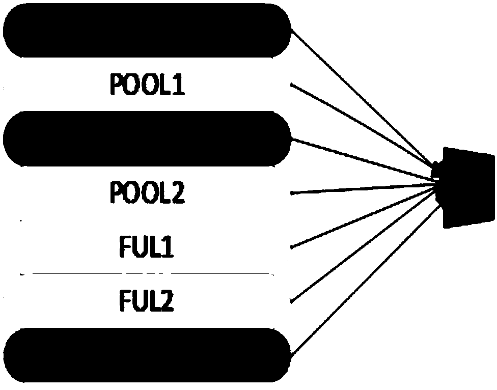
[0065] Step 2, the model construction of the multimodal high-level feature extractor is used to extract the high-level features of multiple modal remote sensing images;

[0066] Step 3, the extraction and storage of high-level features of multi-modal remote sensing images, used for training, verification and testing of multi-classifiers;

[0067] Step 4, the high-level feature fusion algorithm is ...

Embodiment 2

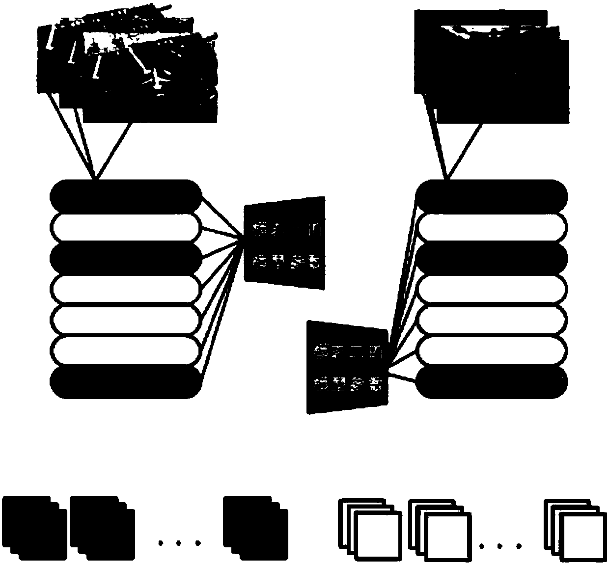
[0110] In this embodiment, the remote sensing satellite image classification database UC Merced Land UseDataset containing 21 types of scenes and the NWPU-RESISC45 dataset created by Northwestern Polytechnical University for remote sensing image scene classification are selected. The resolutions of the two datasets are different and considered as two modalities. In the present invention, the data set is made as follows in the binary classification experiment: for UC Merced Land Use Dataset, since the number of remote sensing images of each class is only more than 100 pieces, in order to expand the data set, the data is processed on the basis of the existing data set. A dataset of 1000 256*256 remote sensing images is obtained by randomly twisting, segmenting, and changing image brightness; for the NWPU-RESISC45 dataset, each category has 700 remote sensing images, and the same method is used to expand the dataset to 1000.

[0111] According to the ratio of 7:1:2, two sets of t...


PUM


Abstract

The invention relates to a multi-modal remote sensing image high-rise feature fusion classification method based on deep learning. The method includes the steps of preprocessing a multi-mode remote sensing data set, manufacturing a training set, a verification set and a test set of a high-rise feature extractor to construct the model parameters of the high-rise feature extractor; constructing a model of the multi-mode high-rise feature extractor to extract high-rise features of a plurality of modal remote sensing images, extracting and storing the high-rise features of the multi-mode remote sensing images to train, verify and test a multi-classifier, a high-rise feature fusion algorithm being used for making a training set, a verification set and a test set of the classifier, constructingthe classifier model parameters for classifying newly generated data sets. Remarkable effect can be achieved in the remote sensing image ground feature classification through deep learning. The methodis suitable for classification of complex and marine remote sensing images and has the characteristics of being precise, rapid, efficient and safe, so that the utilization rate and the utilization value of the remote sensing images are improved.

Description

technical field [0001] The invention relates to the field of machine learning, in particular to the field of deep learning, and in particular to a method for fusion and classification of high-level features of multi-modal remote sensing images based on deep learning. Background technique [0002] With the development of remote sensing technology, it is of great research value to efficiently apply remote sensing technology to regional land surveys, quantitatively extract land use information, and monitor and evaluate the environment. Among them, remote sensing image classification technology, as an important support for remote sensing applications, has been widely used in thematic information extraction, change detection, thematic map production and the establishment of remote sensing databases. [0003] Remote sensing image classification is a key technology in remote sensing application systems. Its main task is to interpret and identify the attributes and distribution of g...

Claims


Application Information

Patent Timeline
Patent Type & Authority Applications(China)
IPC IPC(8): G06K9/00G06K9/62
CPCG06V20/13G06F18/24133G06F18/24147
Inventor 贺琪黄冬梅李瑶杜艳玲查铖李明慧
Owner SHANGHAI OCEAN UNIV
Why Eureka
Try Eureka