Et Estimation Method for Different Crops in Irrigated Area Based on Canopy Temperature Difference and Remote Sensing Information
A technology for crops and irrigation areas, applied in the field of crop ET estimation, can solve problems such as failure to test and apply, and achieve the effect of simplifying the complicated process, improving reliability, and simplifying the model parameters.
- Summary
- Abstract
- Description
- Claims
- Application Information
AI Technical Summary
Problems solved by technology
Method used
Image
Examples
Embodiment Construction
[0018] The present invention will be described in detail below in conjunction with the accompanying drawings and embodiments.
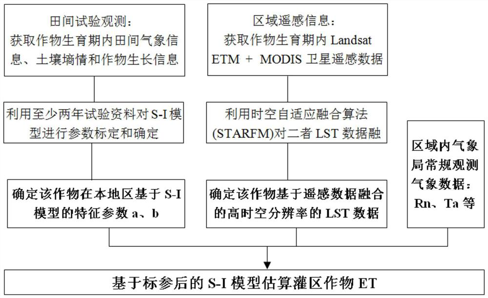
[0019] Such as figure 1 As shown, the present invention provides a method for estimating the evaporation (ET) of different crops in irrigation areas based on canopy air temperature difference and remote sensing information, which may further comprise the steps:
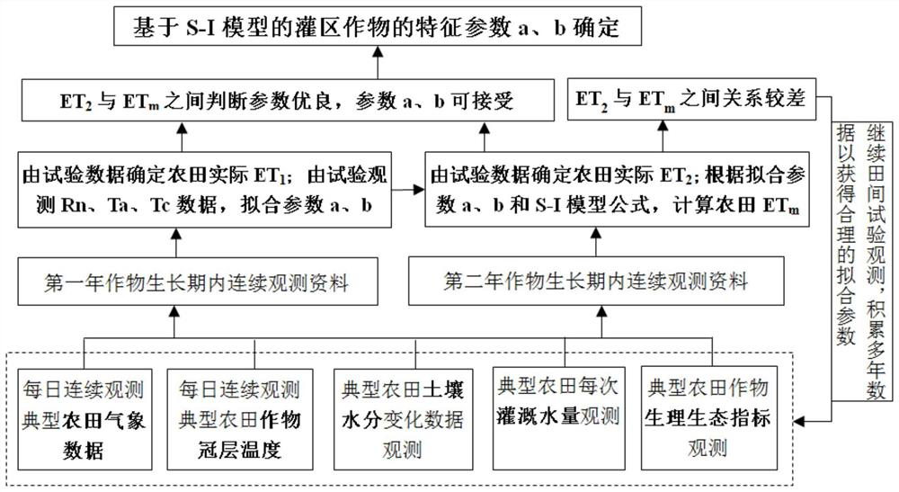
[0020] 1) Based on at least two years of typical farmland detailed experimental historical observation data, the characteristic parameters a and b of the S-I model are calibrated and determined to obtain a reliable and accurate calibrated S-I model;
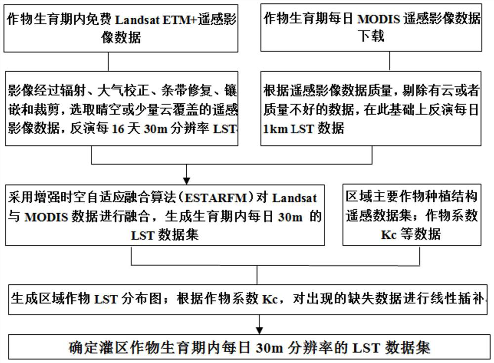
[0021] 2) Using Landsat8 (NASA’s Landsat satellite) and MODIS (Moderate Resolution Imaging Spectrometer on EOS Satellite) remote sensing image data during the crop growth period in the irrigated area, using the enhanced spatiotemporal adaptive fusion algorithm (ESTARFM) to fuse Landsat8 and MODIS data, Obtain the LST (Land Surface Temperature) ...
PUM
 Abstract
Description
Claims
Application Information
 - R&D
- Intellectual Property
- Life Sciences
- Materials
- Tech Scout
- Unparalleled Data Quality
- Higher Quality Content
- 60% Fewer Hallucinations
Browse by: Latest US Patents, China's latest patents, Technical Efficacy Thesaurus, Application Domain, Technology Topic, Popular Technical Reports.
© 2025 PatSnap. All rights reserved.Legal|Privacy policy|Modern Slavery Act Transparency Statement|Sitemap|About US| Contact US: help@patsnap.com


