Unmanned aerial vehicle monitoring system and monitoring method thereof

A monitoring system and unmanned aerial vehicle technology, applied in the parts of the TV system, image data processing, TV and other directions, can solve the problems of low altitude, lack of good defense, difficult to find and track unmanned aerial vehicles, etc., to improve the accuracy , the effect of reducing the cost of testing

Active Publication Date: 2018-08-24
烟台欣飞智能系统有限公司
View PDF8 Cites 17 Cited by
  • Summary
  • Abstract
  • Description
  • Claims
  • Application Information

AI Technical Summary

Problems solved by technology

[0002] In recent years, with the development of UAV technology, the intrusion of low-altitude, low-slow and small targets on civil aviation and the clearance of specific areas has caused great social security risks, such as drone intrusion at Chengdu Shuangliu Airport and UAV intrusion at Hangzhou Xiaoshan Airport The safety hazards and social impact caused by the suspected drone intrusion into the controlled airspace in the clear area and Yantai Airport are incr

Method used


Image

  • Unmanned aerial vehicle monitoring system and monitoring method thereof
  • Unmanned aerial vehicle monitoring system and monitoring method thereof
  • Unmanned aerial vehicle monitoring system and monitoring method thereof

Examples


Embodiment 1

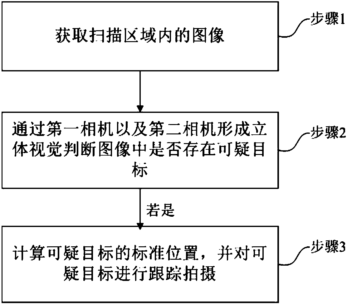
[0085] This embodiment provides a UAV monitoring method, the UAV monitoring method comprising:

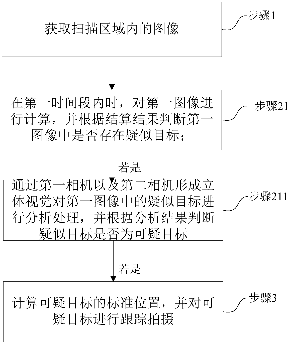
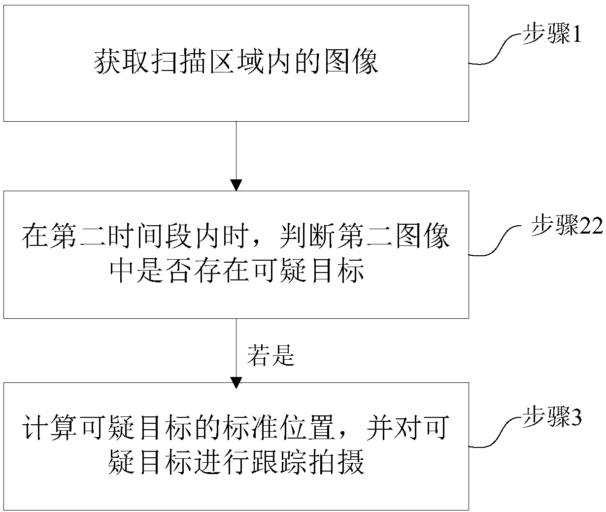
[0086] Step 1, acquiring images in the scanning area;

[0087] Step 2, using the first camera and the second camera to form a stereoscopic vision to determine whether there is a suspicious target in the image;

[0088]Step 3, if yes, calculate the standard position of the suspicious object, and track and shoot the suspicious object. Among them, the suspicious target may be a drone.

[0089] like Figure 14 As shown, the embodiment of the present invention provides an array drone monitoring system based on the combination of infrared thermal imaging camera and visible spectrum camera and its algorithm. The servo pan / tilt can be referred to as the pan / tilt for short. The pan / tilt is usually installed outdoors. The middle of the image shown in the figure is the pan / tilt. The left side of the image shown in the picture is an infrared thermal imaging camera, and the right side of the...

Embodiment 2

[0111] On the basis of Embodiment 1, step 2 in this embodiment uses the first camera and the second camera to form a stereoscopic vision to determine whether the image contains suspicious objects, including:

[0112] The images include a first image acquired during a first time period and a second image acquired during a second time period;

[0113] Step 21: When within the first time period, calculate the first image, and judge whether there is a suspected target in the first image according to the settlement result;

[0114] Step 211: If yes, then use the first camera and the second camera to form stereoscopic vision to analyze and process the suspected target in the first image, and judge whether the suspected target is the suspicious target according to the analysis result; if yes, then Execute step 3;

[0115] Wherein, the first image acquired within the first time period includes:

[0116] Calculate the azimuth angle of the sun in real time, adjust the motion track of ...

Embodiment 3

[0121] On the basis of Embodiment 2, step 2 in this embodiment uses the first camera and the second camera to form a stereoscopic vision to determine whether the image contains suspicious objects, and also includes:

[0122] Step 22: When within the second time period, determine whether the suspicious object exists in the second image; if yes, perform step 3.

[0123] Autonomous airspace scanning. The main working mode of the front-end equipment. The center will send the airspace range that the front-end device needs to scan and search, and convert it into the horizontal angle range and vertical angle range of the local gimbal, and the front-end device will automatically scan continuously within the specified range.

[0124] When working during the day, the infrared thermal imaging camera is mainly used, and the visible spectrum camera is used as a supplementary work. The azimuth of the sun will be calculated in real time, and the sun will be avoided during the scanning proce...


PUM


Abstract

The invention relates to an unmanned aerial vehicle monitoring system and a monitoring method thereof. The unmanned aerial vehicle monitoring method comprises the following steps: step 1, acquiring animage in a scanning area; step 2, forming a three-dimensional vision to determine whether a suspicious object exists in the image or not through a first camera and a second camera; step 3, if yes, calculating the standard position of the suspicious target, and tracking and shooting the suspicious target. A plurality of servo holders are arranged in the area to be detected, the first camera and the second camera are arranged on the two side end faces of each servo holder, after the unmanned aerial vehicle is found, the unmanned aerial vehicle is tracked and monitored through binocular vision according to the position information, the finding, identifying and disposing of the low-altitude low-speed small targets can be realized, the unmanned aerial vehicle is detected through the two cameras, the concept that the unmanned aerial vehicle is detected by radar is changed, and the detection cost of the unmanned aerial vehicle is reduced.

Description

technical field [0001] The invention relates to the field of anti-drone technology, in particular to an unmanned aerial vehicle monitoring system and a monitoring method thereof. Background technique [0002] In recent years, with the development of UAV technology, the intrusion of low-altitude, low-slow and small targets on civil aviation and the clearance of specific areas has caused great social security risks, such as drone intrusion at Chengdu Shuangliu Airport and UAV intrusion at Hangzhou Xiaoshan Airport The safety hazards and social impact caused by the suspected drone intrusion into the controlled airspace in the clear area and Yantai Airport are increasing. In terms of anti-terrorism, although the ground security is impenetrable, there are no good means and methods for effective anti-terrorism at low altitudes. Defense has created a very important security pressure on all aspects. [0003] In the existing technology, UAVs and other "small, slow and low" targets a...

Claims


Application Information

Patent Timeline
IPC IPC(8): G06T7/246G06T7/292G06T7/70H04K3/00H04N5/232H04N5/247
CPCH04K3/825H04K3/84G06T7/246G06T7/292G06T7/70H04N23/60H04N23/90
Inventor 曹龙胜郝加刚李春波赵光顺
Owner 烟台欣飞智能系统有限公司
Why Eureka
Try Eureka