Population distribution calculation method

A population distribution and calculation method technology, applied in calculation, image analysis, image data processing, etc., can solve the problem that the location of the base station is not the actual location, etc., to achieve the effect of improving accuracy, simple calculation method, and improving spatial resolution

Active Publication Date: 2019-01-11
JIANGSU INST OF URBAN PLANNING & DESIGN
View PDF6 Cites 8 Cited by
  • Summary
  • Abstract
  • Description
  • Claims
  • Application Information

AI Technical Summary

Problems solved by technology

However, the location of the base sta

Method used


Image

  • Population distribution calculation method
  • Population distribution calculation method
  • Population distribution calculation method

Examples


Embodiment Construction

[0028] Below in conjunction with accompanying drawing, technical scheme of the present invention is described in further detail:

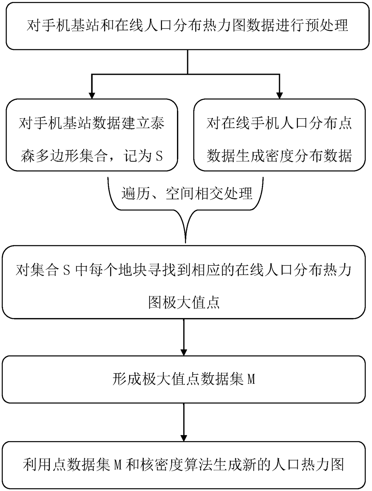
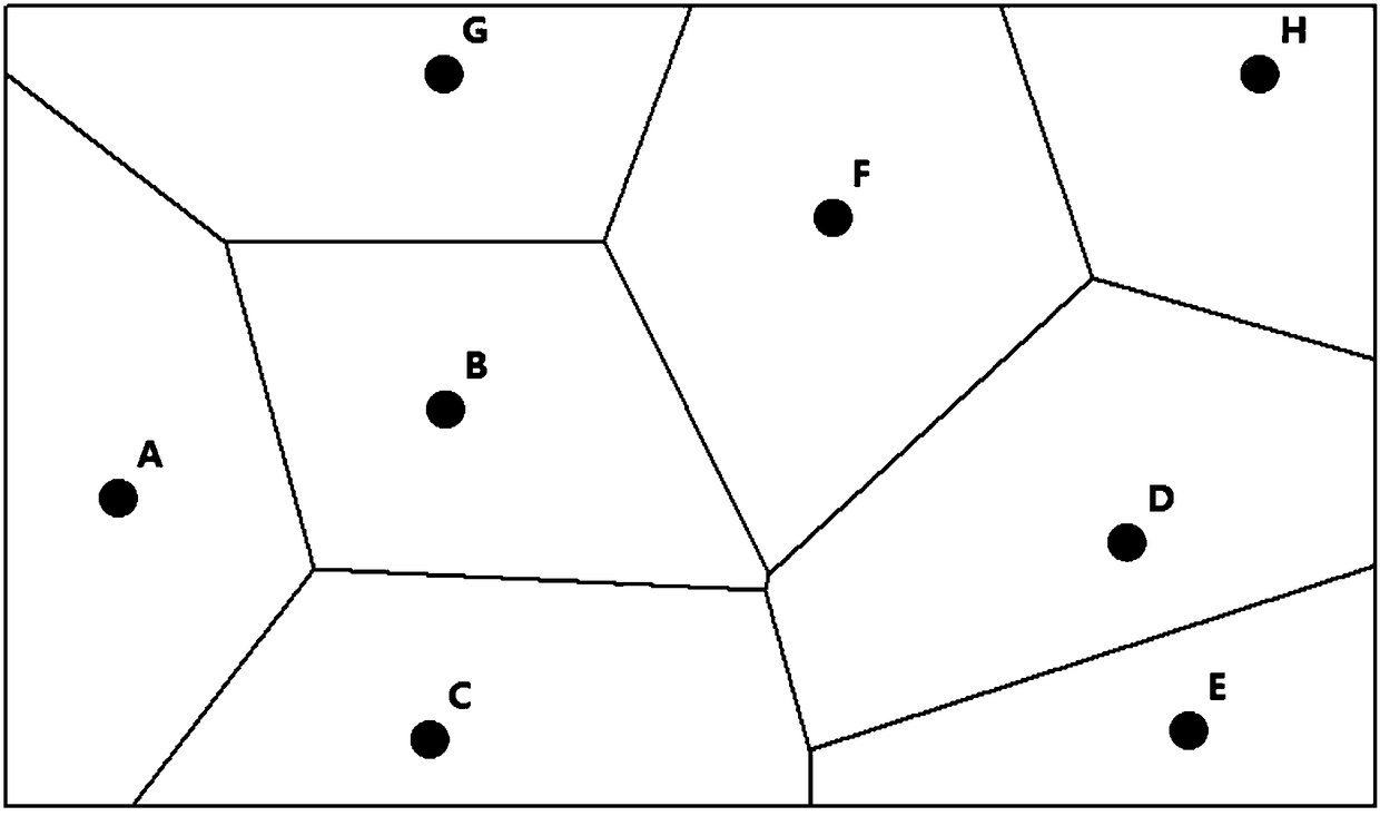
[0029] The present invention provides a population distribution calculation method that coordinates the online population distribution heat map and the characteristics of mobile phone signaling data to solve the problems mentioned in the background technology. The focus of the present invention is to calibrate the location of the base station. As for the more accurate distribution calculation of the population distribution within the service range of each base station, further processing can be done based on other methods (such as power consumption, residential land density, etc.), that is, this method can be Traditional base station positioning data provide a more accurate spatial statistical method for population distribution simulation.

[0030] The technical solution proposed by the present invention is mainly based on the characteristic differ...


PUM


Abstract

The invention discloses a population distribution calculation method. The method includes: firstly, preprocessing a mobile phone base station and on-line population distribution thermodynamic map datain a research area, wherein the Tyson polygon set is established for the base station data of the mobile phone, which is denoted by S; capturing the original point data of the online population distribution thermodynamic map of the corresponding area, and generating the grid data of the population distribution density by using the kernel density method, which is recorded as Z; secondly, finding the corresponding maximum points of online population distribution thermodynamic map for each plot in set S; and then forming a maximum point data set M; Finally, a new population thermodynamic map isgenerated by using the point data set M and the point kernel density algorithm. The invention integrates the characteristics of online population distribution thermodynamic map and mobile phone signaling data, can utilize different types of population thermodynamic map data to improve the accuracy of population distribution calculation, and provides decision basis for urban planning and traffic management.

Description

technical field [0001] The invention relates to the technical fields of urban planning and urban transportation, in particular to a population distribution calculation method that coordinates online population distribution heat maps and mobile phone signaling data features. Background technique [0002] Mobile phone signaling big data is more and more widely used in society, such as urban planning, traffic management, commercial site selection, danger monitoring, etc. However, mobile phone signaling data is stored based on base stations, and the spatial accuracy is not very high: the spatial distance between base stations is about 300-500 meters in the city center, and most of the urban fringes and peripheral areas It must be greater than 800 meters. For application analysis such as urban planning, the spatial resolution accuracy cannot meet the needs of many application scenarios. For example, a spatial accuracy of 500 may shift a large shopping mall with a very concentrat...

Claims


Application Information

Patent Timeline
IPC IPC(8): G06F16/387G06T7/00G06T11/20H04W8/18
Inventor 韦胜
Owner JIANGSU INST OF URBAN PLANNING & DESIGN
Why Eureka
Try Eureka