Image control point information acquisition method and system based on unmanned aerial vehicle

An information collection and UAV technology, applied in the field of UAV surveying and mapping, can solve the problems of shortening the service life of the motor, inconvenient use, poor overall picture effect, etc., achieve reliable measurement results, increase service life, and avoid repeated start and stop Effect

Inactive Publication Date: 2019-03-15
殷德耀
View PDF5 Cites 3 Cited by
  • Summary
  • Abstract
  • Description
  • Claims
  • Application Information

AI Technical Summary

Problems solved by technology

When using this method, repeated start and stop will easily cause damage to the motor itself, which will greatly shorten the service life of the motor and increase the cost of surveying and mapping
[0006] (3) In the existing UAV surveying and mapping method, a plane camera picture is formed by taking continuous frame shots in multiple areas, and the images in different areas are stitched together to form an overall camera picture in a large area. However, due to the Angle changes and unsatisfactory splicing processing lead to very poor overall picture effect, which is difficult to apply to the actual geographic information database; or, collect image control point information for the entire area, and form a DEM model (Digital Elevation Model, digital elevation model)
The data model formed by these methods is difficult to intuitively reflect the actual geographical features, and it is inconvenient to use

Method used


Image

  • Image control point information acquisition method and system based on unmanned aerial vehicle
  • Image control point information acquisition method and system based on unmanned aerial vehicle
  • Image control point information acquisition method and system based on unmanned aerial vehicle

Examples


Embodiment 1

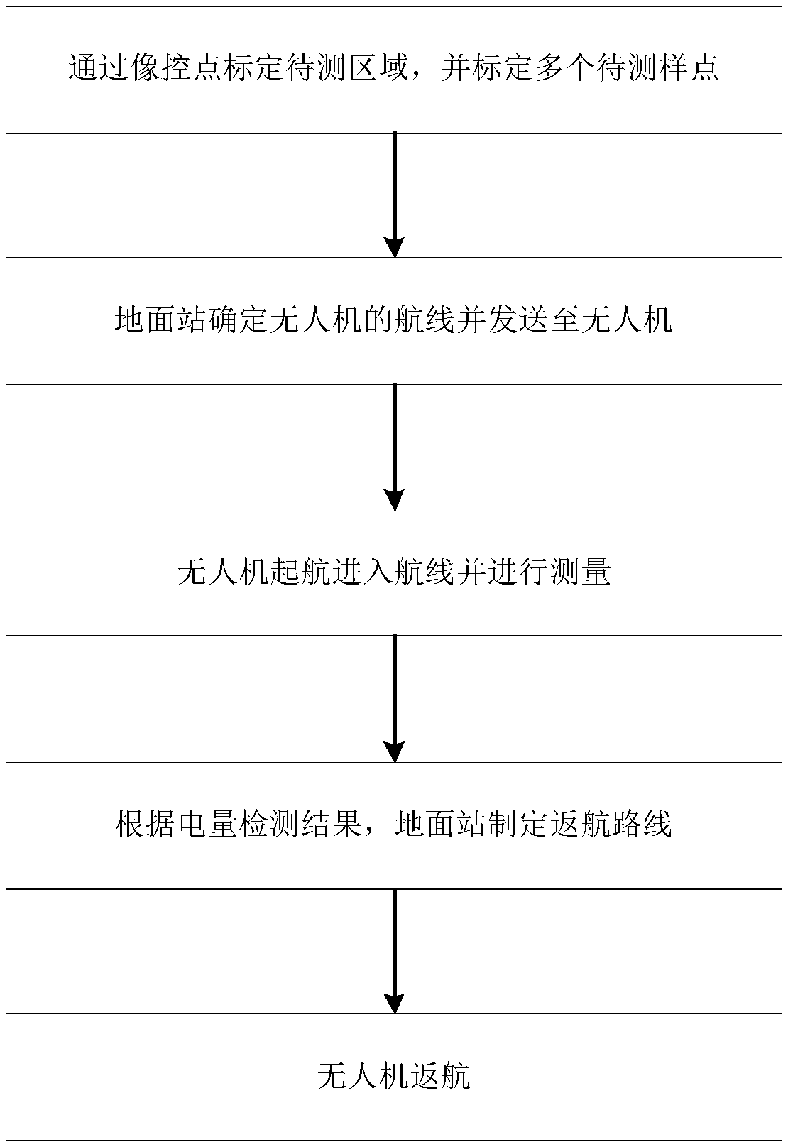
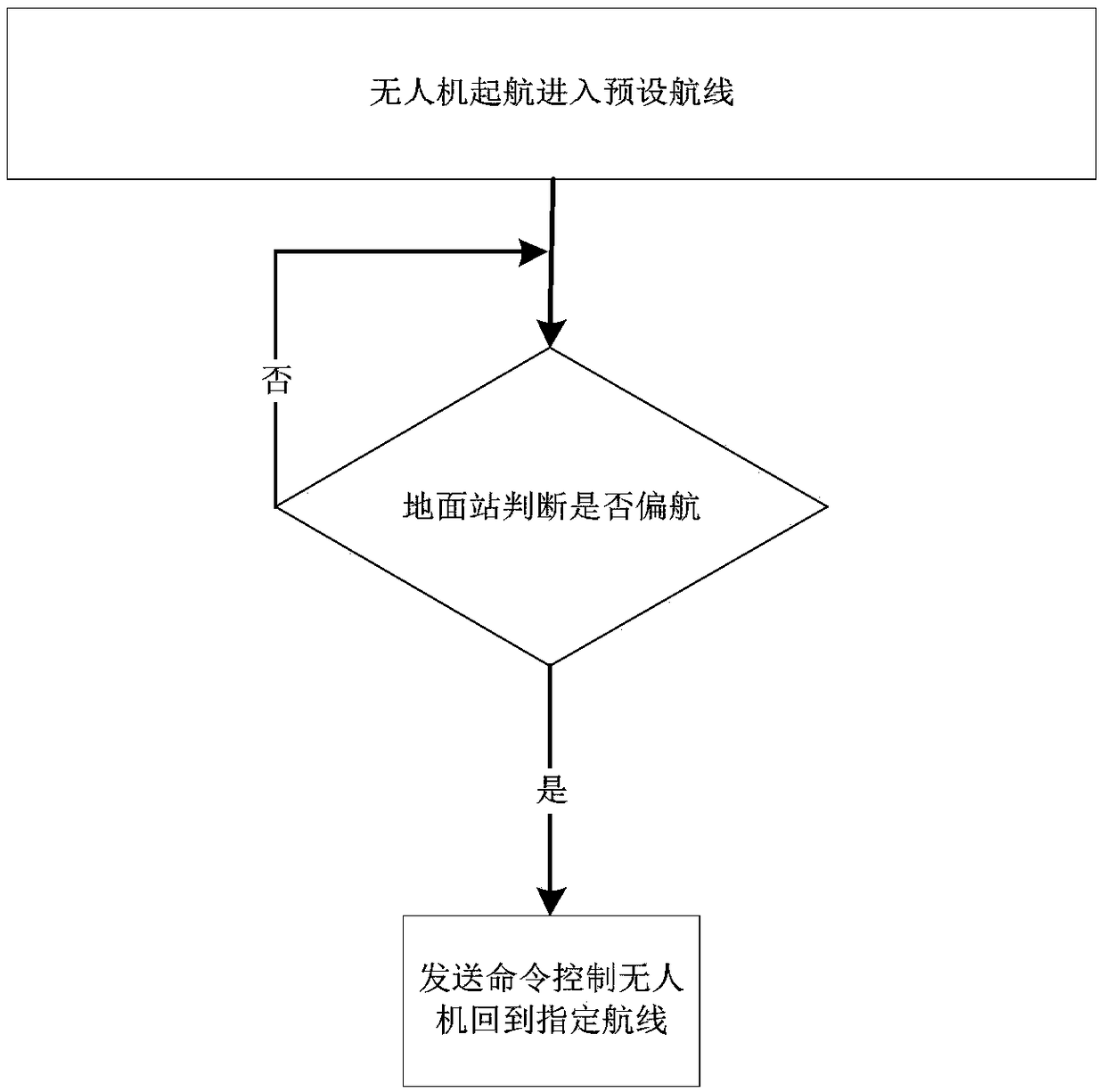
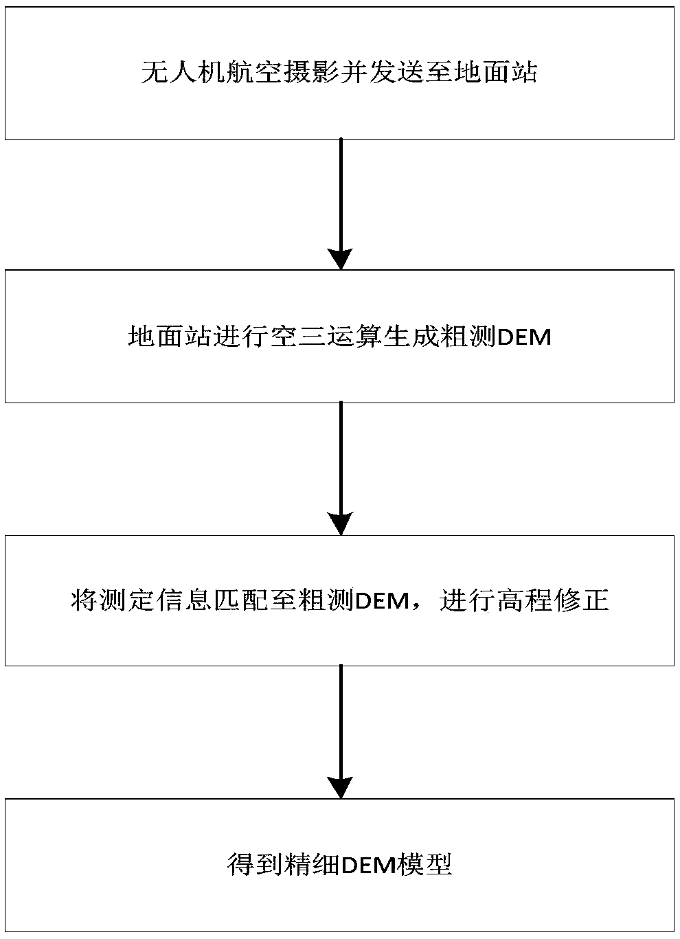
[0047] Such as figure 1 , image 3 As shown, the present embodiment provides a UAV-based image control point information collection method, specifically, the method includes the following steps:

[0048] S01: Enclose a closed area to be measured by calibrating image control points, and calibrate multiple sample points to be measured in the area to be measured; in this embodiment, a rectangular area is measured, and generally more than two image control points are arranged per square kilometer. Point; the image control point selects the intersection point of fine linear features with good intersection angle (30°-150°), the corner point of obvious features, and the center of point-like features less than 0.2mm in the aerial photography image. The images of the image control points are relatively clear, which is easy to judge and measure three-dimensionally. After the image control points are determined, use red paint or other easy-to-observe marks to mark them. The four corner...

Embodiment 2

[0062] This embodiment provides a UAV-based image control point information collection system, which aims to realize the UAV to perform geographic information surveying and mapping through the system, and generate a three-dimensional model of geographic surveying and mapping; the three-dimensional model generated by the acquisition system is intuitive and sensible. , which is more useful for reference.

[0063] Specifically, a drone-based image control point information collection system includes a ground station and a drone. The ground station is used to generate instructions and process information, and the drone launches from the ground station to execute instructions and feed back data.

[0064] In this embodiment, the ground station includes a processor module, and the processor module is respectively connected to the power supply module, the wireless data transmission module and the storage module. The processor module may adopt a single-chip microcomputer or a PLC (Prog...


PUM


Abstract

The invention belongs to the technical field of surveying and mapping based on an unmanned aerial vehicle, and discloses an image control point information acquisition method based on the unmanned aerial vehicle and an image control point information acquisition system based on the unmanned aerial vehicle. By the acquisition method disclosed by the invention, information acquisition is performed in a way of not landing the unmanned aerial vehicle, and elevation photography is synchronously achieved; a geographic image is combined with data information to form a visually-viewable three-dimensional geographic model; in such a manner, not only the efficiency of the surveying and mapping based on the unmanned aerial vehicle is improved, but also the quality of the surveying and mapping based on the unmanned aerial vehicle is improved, so that the combination of field working and interior working is closer. The acquisition system provided by the invention performs geographical information surveying and mapping through the unmanned aerial vehicle to generate a three-dimensional geographic surveying and mapping model; the three-dimensional model generated by the acquisition system is intuitive and sensible, and has higher using reference. Therefore, the acquisition method and the acquisition system are suitable for popularization and use.

Description

technical field [0001] The invention belongs to the technical field of unmanned aerial vehicle surveying and mapping, and in particular relates to a method and system for collecting image control point information based on an unmanned aerial vehicle. Background technique [0002] People survey and use geographic information data in the production and living environment, and constantly improve and refine it; the optimized and confirmed geographic mapping information is included in the national geographic information database. Geographical information data changes with changes in society and the environment, so the data information is constantly updated, and the work of surveying and mapping never stops. For surveying and mapping in areas close to people's production and living, surveying and mapping personnel can be arranged to arrive at image control points for information collection, while in most areas far away from people's production and living, such as waters and mounta...

Claims


Application Information

Patent Timeline
Patent Type & Authority Applications(China)
IPC IPC(8): G01C5/00
CPCG01C5/005
Inventor 殷德耀李淑军白传飞熊慧吴逊来崔明军卢征铁占琦喻广军刘建坡
Owner 殷德耀
Why Eureka
Try Eureka