Ground motion target measuring method and device based on video satellite

A technology for ground moving targets and measurement methods, applied in the field of video satellite-based ground moving target measurement methods and devices, capable of solving problems such as large errors and inability to determine target speed information

Active Publication Date: 2019-04-16
PLA PEOPLES LIBERATION ARMY OF CHINA STRATEGIC SUPPORT FORCE AEROSPACE ENG UNIV
View PDF3 Cites 4 Cited by
  • Summary
  • Abstract
  • Description
  • Claims
  • Application Information

AI Technical Summary

Problems solved by technology

[0003] Traditional remote sensing satellites can only obtain one scene image of the ground target. When determining the target position by solving the intersection point of ...

Method used


Image

  • Ground motion target measuring method and device based on video satellite
  • Ground motion target measuring method and device based on video satellite
  • Ground motion target measuring method and device based on video satellite

Examples


Embodiment Construction

[0071] The present application is described in detail below in conjunction with the examples, but the present application is not limited to these examples.

[0072] This method specifically includes the following steps, which are also carried out in the following simulation examples:

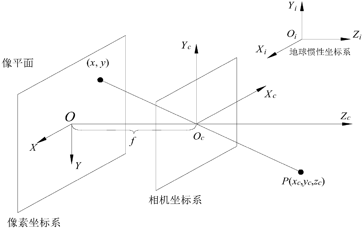
[0073] 1. Define the coordinate system

[0074] see figure 1 , the earth's inertial coordinate system O i -X i Y i Z i Choose the J2000.0 coordinate system, take the center of mass of the earth as the origin of the coordinate system, O i Z i The axis points to the pole of the flat equatorial plane (base plane) in J2000.0, O i x i Axis points to J2000.0 equinox, O i Y i Axis and O i x i Axis and O i Z i The axes form a right-handed coordinate system.

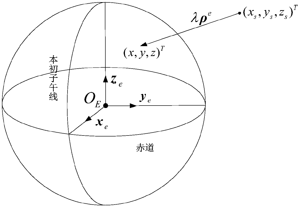
[0075] Define the earth fixed coordinate system O e -X e Y e Z e , taking the center of the earth as the origin of the coordinate system, O e Z e Axis points to Earth's North Pole, O e x e The axis points to the intersection...


PUM


Abstract

The invention discloses a ground motion target measuring method and device based on a video satellite. The method comprises the following steps that S100, real-time solving of a target sight line under a fixed coordinate system of the earth is carried out; S200, real-time solving of the longitude and latitude of an intersection point of the target sight line and the ellipsoid face of the earth iscarried out; and S300, a Kalman filter is adopted, the latitude and longitude of the intersection point serve as input of a target observation equation, and the motion velocity of a motion object andthe earth coordinate of the motion object in a kth frame video image are obtained. By means of the method, the Kalman filter is used for processing video satellite results to obtain the position and velocity of the ground motion target. The invention also provides a ground motion target measuring device based on the video satellite.

Description

technical field [0001] The application belongs to the field of moving target measurement, and relates to a method for measuring a moving target in the aerospace field, in particular to a video satellite-based ground moving target measurement method and a device thereof. Background technique [0002] Video small satellite is a new type of space-based information acquisition micro-satellite that adopts video imaging, real-time transmission of video data, and human-in-the-loop interactive operation. Compared with traditional earth observation satellites, its biggest feature is that it can A certain sensitive area is "stared" to observe, and the continuous video image information of the target area is obtained. A video image contains more information than a single static image. Compared with the existing push-broom camera, the video camera adds a time dimension of information, which can detect the occurrence of dynamic events, obtain the dynamic process information of the target...

Claims


Application Information

Patent Timeline
IPC IPC(8): G01S19/42G01S19/52
CPCG01S19/42G01S19/52
Inventor 张学阳杨雪榕辛朝军武志勇陈超肖龙龙胡敏
Owner PLA PEOPLES LIBERATION ARMY OF CHINA STRATEGIC SUPPORT FORCE AEROSPACE ENG UNIV
Why Eureka
Try Eureka