Eureka AIR delivers breakthrough ideas for toughest innovation challenges, trusted by R&D personnel around the world.

Gravity field forward modeling method and three-dimensional inversion method in spherical coordinate system based on 3D-GLQ

A 3D-GLQ, spherical coordinate system technology, applied in the field of gravity field exploration and calculation, to achieve the effect of simplifying the equivalence relationship

Active Publication Date: 2019-07-23
CENT SOUTH UNIV
View PDF3 Cites 14 Cited by
  • Summary
  • Abstract
  • Description
  • Claims
  • Application Information

AI Technical Summary

Problems solved by technology

However, the traditional exploration scale inversion method and objective function are no longer applicable, and it is necessary to reconstruct the gravity field inversion objective function and depth weighting function in the spherical coordinate system

Method used

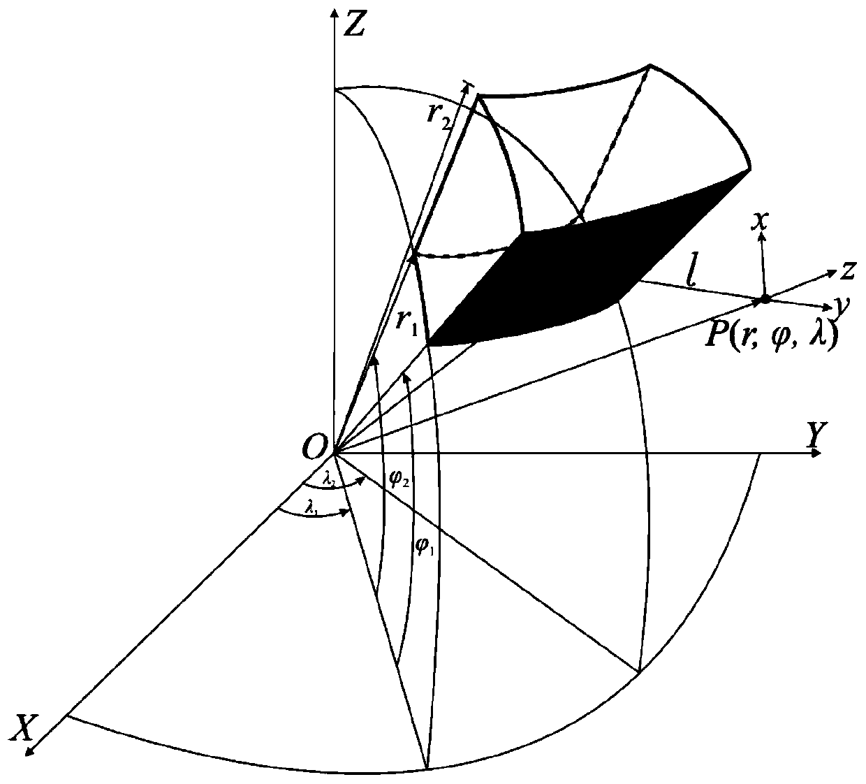
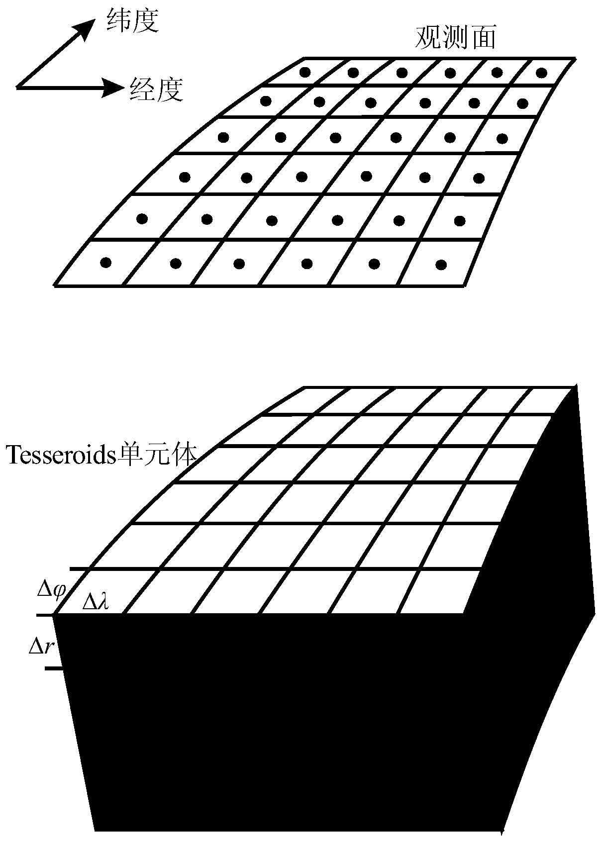
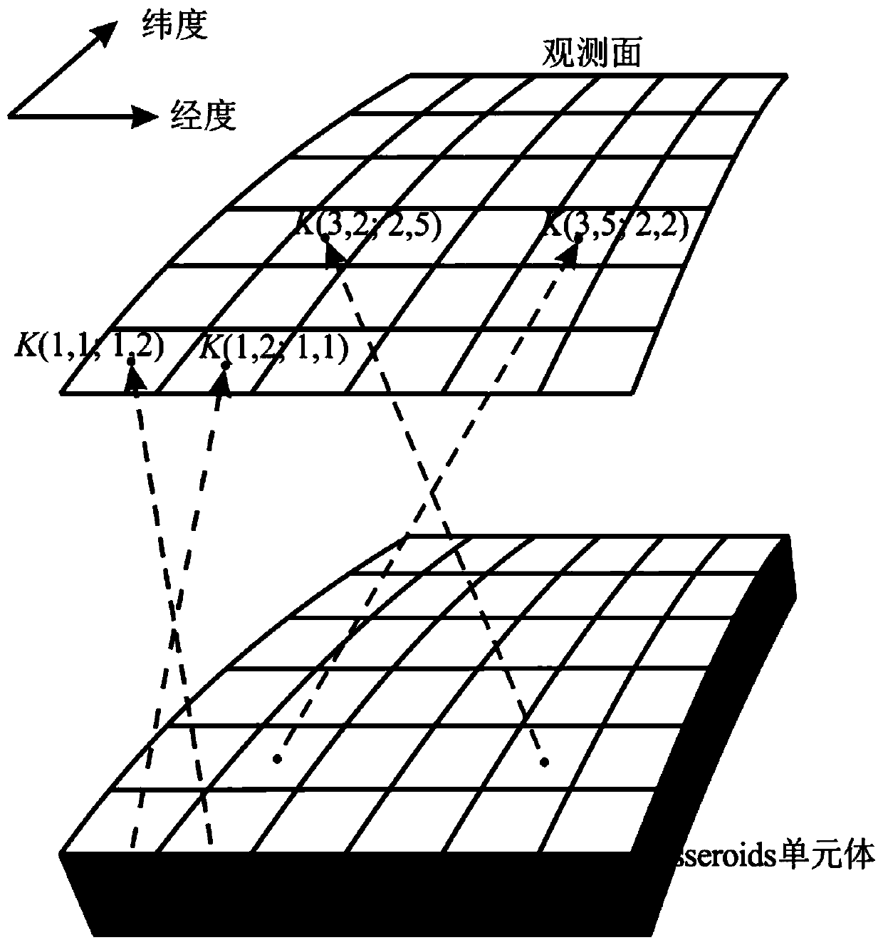

Image

  • Gravity field forward modeling method and three-dimensional inversion method in spherical coordinate system based on 3D-GLQ
  • Gravity field forward modeling method and three-dimensional inversion method in spherical coordinate system based on 3D-GLQ
  • Gravity field forward modeling method and three-dimensional inversion method in spherical coordinate system based on 3D-GLQ

Examples


Embodiment 1

[0141] This example presents a synthetic inversion model consisting of two 3 blocks, such as Figure 5 a and 6a. With the method proposed in this application, the gravity anomaly at the height of 10km from the reference radius (1738km) is calculated forwardly, and then 1% of random noise is added as the observation data ( Figure 5 b). The initial range of model accuracy direction is -35° to 35°; the initial range of latitude direction is 15° to 50°; the depth direction is from 0km to 100km. This model is subdivided into 280×140×20 tesseroid units at intervals of 0.25°, 0.25°, and 5km.

[0142] Using the fast and high-precision forward modeling algorithm of the three-dimensional gravity field in the spherical coordinate system proposed by this application to invert the synthetic gravity field data, the predicted data and its residual are as follows: Figure 5 c and 5d are shown. The density distribution obtained by inversion is as follows Image 6 as shown in b. Such as...

Embodiment 2

[0145] In order to further illustrate the correctness and efficiency of the method proposed in this application, next this application gives a real inversion case, applying the proposed method to the local gravity data of the moon. This application selects the Imbrium Basin and Chenghai Basin as the research area, the longitude range is 35°W to 35°E, and the latitude range is 15°N to 50°N, such as Figure 7 as shown in a.

[0146] Here, this application uses the latest lunar gravity field model GL1500E and the latest lunar terrain model LRO_LTM05_2050 to calculate the Bouguer gravity anomaly. Free air gravity anomalies such as Figure 7 As shown in b, the terrain correction result is as follows Figure 7 as shown in c. Then the Bouguer gravity anomaly can be passed through the free air gravity anomaly ( Figure 7 b) minus the terrain correction ( Figure 7 c) get, such as Figure 7 shown in d. Here, the density used for terrain correction is 2560kg / m 3 , the observatio...


PUM

PropertyMeasurementUnit
Densityaaaaaaaaaa

Abstract

The application provides a three-dimensional gravity field fast and high-precision inversion algorithm in a spherical coordinate system based on a three-dimensional Gauss-legendre numerical integration formula (3D-GLQ). The core content comprises the following two points that the first point lies in the aspect of three-dimensional gravity field forward modeling in the spherical coordinate system,a nuclear matrix equivalent storage strategy is proposed aiming at the problem of low computational efficiency of the traditional 3D-GLQ three-dimensional gravity field forward modeling algorithm, thenuclear matrix equivalence is combined with the existing adaptive splitting strategy, the computational efficiency is increased by two orders of magnitude under the premise of ensuring that the maximum relative error of the forward modeling calculation is less than 0.1%, and the memory occupancy is greatly reduced at the same time; and the second point lies in that the above fast and high-precision forward modeling algorithm is applied to the gravity field three-dimensional inversion, and the gravity field inversion objective function and depth weighting function in the spherical coordinate system are constructed, so that the computational efficiency and credibility of the large-scale gravity field three-dimensional inversion in the spherical coordinate system are greatly improved.

Description

technical field [0001] This application relates to the gravitational field exploration calculation in the spherical coordinate system in the field of geophysics, in particular, it involves a 3D-GLQ-based, proposed kernel matrix equivalent storage strategy, and added mature self-adaptive subdivision technology in the spherical coordinate system Gravity field forward modeling method and 3D inversion method. Background technique [0002] As an ancient geophysical method, gravity prospecting has been widely used in resource exploration (mineral, oil, natural gas), hydrological environment and large-scale research on the earth. At the exploration scale, the gravity field inversion is often carried out in the Cartesian coordinate system, and a variety of fast forward calculation algorithms (including FFT method, Gauss-FFT method, multi-level expansion method, etc.) ensure the calculation efficiency and accuracy of the inversion. However, when the research area has a large span or...

Claims


Application Information

Patent Timeline
IPC IPC(8): G01V7/00
CPCG01V7/00
Inventor 赵广东柳建新陈波
Owner CENT SOUTH UNIV
Why Eureka
Eureka Blog
Learn More