A method for monitoring surface subsidence in mining areas by ground-based three-dimensional laser scanning without targets

A three-dimensional laser and ground technology, applied in cross-section drawing, measuring devices, surveying and navigation, etc., can solve the problems of high labor intensity, difficulty in target layout, and low efficiency, so as to reduce labor intensity, simplify field operation process, reduce dangerous effect

Active Publication Date: 2021-11-02
CHINA UNIV OF MINING & TECH +1
View PDF5 Cites 0 Cited by
  • Summary
  • Abstract
  • Description
  • Claims
  • Application Information

AI Technical Summary

Problems solved by technology

[0004] In view of the above analysis, the embodiment of the present invention aims to provide a method for ground 3D laser scanning targetless monitoring of surface subsidence in mining areas to solve the problems of high labor intensity, difficulty in target layout and low efficiency in the field of mining subsidence monitoring in existing mining areas. and personal safety risks

Method used


Image

  • A method for monitoring surface subsidence in mining areas by ground-based three-dimensional laser scanning without targets
  • A method for monitoring surface subsidence in mining areas by ground-based three-dimensional laser scanning without targets
  • A method for monitoring surface subsidence in mining areas by ground-based three-dimensional laser scanning without targets

Examples


Embodiment Construction

[0038] The preferred embodiments of the present invention will be specifically described below in conjunction with the accompanying drawings, wherein the accompanying drawings constitute a part of the present invention and together with the embodiments of the present invention are used to explain the principles of the present invention and are not intended to limit the scope of the present invention.

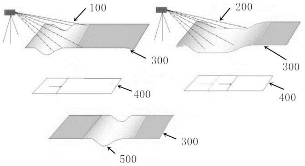
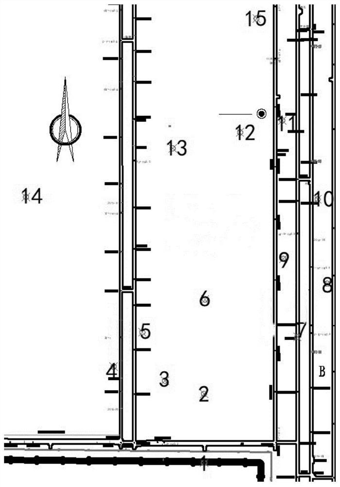
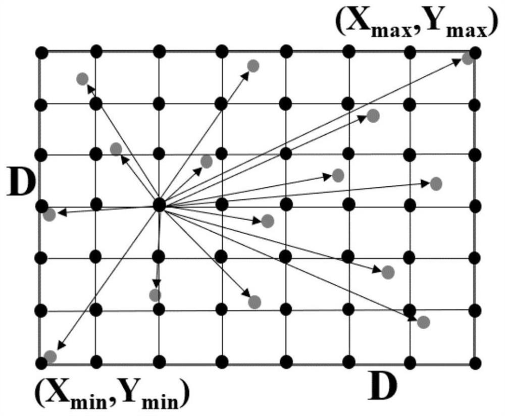
[0039] This embodiment discloses a method for monitoring surface subsidence in a mining area by ground three-dimensional laser scanning without a target, such as Figure 1-Figure 5 As shown, the main steps are as follows: Arrange ground 3D laser scanner to measure site position on the working face of the mining area → use the 3D laser scanner to scan the working face of the mining area at multiple sites to obtain multi-site cloud data during the same period → preprocess the point cloud data → Use the preprocessed point cloud data of each period to establish the surface DEM → subt...


PUM


Abstract

The invention relates to a method for monitoring surface subsidence in a mining area by ground three-dimensional laser scanning without a target, which belongs to the technical field of mining subsidence in a mining area, and solves the problems of high field labor intensity, difficulty in target layout, low efficiency and low efficiency in mining subsidence monitoring in the prior art. There is an issue of personal safety risk. The method steps of the present invention include: arranging a ground three-dimensional laser scanner on the working face of the mining area to measure the position of the site; using a three-dimensional laser scanner to scan the working face of the mining area at multiple sites to obtain multi-site cloud data in the same period; preprocessing the point cloud data; using The preprocessed point cloud data of each period establishes the surface DEM; the dynamic subsidence value of the surface during the observation period is obtained by subtracting the multi-phase surface DEM. The invention does not need to deploy targets to monitor the surface subsidence of the mining area, uses the feature points to complete the multi-site cloud data splicing in the same period, and uniformly converts the overall point cloud to the geodetic coordinate system, which simplifies the field operation process, reduces the risk of work, and improves work efficiency.

Description

technical field [0001] The invention relates to the technical field of mining subsidence in mining areas, in particular to a method for monitoring surface subsidence in mining areas by ground three-dimensional laser scanning without a target. Background technique [0002] Three-dimensional laser scanning technology belongs to the surface measurement mode. In recent years, this technology has been widely used in deformation monitoring, geological disaster protection, industrial and building modeling and other fields due to its high efficiency, high precision and non-contact characteristics. Among them, in the field of surface subsidence monitoring It overcomes the shortcomings and deficiencies of the traditional "cross" linear observation station on the main section to monitor surface subsidence. Practice shows that this method can effectively obtain deformation information such as buildings and ground surfaces. [0003] When using 3D laser scanning to collect data on the tar...

Claims


Application Information

Patent Timeline
Patent Type & Authority Patents(China)
IPC IPC(8): G01C7/02
CPCG01C7/02
Inventor 周大伟张德民顾元元周宝慧郭良林亓立壮李昱昊
Owner CHINA UNIV OF MINING & TECH
Why Eureka
Try Eureka