GIS data acquisition system and method for power distribution network
A data acquisition system and data acquisition technology, applied in data processing applications, structured data retrieval, geographic information databases, etc., can solve problems such as poor data quality, reduce manual operations, reduce limitations, improve data quality and collection efficiency effect
- Summary
- Abstract
- Description
- Claims
- Application Information
AI Technical Summary
Problems solved by technology
Method used
Image

Examples
Embodiment
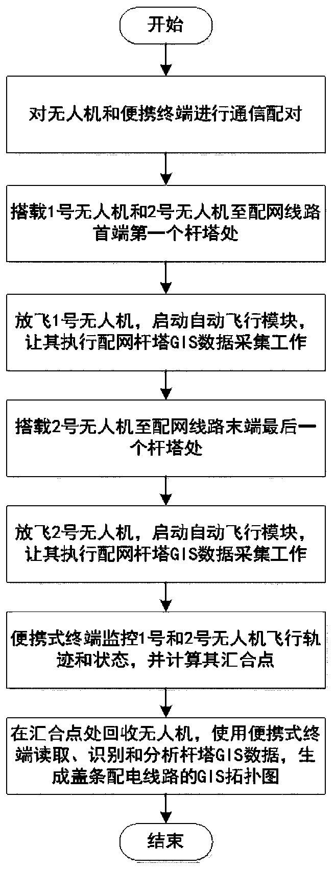
[0055] In this example, two drones are used to collect GIS data of linear distribution lines;
[0056] Step 1: Before starting the collection work, pair the UAV and the portable terminal to ensure that a reliable communication channel is established between them, and drive two UAVs and the portable terminal to the head end of the distribution network line where the GIS data is to be collected. at a tower.
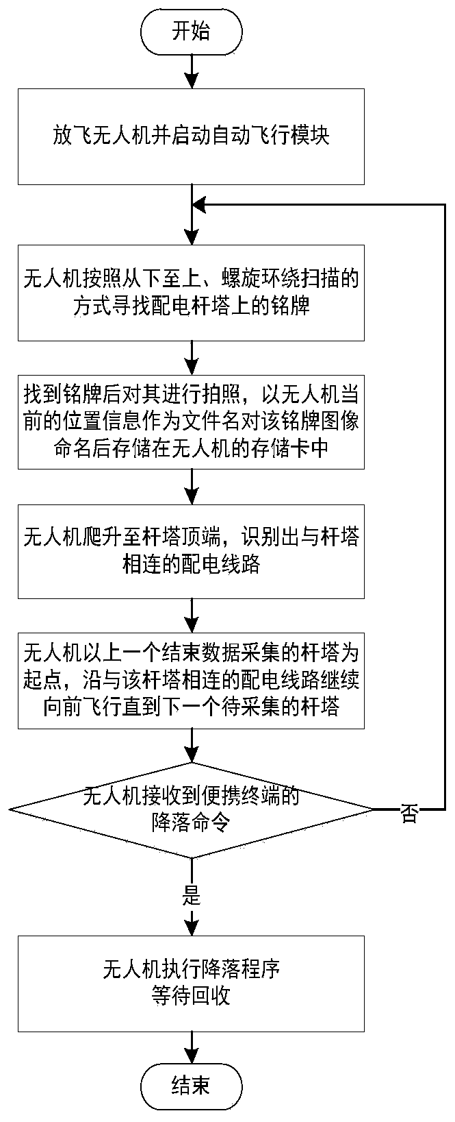
[0057] Step 2: Fly No. 1 UAV at the first tower at the head end of the distribution network line.
[0058] Step 3: UAV No. 1 climbs to the top of the tower, identifies the power distribution line connected to the tower, starts from the tower that has just finished collecting, and continues to fly forward along the power distribution line connected to the tower until the second waiting line After collecting towers, repeat the GIS data collection work in step 2.
[0059] Step 4: After confirming that the No. 1 drone is working normally, drive the No. 2 drone and the portabl...
PUM
 Abstract
Description
Claims
Application Information
 - R&D
- Intellectual Property
- Life Sciences
- Materials
- Tech Scout
- Unparalleled Data Quality
- Higher Quality Content
- 60% Fewer Hallucinations
Browse by: Latest US Patents, China's latest patents, Technical Efficacy Thesaurus, Application Domain, Technology Topic, Popular Technical Reports.
© 2025 PatSnap. All rights reserved.Legal|Privacy policy|Modern Slavery Act Transparency Statement|Sitemap|About US| Contact US: help@patsnap.com