
DEM real-time visualization method driven by linear quaternion tree multilayer model

A multi-layer model and linear technology, applied in 3D modeling, structured data retrieval, image data processing, etc., can solve problems such as model complexity, surface equation parameters are not easy to control, and terrain is too smooth, achieving generation speed and readability Take advantage of speed improvements, instant visualization, and time savings

Pending Publication Date: 2020-03-27
王程
View PDF0 Cites 4 Cited by
  • Summary
  • Abstract
  • Description
  • Claims
  • Application Information

AI Technical Summary

Problems solved by technology

[0008] First, when the amount of terrain data in the existing technology is very large, the number of generated polygons will increase sharply, making the model too complicated, and it is difficult to meet the demand for real-time rendering of the terrain. The existing technology has proposed some fast rendering algorithms for scenes, and most of them have some Problems and deficiencies, in many cases, real-time high-speed rendering of large-area terrain scenes cannot be realized;
[0009] The second is that the complexity of the fractal landscape simulation algorithm in the prior art is relatively high, and there is no connection with the real terrain and landform, so the application is greatly restricted;
[0010] The third is that the surface fitting terrain simulation of the prior art is based on the ground control points, but has many shortcomings, such as the surface equation and its parameters are not easy to control, and the generated terrain is too smooth, which looks quite different from the real ground;
[0011] Fourth, the fine-level algorithm of the existing technology is to store the data in the memory at one time, and then draw the data through the nodes of the quad tree. When the DEM data is too large to exceed a certain scale, the data volume of the quad tree will be Far larger than the size of computer memory space, this algorithm is obviously not applicable;
[0012] Fifth, some algorithms in the prior art are too complex, limited by high computational complexity, cannot be extended to practical applications, and have almost no practical value

Method used


Image

  • DEM real-time visualization method driven by linear quaternion tree multilayer model
  • DEM real-time visualization method driven by linear quaternion tree multilayer model
  • DEM real-time visualization method driven by linear quaternion tree multilayer model

Examples


Embodiment Construction

[0045] The technical scheme of the linear quadtree multi-layer model-driven DEM real-time visualization method provided by the present invention will be further described below in conjunction with the accompanying drawings, so that those skilled in the art can better understand the present invention and implement it.

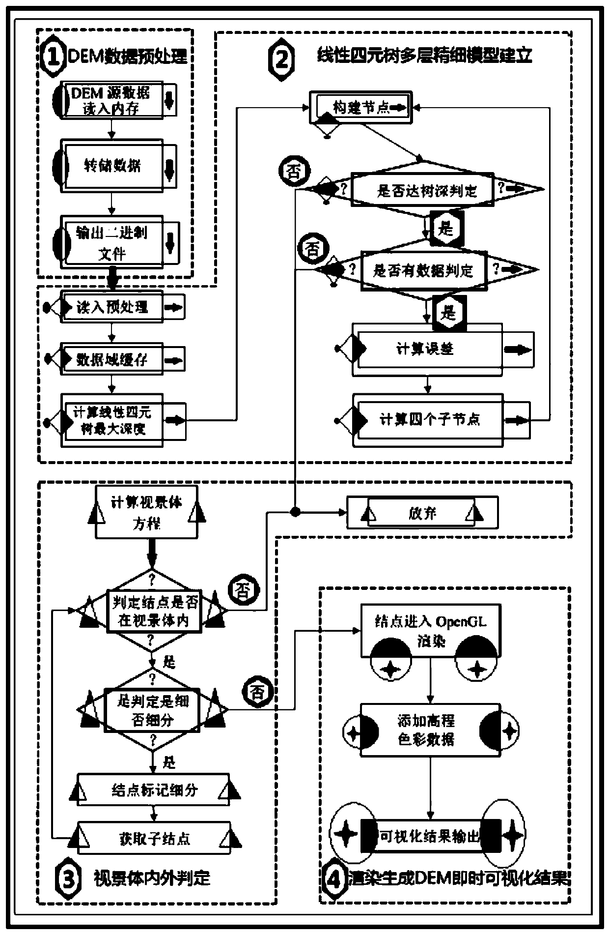
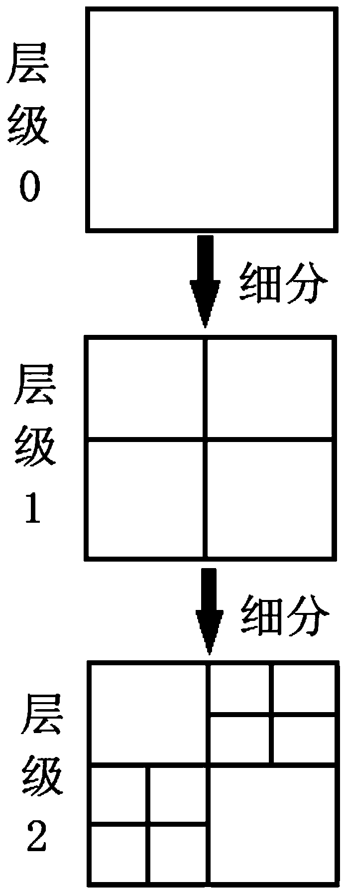
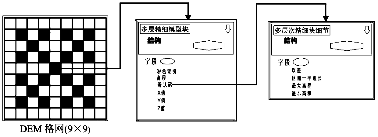
[0046] see Figure 1 to Figure 4 , the DEM real-time visualization method driven by the linear quadruple tree multi-layer model provided by the present invention, organizes DEM data real-time visualization by building a linear quadruple tree to construct a multi-layer fine model, mainly including DEM data preprocessing, linear quadruple tree multi-layer fine Model establishment, visual scene internal and external judgment, rendering to generate DEM real-time visualization results, quickly repair the cracks caused by multi-layer fine models, and propose a method for saving node data color, cooperate with OpenGL rendering engine, when adding elevation color data R...


PUM


Abstract

The invention provides a DEM real-time visualization method driven by a linear quaternary tree multilayer model, cracks finely generated by multiple layers can be repaired more quickly, meanwhile, a method for saving node data colors is provided, an OpenGL rendering engine is matched, and instant visualization of high-resolution DEM topographic data can be achieved under the condition that an elevation color code is added. In the experimental process, an index structure of a linear quaternion tree is constructed; by combining the proximity advantage of DEM grid data, in the multi-layer fine rendering display process, the high real-time visualization speed is achieved, the quaternion tree partitioning model can well keep the high drawing speed on the terrain, the expected design purpose isachieved, real-time drawing is guaranteed, and efficient reading and writing of point cloud data are also guaranteed. Results show that compared with a storage method in the prior art, the generationspeed and the reading speed of the model are obviously improved.

Description

technical field [0001] The invention relates to a DEM real-time visualization method, in particular to a DEM real-time visualization method driven by a linear quadruple tree multi-layer model, and belongs to the technical field of DEM visualization methods. Background technique [0002] Terrain visualization analysis is a method to deduce and deduce the process and development of crustal movement that cannot be directly observed by using directly observable landform information. With the development of science and technology, GIS has the advantages of powerful geospatial information processing, Many fields such as research, global change and monitoring, crop yield estimation, resource management, urban planning, disaster prediction and assessment, mineral resource evaluation, and cultural relic protection are playing an increasingly important role. The role of terrain visualization analysis in GIS is also increasing. It is an important analysis method in GIS application. ...

Claims


Application Information

Patent Timeline
IPC IPC(8): G06T17/05G06F16/29
CPCG06T17/05G06F16/29
Inventor 王程刘文平
Owner 王程
Learn More