
Remote sensing image ground object classification method and system

A remote sensing image and feature classification technology, applied in biological neural network models, instruments, character and pattern recognition, etc., can solve the problems of unfavorable detail information classification, blurred edges of land feature classification results, insufficient details and accuracy, etc., to improve High-resolution information loss problem, high overall classification accuracy, and the effect of rich edge information

Pending Publication Date: 2020-07-17
SHENZHEN INST OF ADVANCED TECH CHINESE ACAD OF SCI
View PDF2 Cites 5 Cited by
  • Summary
  • Abstract
  • Description
  • Claims
  • Application Information

AI Technical Summary

Problems solved by technology

Resampling is one of the commonly used methods. This process further causes the loss of image detail information (edge ​​information, gradient information or high-frequency noise signals, etc.), which makes the edges of the object classification results blurred, and the details are not rich and accurate enough, which affects the final image quality. classification accuracy
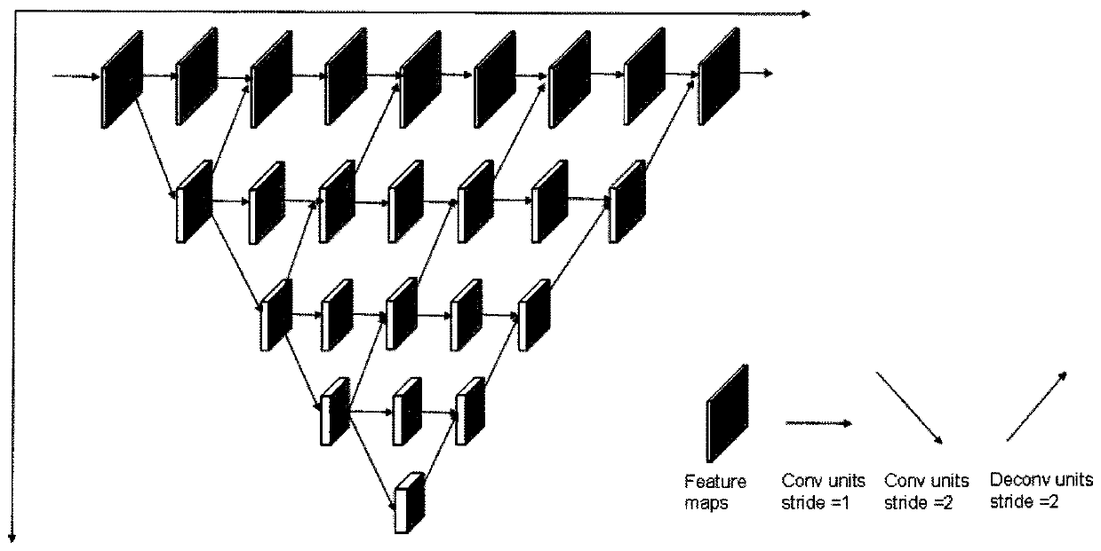
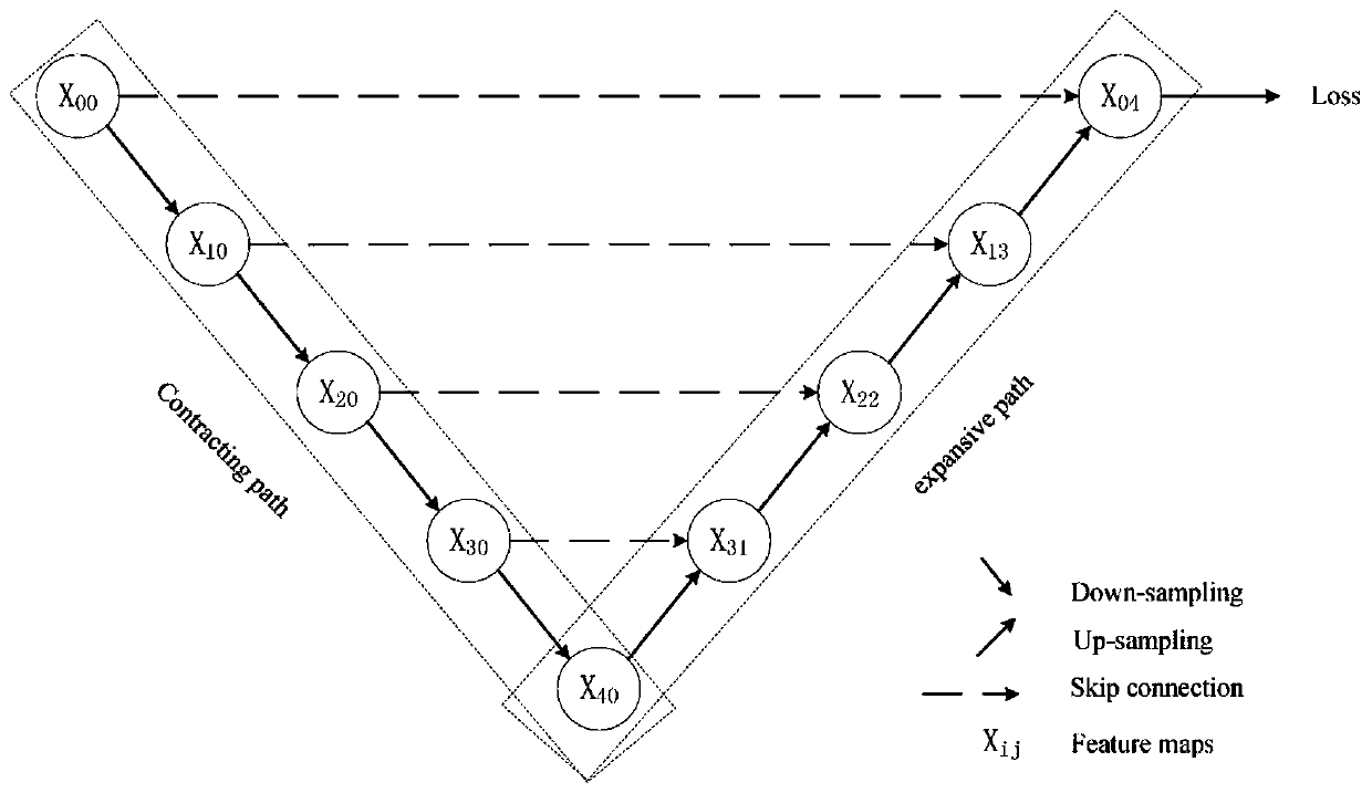
[0007] To sum up, the shortcomings of the existing technology mainly include: the detailed information on the remote sensing image and the general surface feature information have different requirements on the resolution of the remote sensing image, and the fusion of remote sensing images with different resolutions is difficult due to different sensors; the traditional remote sensing image classification algorithm relies on feature Extraction, not suitable for processing large-scale remote sensing images; in the end-to-end method, the downsampling process of the convolutional neural network leads to the loss of high-resolution information, which is not conducive to the classification of detailed information

Method used


Image

  • Remote sensing image ground object classification method and system
  • Remote sensing image ground object classification method and system
  • Remote sensing image ground object classification method and system

Examples


Embodiment Construction

[0035] The present invention will be described in further detail below in conjunction with the accompanying drawings and specific embodiments.

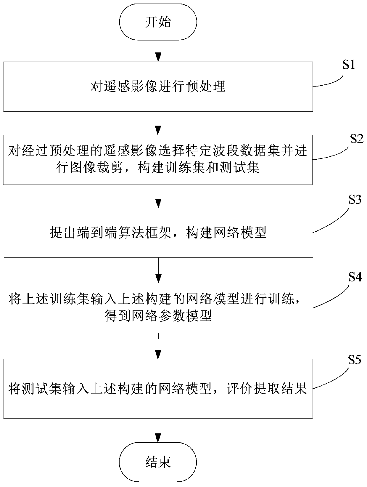
[0036] refer to figure 1 As shown, it is a flow chart of a preferred embodiment of the method for classifying remote sensing image features of the present invention.

[0037] Step S1, preprocessing the remote sensing images. in particular:

[0038] Download the Landset remote sensing image, and use arcgis and ENVI to perform radiation correction and spatial domain enhancement processing and filtering on the remote sensing image.

[0039] Step S2, select a specific band data set from the preprocessed remote sensing image and perform image cropping to construct a training set and a test set. in particular:

[0040] Select the data of the red, green and blue bands, near-infrared and red-green bands, and the full band of the remote sensing images, respectively construct three corresponding data sets, and cut the remote sensing images ...


PUM


Abstract

The invention relates to a remote sensing image ground object classification method. The method comprises the steps of preprocessing a remote sensing image; selecting data sets of red, green and bluebands, near-infrared bands, red and green bands and full bands for the preprocessed remote sensing images, cutting the images, and constructing a training set and a test set; providing an end-to-end algorithm framework, and constructing a network model; and inputting the training set into the constructed network model for training to obtain a network parameter model so as to use the obtained network parameter model to carry out ground object classification on the remote sensing image. The invention also relates to a remote sensing image ground object classification system. According to the method, remote sensing image fusion is not needed, the problem of high-resolution information loss in the convolutional neural network can be improved, detail information in the remote sensing image canbe better classified, details of a ground object classification result are more accurate, edge information is richer, and the overall classification precision is higher.

Description

technical field [0001] The invention relates to a method and a system for classifying ground objects of remote sensing images. Background technique [0002] There are a lot of detailed information (edge ​​information, gradient information, small targets, etc.) in remote sensing images. Due to the limited resolution of remote sensing images, it is difficult to extract and classify these detailed information in the process of object classification, which makes the details of the final classification results lost. Seriously, the edge of the object is blurred and distorted, which also affects the final classification accuracy of the object. Accurate classification of detailed information in images requires remote sensing images to provide more high-resolution information, while the extraction of common features in images requires a larger width of images for higher extraction efficiency and lower resolution requirements. The fusion of remote sensing images with different resolu...

Claims


Application Information

Patent Timeline
Patent Type & Authority Applications(China)
IPC IPC(8): G06K9/62G06K9/00G06N3/04
CPCG06V20/13G06N3/045G06F18/241G06F18/214
Inventor 徐文娜陈劲松
Owner SHENZHEN INST OF ADVANCED TECH CHINESE ACAD OF SCI
Learn More